UN/LOCODE hub · South Africa
ZASHL

Stamford Hill

-29.8167°, 31.0167°
1
Transport functions

Transport Functions

Multimodal
UN/LOCODE

Hub Profile

Region
KZN
GeoNames

Location

Location of ZASHL
Natural Earth 10m (public domain) · KZN · ZASHL · -29.82, 31.02GoogleOSMYandex

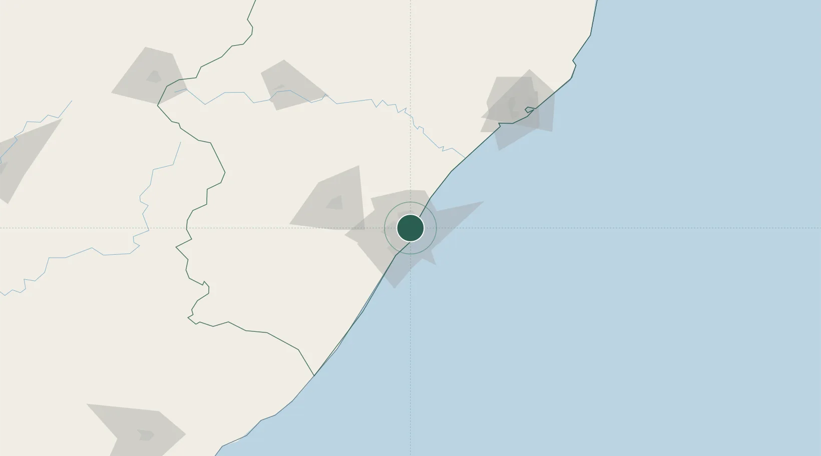
Nearby Logistics Neighbours

Cities
  1. 1Sydenham3 km
  2. 2Briardene6 km
  3. 3Congella6 km
  4. 4Glenwood6 km
  5. 5Island View8 km
Nearest neighbours — logibook spatial index (haversine) over the source coordinates
Ports
  1. 1Durban7 km
  2. 2Richards Bay153 km
  3. 3Maputo454 km
  4. 4East London463 km
  5. 5Port Elizabeth685 km
Nearest neighbours — logibook spatial index (haversine) over the source coordinates
Airports
  1. 1Virginia Airport7 km
  2. 2King Shaka International Airport25 km
  3. 3Pietermaritzburg Airport63 km
  4. 4Margate Airport133 km
  5. 5Richards Bay Airport159 km
Nearest neighbours — logibook spatial index (haversine) over the source coordinates
Trade Zones
  1. 1Dube TradePort23 km
  2. 2Dube AgriZone24 km
  3. 3Dube TradeZone25 km
  4. 4Durban Aerotropolis28 km
  5. 5Isithebe Industrial Park89 km
Nearest neighbours — logibook spatial index (haversine) over the source coordinates
DatabookThe Record of Consolidated Knowledge
South Africa beyond logistics?
Browse databook

All Sources

LocationsUN/LOCODE
UN/LOCODE — free
Portsthe NGA World Port Index
Public domain (US gov)
AirportsOurAirports
Public domain
Trade Zonesthe World Bank SEZ database
CC BY 4.0
Trade ZonesOpen Zone Map
CC BY
← South Africa locations