UN/LOCODE hub · United States
USXTO

Trenton

33.7333°, -81.8333°
191
Population
3
Transport functions

Transport Functions

Rail
Road
Multimodal
UN/LOCODE

Hub Profile

Place type
Populated place
GeoNames
Region
South Carolina
GeoNames
Population
191
GeoNames
Time zone
America/New_York
GeoNames
Elevation
189 m
GeoNames

Location

Location of USXTO
Natural Earth 10m (public domain) · South Carolina · USXTO · 33.73, -81.83GoogleOSMYandex

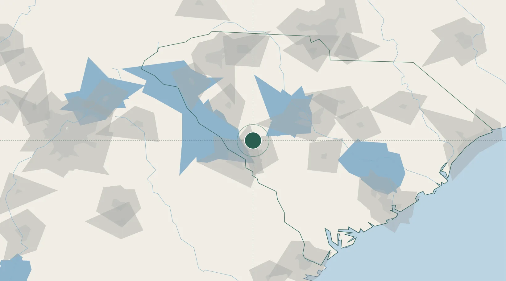
Nearby Logistics Neighbours

Cities
  1. 1Johnston10 km
  2. 2Ward17 km
  3. 3Martinez32 km
  4. 4North Augusta33 km
  5. 5Grovetown44 km
Nearest neighbours — logibook spatial index (haversine) over the source coordinates
Ports
  1. 1Beaufort181 km
  2. 2Port Royal186 km
  3. 3Savannah196 km
  4. 4Charleston207 km
  5. 5Georgetown240 km
Nearest neighbours — logibook spatial index (haversine) over the source coordinates
Airports
  1. 1Daniel Field35 km
  2. 2Augusta Regional At Bush Field42 km
  3. 3Columbia Metropolitan Airport69 km
  4. 4Jim Hamilton L.B. Owens Airport82 km
  5. 5Orangeburg Municipal Airport95 km
Nearest neighbours — logibook spatial index (haversine) over the source coordinates
Trade Zones
  1. 1FTZ No. 127 West Columbia71 km
  2. 2FTZ No. 021 Dorchester County127 km
  3. 3FTZ No. 038 Spartanburg County134 km
  4. 4FTZ No. 057 Mecklenburg County183 km
  5. 5FTZ No. 104 Savannah195 km
Nearest neighbours — logibook spatial index (haversine) over the source coordinates
DatabookThe Record of Consolidated Knowledge
United States beyond logistics?
Browse databook

All Sources

LocationsUN/LOCODE
UN/LOCODE — free
LocationsGeoNames
CC BY 4.0
Portsthe NGA World Port Index
Public domain (US gov)
AirportsOurAirports
Public domain
Trade Zonesthe World Bank SEZ database
CC BY 4.0
Trade ZonesOpen Zone Map
CC BY
← United States locations