UN/LOCODE hub · United States
USSBR

Ambrose

31.5833°, -83.0000°
380
Population
3
Transport functions

Transport Functions

Rail
Road
Multimodal
UN/LOCODE

Hub Profile

Place type
Populated place
GeoNames
Region
Georgia
GeoNames
Population
380
GeoNames
Time zone
America/New_York
GeoNames
Elevation
95 m
GeoNames

Location

Location of USSBR
Natural Earth 10m (public domain) · Georgia · USSBR · 31.58, -83.00GoogleOSMYandex

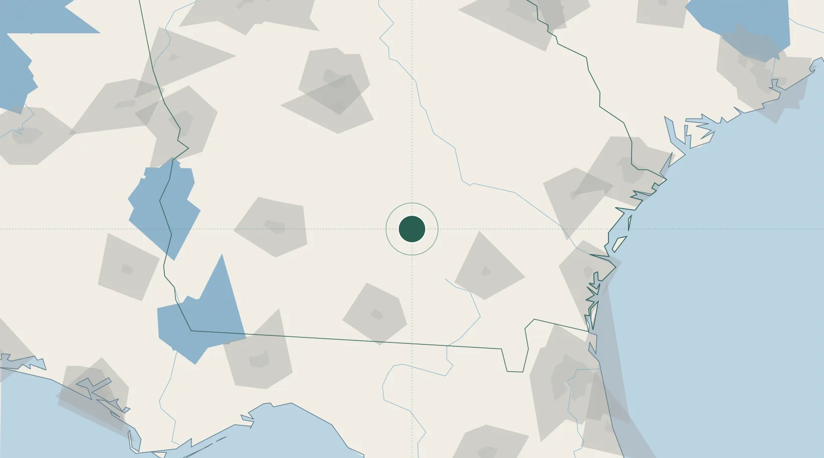
Nearby Logistics Neighbours

Cities
  1. 1Willacoochee28 km
  2. 2Denton33 km
  3. 3Nicholls36 km
  4. 4Axson43 km
  5. 5Rhine48 km
Nearest neighbours — logibook spatial index (haversine) over the source coordinates
Ports
  1. 1Brunswick150 km
  2. 2Darien151 km
  3. 3Fernandina Beach177 km
  4. 4Savannah189 km
  5. 5Jacksonville191 km
Nearest neighbours — logibook spatial index (haversine) over the source coordinates
Airports
  1. 1Moody Air Force Base71 km
  2. 2Valdosta Regional Airport93 km
  3. 3Southwest Georgia Regional Airport114 km
  4. 4Robins Air Force Base130 km
  5. 5Middle Georgia Regional Airport138 km
Nearest neighbours — logibook spatial index (haversine) over the source coordinates
Trade Zones
  1. 1FTZ No. 144 Brunswick150 km
  2. 2FTZ No. 064 Jacksonville170 km
  3. 3FTZ No. 104 Savannah189 km
  4. 4FTZ No. 233 Dothan234 km
  5. 5FTZ No. 021 Dorchester County271 km
Nearest neighbours — logibook spatial index (haversine) over the source coordinates
DatabookThe Record of Consolidated Knowledge
United States beyond logistics?
Browse databook

All Sources

LocationsUN/LOCODE
UN/LOCODE — free
LocationsGeoNames
CC BY 4.0
Portsthe NGA World Port Index
Public domain (US gov)
AirportsOurAirports
Public domain
Trade Zonesthe World Bank SEZ database
CC BY 4.0
Trade ZonesOpen Zone Map
CC BY
← United States locations