UN/LOCODE hub · United States
USEUD

Eudora

33.1000°, -91.2500°
2,102
Population
4
Transport functions

Transport Functions

Port
Rail
Road
Multimodal
UN/LOCODE

Hub Profile

Place type
Populated place
GeoNames
Region
Arkansas
GeoNames
Population
2,102
GeoNames
Time zone
America/Chicago
GeoNames
Elevation
41 m
GeoNames

Location

Location of USEUD
Natural Earth 10m (public domain) · Arkansas · USEUD · 33.10, -91.25GoogleOSMYandex

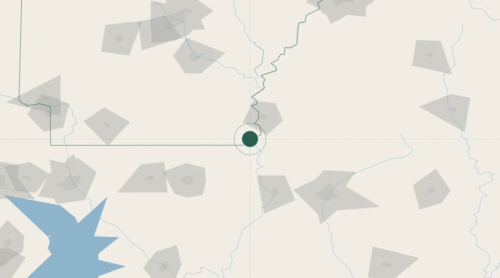
Nearby Logistics Neighbours

Cities
  1. 1Portland29 km
  2. 2Lake Providence34 km
  3. 3Hollandale38 km
  4. 4Greenville43 km
  5. 5Lamont51 km
Nearest neighbours — logibook spatial index (haversine) over the source coordinates
Ports
  1. 1Port Of Memphis240 km
  2. 2Baton Rouge295 km
  3. 3Madisonville318 km
  4. 4Slidell344 km
  5. 5Convent345 km
Nearest neighbours — logibook spatial index (haversine) over the source coordinates
Airports
  1. 1Mid Delta Regional Airport49 km
  2. 2Monticello Municipal Ellis Field76 km
  3. 3Monroe Regional Airport99 km
  4. 4Greenwood–Leflore Airport117 km
  5. 5Pine Bluff Regional Airport, Grider Field135 km
Nearest neighbours — logibook spatial index (haversine) over the source coordinates
Trade Zones
  1. 1FTZ No. 158 Vicksburg Jackson97 km
  2. 2FTZ No. 287 Tunica County181 km
  3. 3FTZ No. 014 Little Rock199 km
  4. 4FTZ No. 262 Southaven234 km
  5. 5FTZ No. 077 Memphis244 km
Nearest neighbours — logibook spatial index (haversine) over the source coordinates
DatabookThe Record of Consolidated Knowledge
United States beyond logistics?
Browse databook

All Sources

LocationsUN/LOCODE
UN/LOCODE — free
LocationsGeoNames
CC BY 4.0
Portsthe NGA World Port Index
Public domain (US gov)
AirportsOurAirports
Public domain
Trade Zonesthe World Bank SEZ database
CC BY 4.0
Trade ZonesOpen Zone Map
CC BY
← United States locations