UN/LOCODE hub · United States
USCM6

Campton

43.8333°, -71.6667°
431
Population
2
Transport functions

Transport Functions

Road
Multimodal
UN/LOCODE

Hub Profile

Place type
Provincial seat
GeoNames
Region
Kentucky
GeoNames
Population
431
GeoNames
Time zone
America/New_York
GeoNames
Elevation
293 m
GeoNames

Location

Location of USCM6
Natural Earth 10m (public domain) · Kentucky · USCM6 · 43.83, -71.67GoogleOSMYandex

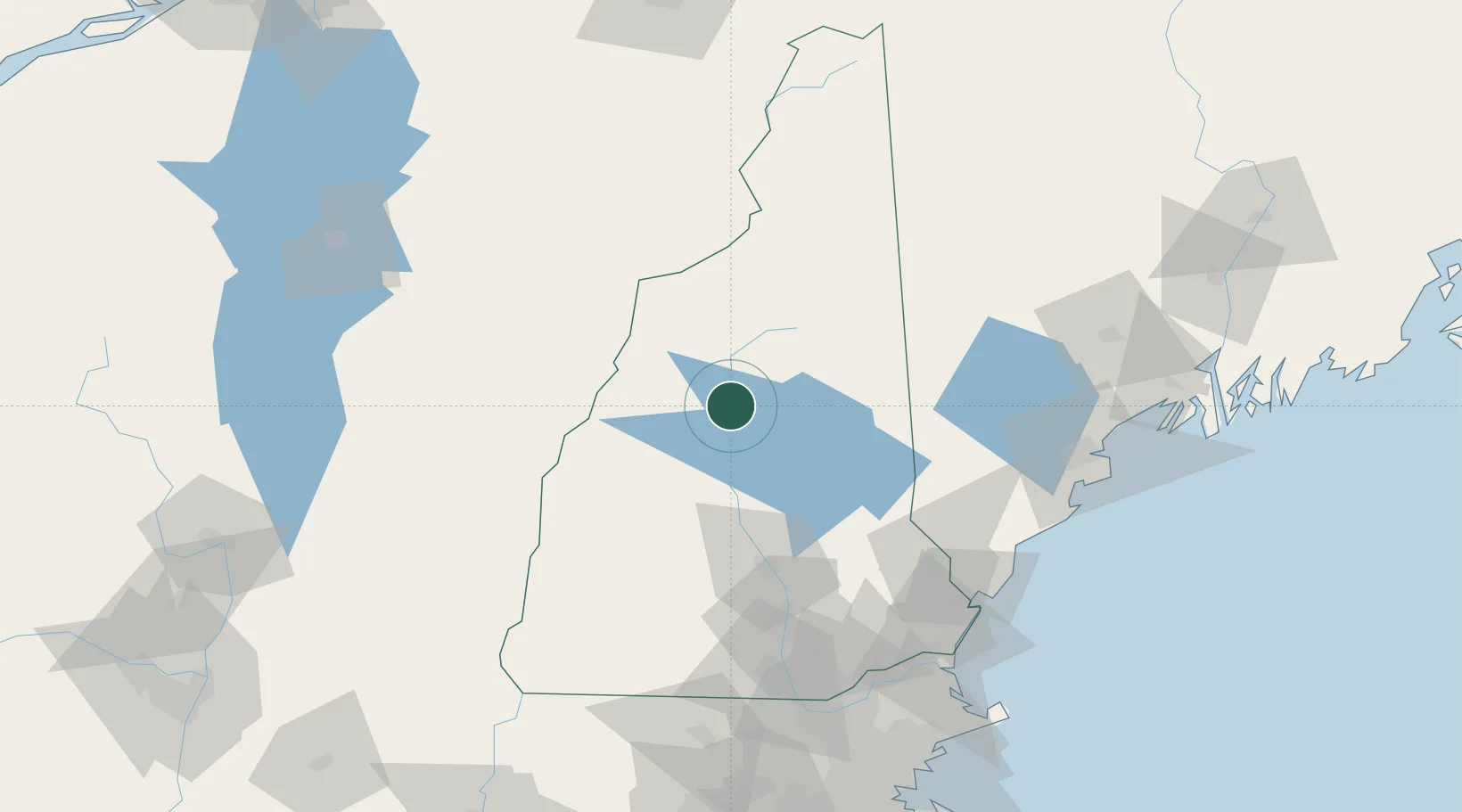
Nearby Logistics Neighbours

Cities
  1. 1Ellsworth7 km
  2. 2Ashland17 km
  3. 3Wentworth20 km
  4. 4North Woodstock20 km
  5. 5Lincoln22 km
Nearest neighbours — logibook spatial index (haversine) over the source coordinates
Ports
  1. 1Saco105 km
  2. 2Kennebunkport110 km
  3. 3Portsmouth112 km
  4. 4Portland115 km
  5. 5Newburyport130 km
Nearest neighbours — logibook spatial index (haversine) over the source coordinates
Airports
  1. 1Lebanon Municipal Airport56 km
  2. 2Concord Municipal Airport71 km
  3. 3Edward F Knapp State Airport83 km
  4. 4Manchester-Boston Regional Airport102 km
  5. 5Portsmouth International Airport at Pease108 km
Nearest neighbours — logibook spatial index (haversine) over the source coordinates
Trade Zones
  1. 1FTZ No. 081 Portsmouth109 km
  2. 2FTZ No. 263 Auburn120 km
  3. 3FTZ No. 268 Brattleboro132 km
  4. 4FTZ No. 027 Boston175 km
  5. 5FTZ No. 186 Waterville176 km
Nearest neighbours — logibook spatial index (haversine) over the source coordinates
DatabookThe Record of Consolidated Knowledge
United States beyond logistics?
Browse databook

All Sources

LocationsUN/LOCODE
UN/LOCODE — free
LocationsGeoNames
CC BY 4.0
Portsthe NGA World Port Index
Public domain (US gov)
AirportsOurAirports
Public domain
Trade Zonesthe World Bank SEZ database
CC BY 4.0
Trade ZonesOpen Zone Map
CC BY
← United States locations