UN/LOCODE hub · Philippines
PHPPB

Busan Bay

7.5833°, 122.4500°
1
Transport functions

Transport Functions

Multimodal
UN/LOCODE

Hub Profile

Region
ZAS
GeoNames

Location

Location of PHPPB
Natural Earth 10m (public domain) · ZAS · PHPPB · 7.58, 122.45GoogleOSMYandex

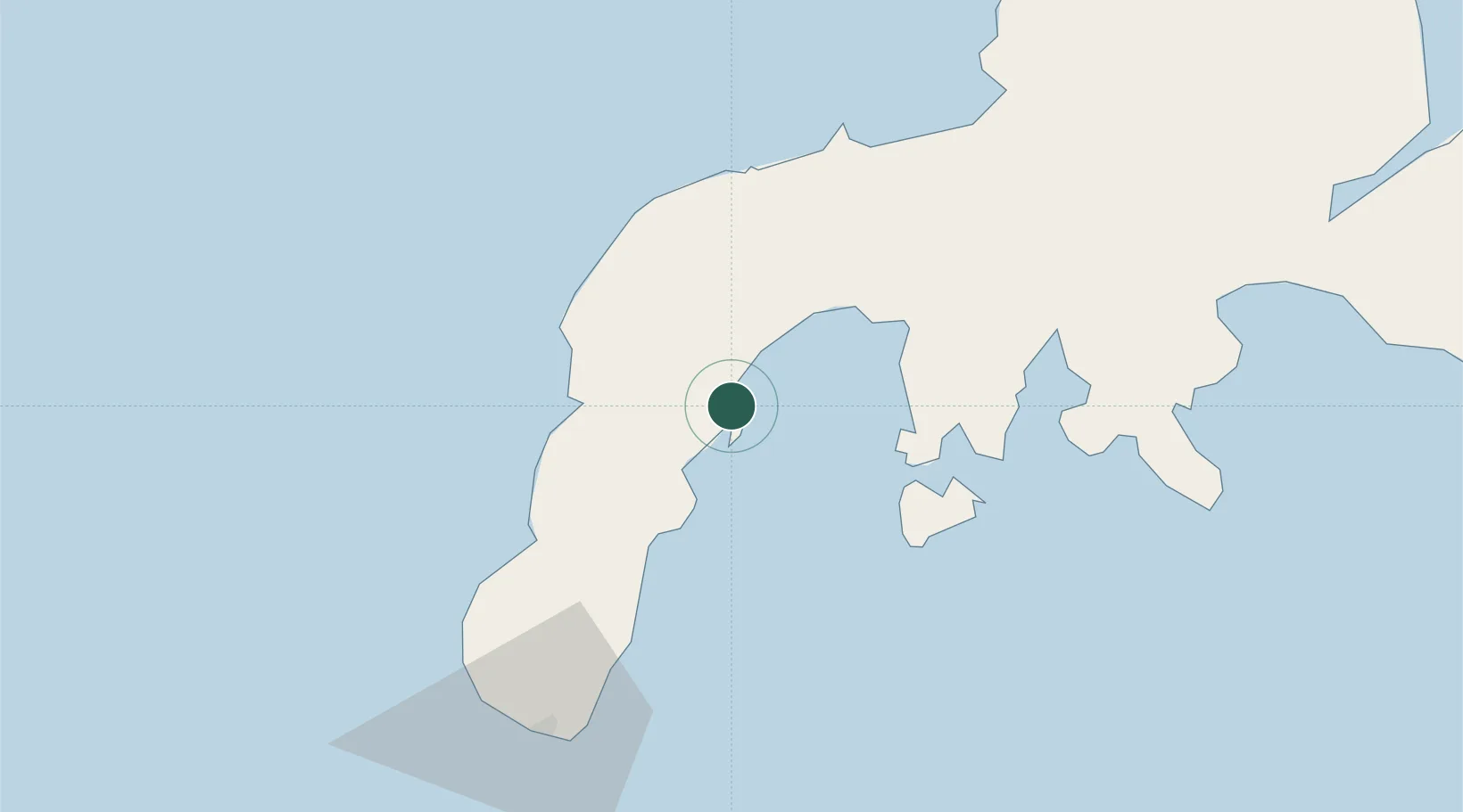
Nearby Logistics Neighbours

Cities
  1. 1Vitali/Zamboanga30 km
  2. 2Kabasalan/Zamboanga40 km
  3. 3Labason/Zamboanga54 km
  4. 4Zamboanga86 km
  5. 5Isabela, Basilan112 km
Nearest neighbours — logibook spatial index (haversine) over the source coordinates
Ports
  1. 1Zamboanga87 km
  2. 2Basilian City (Isabela)110 km
  3. 3Pagadian112 km
  4. 4Port Holland132 km
  5. 5Port Ozamis166 km
Nearest neighbours — logibook spatial index (haversine) over the source coordinates
Airports
  1. 1Zamboanga International Airport85 km
  2. 2Pagadian Airport115 km
  3. 3Dipolog Airport150 km
  4. 4Labo Airport167 km
  5. 5Cotabato (Awang) Airport200 km
Nearest neighbours — logibook spatial index (haversine) over the source coordinates
Trade Zones
  1. 1Zamboanga City Special Economic Zone87 km
  2. 2Irasan-Roxas Zanorte Special Economic Zone135 km
  3. 3Misamis Occidental-Oroquieta City Economic Zone174 km
  4. 4NUIVI IALT Ecozone186 km
  5. 5Polloc Free Port and Economic Zone BARMM195 km
Nearest neighbours — logibook spatial index (haversine) over the source coordinates
DatabookThe Record of Consolidated Knowledge
Philippines beyond logistics?
Browse databook

All Sources

LocationsUN/LOCODE
UN/LOCODE — free
Portsthe NGA World Port Index
Public domain (US gov)
AirportsOurAirports
Public domain
Trade Zonesthe World Bank SEZ database
CC BY 4.0
Trade ZonesOpen Zone Map
CC BY
← Philippines locations