UN/LOCODE hub · New Zealand
NZPCN

Picton

-41.2833°, 174.0000°
4,930
Population
2
Transport functions

Transport Functions

Port
Airport
Picton is also a profiled seaport →
UN/LOCODE

Hub Profile

Place type
Populated place
GeoNames
Region
Marlborough
GeoNames
Population
4,930
GeoNames
Time zone
Pacific/Auckland
GeoNames
Elevation
13 m
GeoNames

Location

Location of NZPCN
Natural Earth 10m (public domain) · Marlborough · NZPCN · -41.28, 174.00GoogleOSMYandex

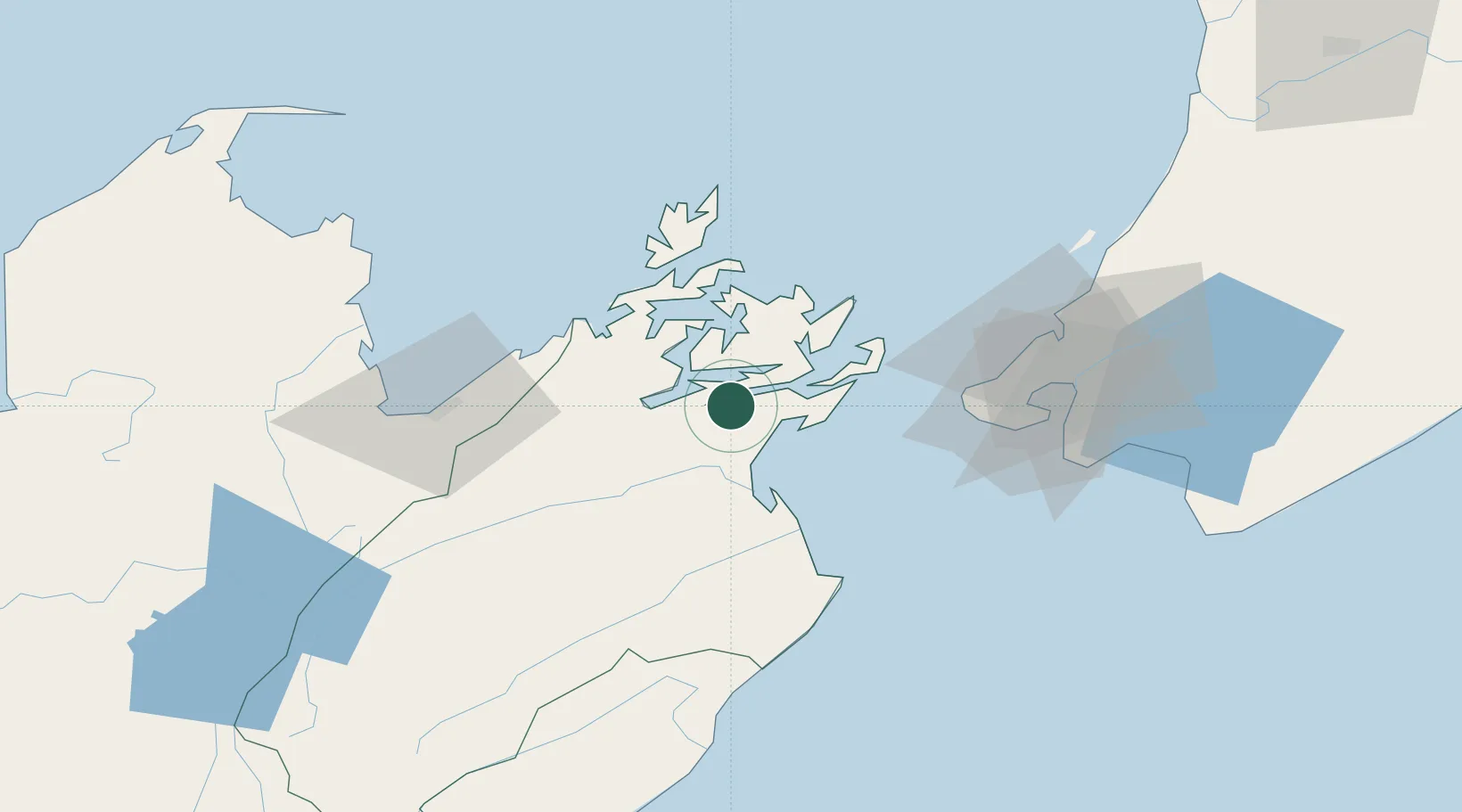
Nearby Logistics Neighbours

Cities
  1. 1Whekenui27 km
  2. 2Port Nelson61 km
  3. 3Nelson62 km
  4. 4Pipitea64 km
  5. 5Burnham Wharf67 km
Nearest neighbours — logibook spatial index (haversine) over the source coordinates
Ports
  1. 1Nelson61 km
  2. 2Wellington66 km
  3. 3Tarakohe104 km
  4. 4Wanganui172 km
  5. 5Westport206 km
Nearest neighbours — logibook spatial index (haversine) over the source coordinates
Airports
  1. 1Picton Aerodrome8 km
  2. 2Woodbourne Airport28 km
  3. 3Nelson Airport65 km
  4. 4Wellington International Airport68 km
  5. 5Paraparaumu Airport93 km
Nearest neighbours — logibook spatial index (haversine) over the source coordinates
Trade Zones
  1. 1Hicks Bay Area Special Economic Zone542 km
  2. 2Latrobe Valley Economic Growth Zone2374 km
  3. 3Rotuma-Kadavu Tax-Free Region2607 km
  4. 4Kalabu Tax Free Zone2614 km
  5. 5Nausori-Ba Tax-Free Region2622 km
Nearest neighbours — logibook spatial index (haversine) over the source coordinates
DatabookThe Record of Consolidated Knowledge
New Zealand beyond logistics?
Browse databook

All Sources

LocationsUN/LOCODE
UN/LOCODE — free
LocationsGeoNames
CC BY 4.0
Portsthe NGA World Port Index
Public domain (US gov)
AirportsOurAirports
Public domain
Trade Zonesthe World Bank SEZ database
CC BY 4.0
Trade ZonesOpen Zone Map
CC BY
← New Zealand locations