UN/LOCODE hub · New Zealand
NZWHE

Whekenui

-41.1833°, 174.3000°
1
Transport functions

Transport Functions

Multimodal
UN/LOCODE

Hub Profile

Region
MBH
GeoNames

Location

Location of NZWHE
Natural Earth 10m (public domain) · MBH · NZWHE · -41.18, 174.30GoogleOSMYandex

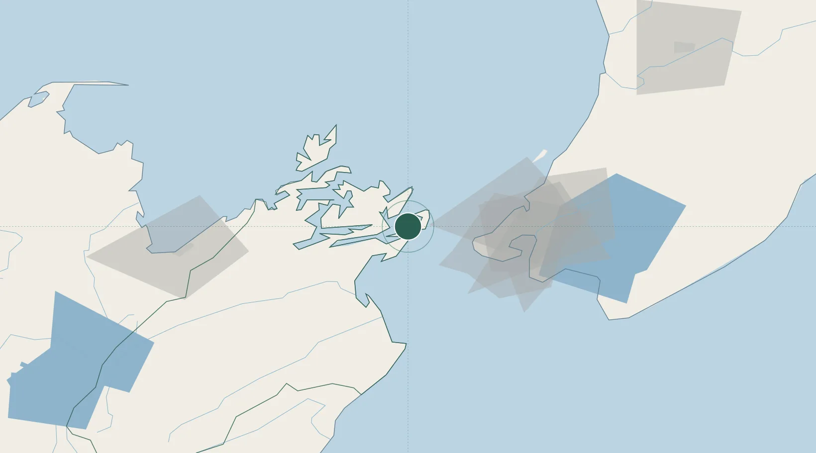
Nearby Logistics Neighbours

Cities
  1. 1Picton27 km
  2. 2Pipitea40 km
  3. 3Wellington44 km
  4. 4Burnham Wharf44 km
  5. 5Shelly Bay45 km
Nearest neighbours — logibook spatial index (haversine) over the source coordinates
Ports
  1. 1Picton26 km
  2. 2Wellington42 km
  3. 3Nelson87 km
  4. 4Tarakohe123 km
  5. 5Wanganui151 km
Nearest neighbours — logibook spatial index (haversine) over the source coordinates
Airports
  1. 1Picton Aerodrome34 km
  2. 2Wellington International Airport45 km
  3. 3Woodbourne Airport52 km
  4. 4Paraparaumu Airport66 km
  5. 5Otaki Airport84 km
Nearest neighbours — logibook spatial index (haversine) over the source coordinates
Trade Zones
  1. 1Hicks Bay Area Special Economic Zone517 km
  2. 2Latrobe Valley Economic Growth Zone2399 km
  3. 3Rotuma-Kadavu Tax-Free Region2592 km
  4. 4Kalabu Tax Free Zone2599 km
  5. 5Nausori-Ba Tax-Free Region2606 km
Nearest neighbours — logibook spatial index (haversine) over the source coordinates
DatabookThe Record of Consolidated Knowledge
New Zealand beyond logistics?
Browse databook

All Sources

LocationsUN/LOCODE
UN/LOCODE — free
Portsthe NGA World Port Index
Public domain (US gov)
AirportsOurAirports
Public domain
Trade Zonesthe World Bank SEZ database
CC BY 4.0
Trade ZonesOpen Zone Map
CC BY
← New Zealand locations