UN/LOCODE hub · Norway
NOOSY

Namsos

64.4500°, 11.5000°
8,413
Population
4
Transport functions

Transport Functions

Port
Rail
Road
Airport
Namsos is also a profiled seaport →
UN/LOCODE

Hub Profile

Place type
Provincial seat
GeoNames
Region
Trøndelag
GeoNames
Population
8,413
GeoNames
Time zone
Europe/Oslo
GeoNames

Location

Location of NOOSY
Natural Earth 10m (public domain) · Trøndelag · NOOSY · 64.45, 11.50GoogleOSMYandex

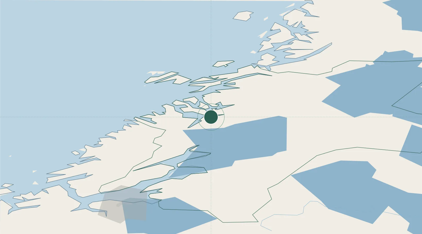
Nearby Logistics Neighbours

Cities
  1. 1Utvorda31 km
  2. 2Abelvær35 km
  3. 3Salsbruket43 km
  4. 4Malm45 km
  5. 5Ottersøya46 km
Nearest neighbours — logibook spatial index (haversine) over the source coordinates
Ports
  1. 1Salsbruket42 km
  2. 2Malm45 km
  3. 3Rorvik48 km
  4. 4Steinkjer49 km
  5. 5Levanger78 km
Nearest neighbours — logibook spatial index (haversine) over the source coordinates
Airports
  1. 1Namsos Airport5 km
  2. 2Rørvik Airport, Ryum46 km
  3. 3Trondheim Airport, Værnes114 km
  4. 4Brønnøysund Airport, Brønnøy117 km
  5. 5Ørland Airport124 km
Nearest neighbours — logibook spatial index (haversine) over the source coordinates
Trade Zones
  1. 1Stockholm Free Zone664 km
  2. 2Turku Free Zone707 km
  3. 3Gothenburg Boundless Customs Warehouse750 km
  4. 4Jönköping Free Zone756 km
  5. 5Freeport of Hanko782 km
Nearest neighbours — logibook spatial index (haversine) over the source coordinates
DatabookThe Record of Consolidated Knowledge
Norway beyond logistics?
Browse databook

All Sources

LocationsUN/LOCODE
UN/LOCODE — free
LocationsGeoNames
CC BY 4.0
Portsthe NGA World Port Index
Public domain (US gov)
AirportsOurAirports
Public domain
Trade Zonesthe World Bank SEZ database
CC BY 4.0
Trade ZonesOpen Zone Map
CC BY
← Norway locations