UN/LOCODE hub · Norway
NOMOR

Mørsvikbotn

67.7000°, 15.8333°
1
Transport functions

Transport Functions

Port
UN/LOCODE

Hub Profile

Region
18
GeoNames

Location

Location of NOMOR
Natural Earth 10m (public domain) · 18 · NOMOR · 67.70, 15.83GoogleOSMYandex

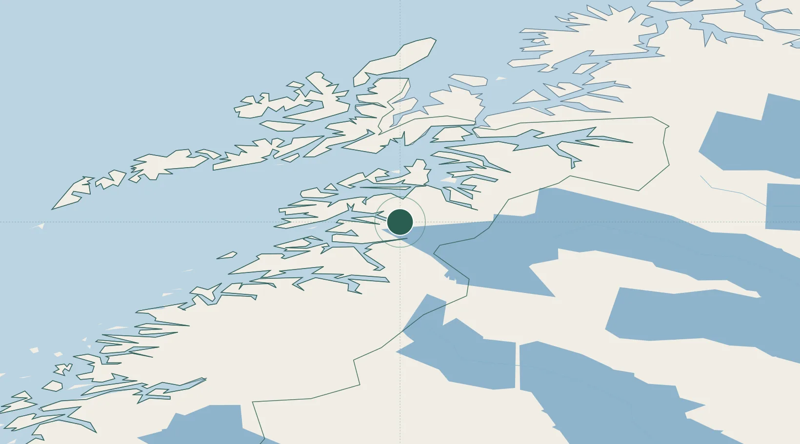
Nearby Logistics Neighbours

Cities
  1. 1Innhavet30 km
  2. 2Bogøy35 km
  3. 3Hammerfall36 km
  4. 4Evenestangen36 km
  5. 5Drag38 km
Nearest neighbours — logibook spatial index (haversine) over the source coordinates
Ports
  1. 1Lakselv39 km
  2. 2Drag40 km
  3. 3Kjerringoy50 km
  4. 4Fauske53 km
  5. 5Tranoy54 km
Nearest neighbours — logibook spatial index (haversine) over the source coordinates
Airports
  1. 1Svolvær Airport, Helle78 km
  2. 2Bodø Airport79 km
  3. 3Harstad/Narvik Airport95 km
  4. 4Stokmarknes Airport, Skagen103 km
  5. 5Leknes Airport106 km
Nearest neighbours — logibook spatial index (haversine) over the source coordinates
Trade Zones
  1. 1Oulu Port Free Warehouse Area522 km
  2. 2Turku Free Zone863 km
  3. 3Stockholm Free Zone935 km
  4. 4Freeport of Hanko940 km
  5. 5Port of Hamina-Kotka965 km
Nearest neighbours — logibook spatial index (haversine) over the source coordinates
DatabookThe Record of Consolidated Knowledge
Norway beyond logistics?
Browse databook

All Sources

LocationsUN/LOCODE
UN/LOCODE — free
Portsthe NGA World Port Index
Public domain (US gov)
AirportsOurAirports
Public domain
Trade Zonesthe World Bank SEZ database
CC BY 4.0
Trade ZonesOpen Zone Map
CC BY
← Norway locations