UN/LOCODE hub · Norway
NOBLL

Ballangen

68.3333°, 16.8333°
956
Population
1
Transport functions

Transport Functions

Port
Ballangen is also a profiled seaport →
UN/LOCODE

Hub Profile

Place type
Populated place
GeoNames
Region
Nordland
GeoNames
Population
956
GeoNames
Time zone
Europe/Oslo
GeoNames
Elevation
15 m
GeoNames

Location

Location of NOBLL
Natural Earth 10m (public domain) · Nordland · NOBLL · 68.33, 16.83GoogleOSMYandex

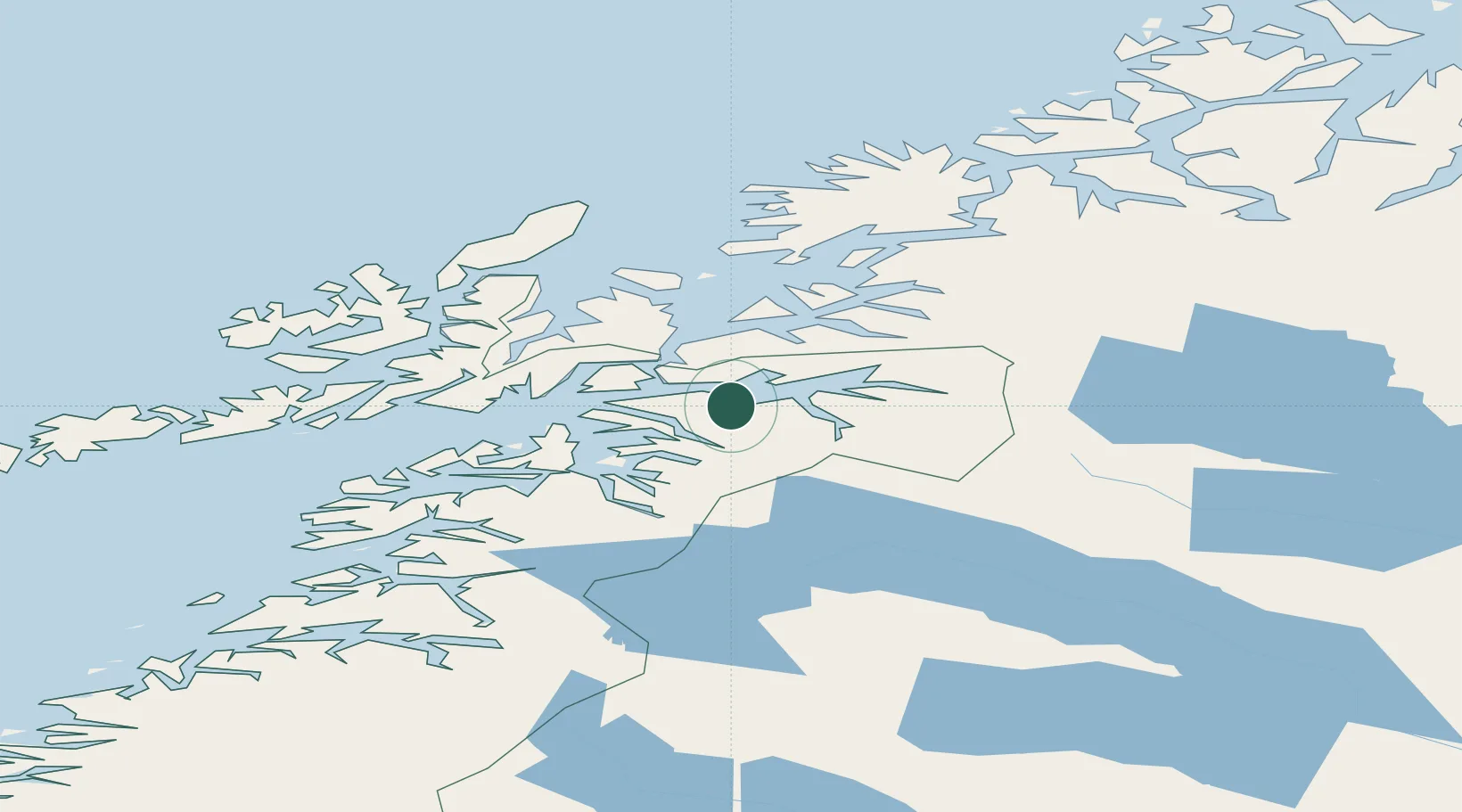
Nearby Logistics Neighbours

Cities
  1. 1Hekkelstrand7 km
  2. 2Bogen21 km
  3. 3Ramsund22 km
  4. 4Narvik26 km
  5. 5Fjelldal28 km
Nearest neighbours — logibook spatial index (haversine) over the source coordinates
Ports
  1. 1Lilandsgrunnen16 km
  2. 2Narvik25 km
  3. 3Ulvik35 km
  4. 4Lodingen35 km
  5. 5Drag44 km
Nearest neighbours — logibook spatial index (haversine) over the source coordinates
Airports
  1. 1Harstad/Narvik Airport19 km
  2. 2Stokmarknes Airport, Skagen78 km
  3. 3Svolvær Airport, Helle90 km
  4. 4Bardufoss Airport106 km
  5. 5Andøya Airport, Andenes111 km
Nearest neighbours — logibook spatial index (haversine) over the source coordinates
Trade Zones
  1. 1Oulu Port Free Warehouse Area529 km
  2. 2Turku Free Zone914 km
  3. 3Free Zone of Lappeenranta969 km
  4. 4Freeport of Hanko989 km
  5. 5Port of Hamina-Kotka997 km
Nearest neighbours — logibook spatial index (haversine) over the source coordinates
DatabookThe Record of Consolidated Knowledge
Norway beyond logistics?
Browse databook

All Sources

LocationsUN/LOCODE
UN/LOCODE — free
LocationsGeoNames
CC BY 4.0
Portsthe NGA World Port Index
Public domain (US gov)
AirportsOurAirports
Public domain
Trade Zonesthe World Bank SEZ database
CC BY 4.0
Trade ZonesOpen Zone Map
CC BY
← Norway locations