UN/LOCODE hub · Netherlands
NLKTL

Kloosterburen

53.1500°, 5.9833°
575
Population
1
Transport functions

Transport Functions

Multimodal
UN/LOCODE

Hub Profile

Place type
Populated place
GeoNames
Region
Groningen
GeoNames
Population
575
GeoNames
Time zone
Europe/Amsterdam
GeoNames
Elevation
2 m
GeoNames

Location

Location of NLKTL
Natural Earth 10m (public domain) · Groningen · NLKTL · 53.15, 5.98GoogleOSMYandex

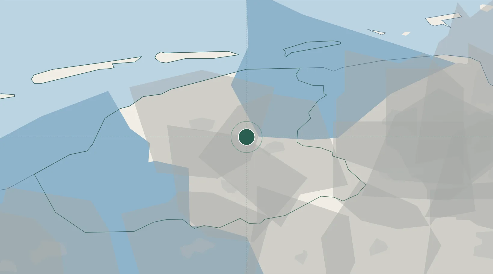
Nearby Logistics Neighbours

Cities
  1. 1Eernewoude4 km
  2. 2Oostermeer5 km
  3. 3Veenwouden9 km
  4. 4Hempens11 km
  5. 5Kootstertille11 km
Nearest neighbours — logibook spatial index (haversine) over the source coordinates
Ports
  1. 1Harlingen38 km
  2. 2Eemshaven66 km
  3. 3Delfzijl66 km
  4. 4Emden82 km
  5. 5Den Helder83 km
Nearest neighbours — logibook spatial index (haversine) over the source coordinates
Airports
  1. 1Leeuwarden Air Base17 km
  2. 2Groningen Airport Eelde40 km
  3. 3Borkum Airport69 km
  4. 4Lelystad Airport84 km
  5. 5De Kooy Airfield / Den Helder Naval Air Station84 km
Nearest neighbours — logibook spatial index (haversine) over the source coordinates
Trade Zones
  1. 1Freeport of Emden83 km
  2. 2Freeport of Bremerhaven (Freihafen Bremerhaven)186 km
  3. 3Freeport of Cuxhaven (Freihafen Cuxhaven)187 km
  4. 4Freeport of Duisburg194 km
  5. 5Rheinische Revier SWZ251 km
Nearest neighbours — logibook spatial index (haversine) over the source coordinates
DatabookThe Record of Consolidated Knowledge
Netherlands beyond logistics?
Browse databook

All Sources

LocationsUN/LOCODE
UN/LOCODE — free
LocationsGeoNames
CC BY 4.0
Portsthe NGA World Port Index
Public domain (US gov)
AirportsOurAirports
Public domain
Trade Zonesthe World Bank SEZ database
CC BY 4.0
Trade ZonesOpen Zone Map
CC BY
← Netherlands locations