UN/LOCODE hub · Japan
JPRPJ

Nanto

36.5833°, 136.9167°
47,976
Population
1
Transport functions

Transport Functions

Multimodal
UN/LOCODE

Hub Profile

Place type
Provincial seat
GeoNames
Region
Toyama
GeoNames
Population
47,976
GeoNames
Time zone
Asia/Tokyo
GeoNames
Elevation
141 m
GeoNames

Location

Location of JPRPJ
Natural Earth 10m (public domain) · Toyama · JPRPJ · 36.58, 136.92GoogleOSMYandex

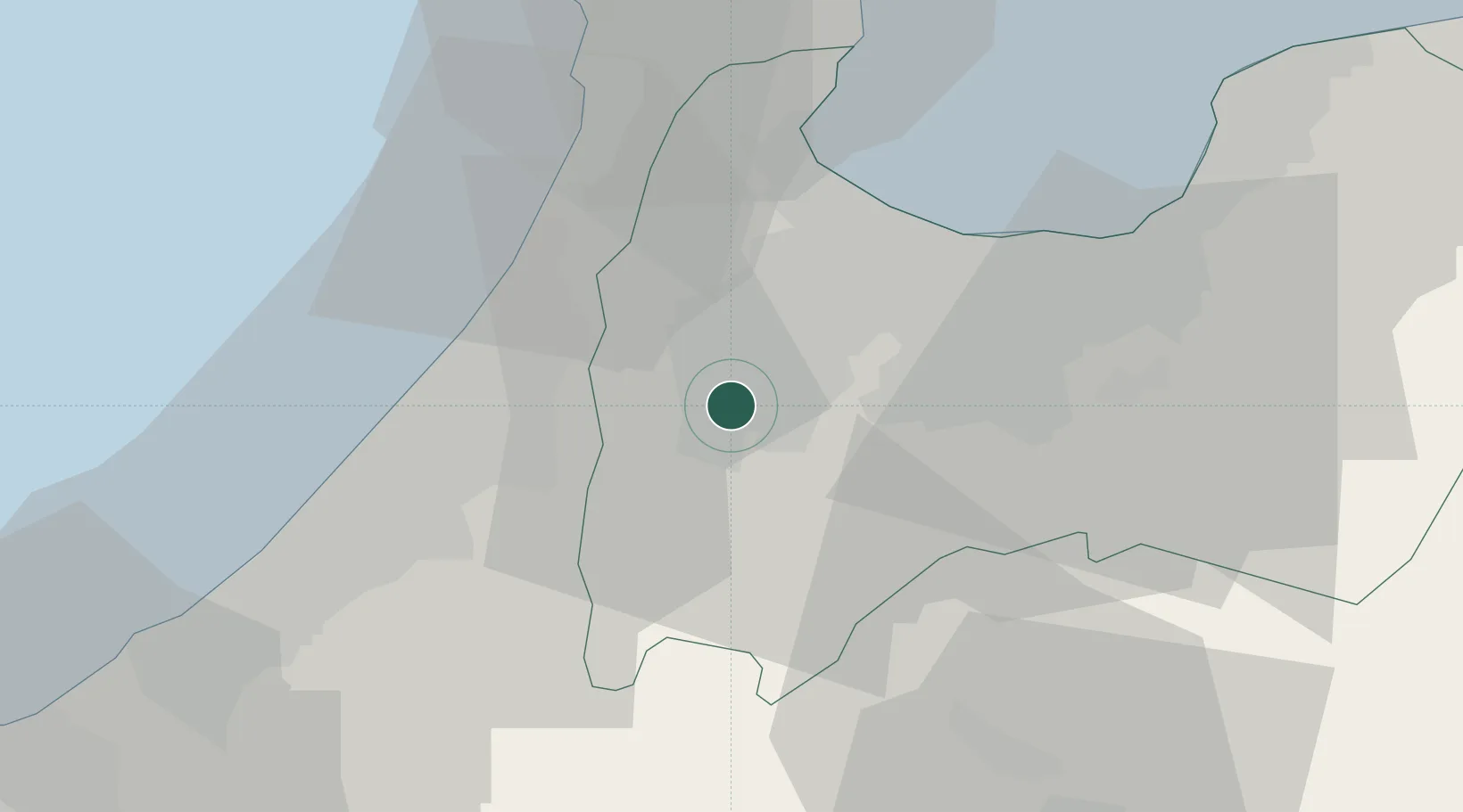
Nearby Logistics Neighbours

Cities
  1. 1Tonami6 km
  2. 2Tsubata, Ishikawa19 km
  3. 3Kanazawa27 km
  4. 4Toyama27 km
  5. 5Toyamashinko27 km
Nearest neighbours — logibook spatial index (haversine) over the source coordinates
Ports
  1. 1Fushiki-Toyama28 km
  2. 2Kanazawa29 km
  3. 3Nanao Ko52 km
  4. 4Fukui86 km
  5. 5Himekawa97 km
Nearest neighbours — logibook spatial index (haversine) over the source coordinates
Airports
  1. 1Toyama Kitokito Airport25 km
  2. 2Komatsu Airport / JASDF Komatsu Air Base50 km
  3. 3Noto Satoyama Airport79 km
  4. 4Fukui Airport79 km
  5. 5Shinshu-Matsumoto Airport101 km
Nearest neighbours — logibook spatial index (haversine) over the source coordinates
DatabookThe Record of Consolidated Knowledge
Japan beyond logistics?
Browse databook

All Sources

LocationsUN/LOCODE
UN/LOCODE — free
LocationsGeoNames
CC BY 4.0
Portsthe NGA World Port Index
Public domain (US gov)
AirportsOurAirports
Public domain
Trade Zonesthe World Bank SEZ database
CC BY 4.0
Trade ZonesOpen Zone Map
CC BY
← Japan locations