UN/LOCODE hub · India
INRJU

Rajula

20.9480°, 71.4934°
38,489
Population
2
Transport functions

Transport Functions

Road
Multimodal
UN/LOCODE

Hub Profile

Place type
Populated place
GeoNames
Region
Gujarat
GeoNames
Population
38,489
GeoNames
Time zone
Asia/Kolkata
GeoNames
Elevation
47 m
GeoNames
Logistics facilities
2
UN/LOCODE

Location

Location of INRJU
Natural Earth 10m (public domain) · Gujarat · INRJU · 20.95, 71.49GoogleOSMYandex

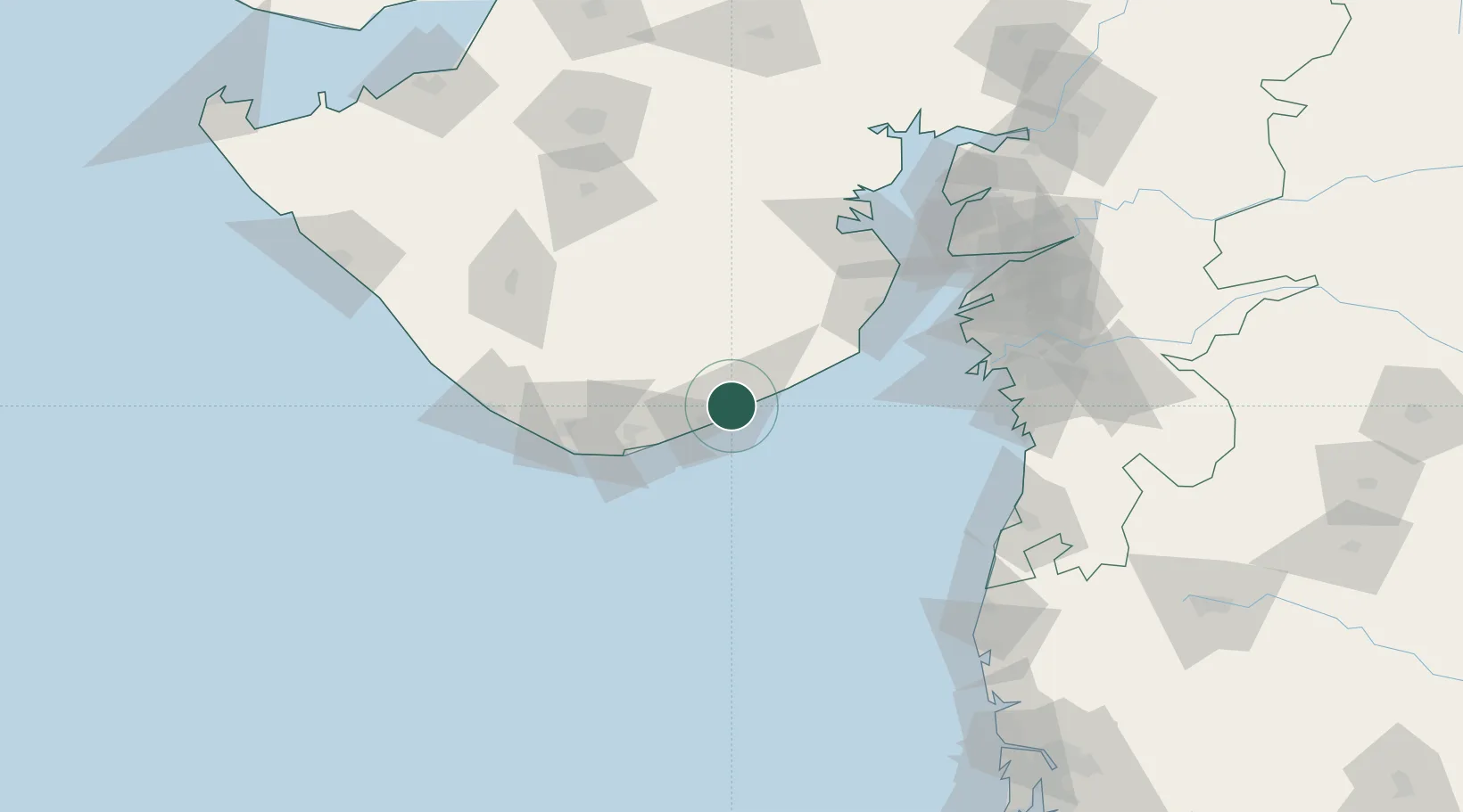
Nearby Logistics Neighbours

Cities
  1. 1Port Pipavav4 km
  2. 2Jafarabad17 km
  3. 3Pipavav (Victor) Port68 km
  4. 4E-Complex-SEZ/Amreli79 km
  5. 5Mul Dwårka89 km
Nearest neighbours — logibook spatial index (haversine) over the source coordinates
Ports
  1. 1Pipavav Bandar4 km
  2. 2Jafarabad15 km
  3. 3Veraval117 km
  4. 4Bhavnagar119 km
  5. 5Hazira119 km
Nearest neighbours — logibook spatial index (haversine) over the source coordinates
Airports
  1. 1Diu Airport65 km
  2. 2Bhavnagar Airport115 km
  3. 3Surat International Airport131 km
  4. 4Keshod Airport133 km
  5. 5Daman Airport152 km
Nearest neighbours — logibook spatial index (haversine) over the source coordinates
Trade Zones
  1. 1Gujarat Hira Bourse132 km
  2. 2Dahej SEZ Ltd.141 km
  3. 3Surat Special Economic Zone144 km
  4. 4Surat Apparel Park146 km
  5. 5HBS Pharma SEZ Private Limited, Bharuch167 km
Nearest neighbours — logibook spatial index (haversine) over the source coordinates
DatabookThe Record of Consolidated Knowledge
India beyond logistics?
Browse databook

All Sources

LocationsUN/LOCODE
UN/LOCODE — free
LocationsGeoNames
CC BY 4.0
Portsthe NGA World Port Index
Public domain (US gov)
AirportsOurAirports
Public domain
Trade Zonesthe World Bank SEZ database
CC BY 4.0
Trade ZonesOpen Zone Map
CC BY
← India locations