UN/LOCODE hub · Israel
ILYVE

Yavne

31.8833°, 34.7333°
47,585
Population
2
Transport functions

Transport Functions

Rail
Multimodal
UN/LOCODE

Hub Profile

Place type
Populated place
GeoNames
Region
Central District
GeoNames
Population
47,585
GeoNames
Time zone
Asia/Jerusalem
GeoNames
Elevation
37 m
GeoNames

Location

Location of ILYVE
Natural Earth 10m (public domain) · Central District · ILYVE · 31.88, 34.73GoogleOSMYandex

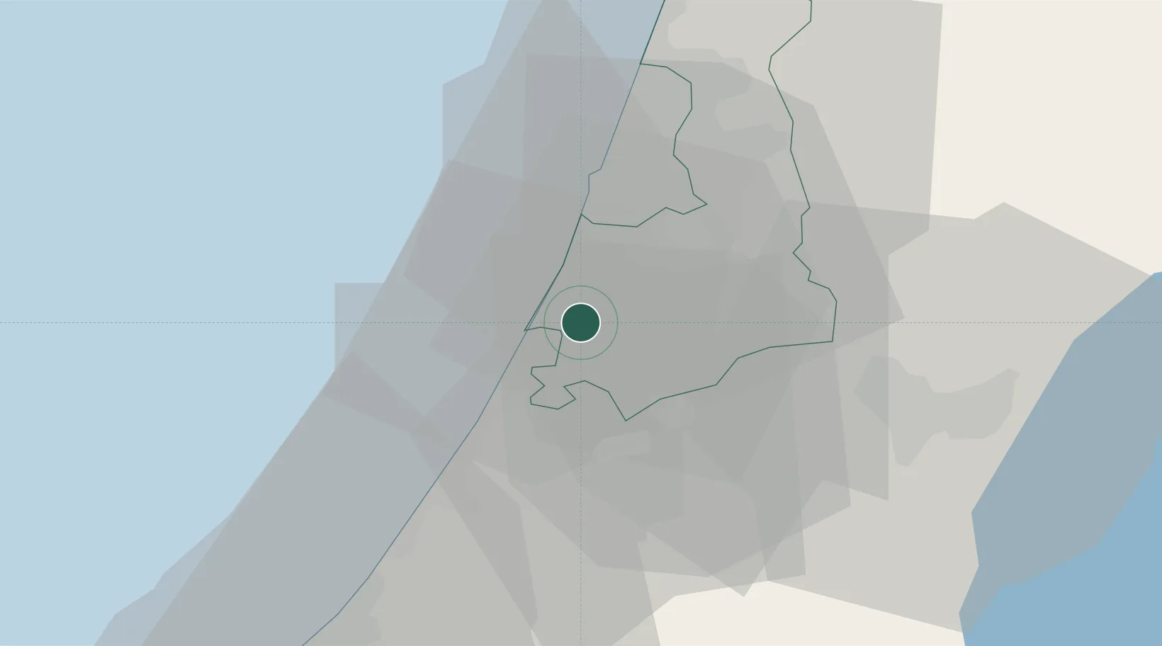
Nearby Logistics Neighbours

Cities
  1. 1Ashdod9 km
  2. 2Ashdod Bonded Air11 km
  3. 3Ashdod Fridenson11 km
  4. 4Ashdod Granaries11 km
  5. 5Ashdod Southport11 km
Nearest neighbours — logibook spatial index (haversine) over the source coordinates
Ports
  1. 1Ashdod11 km
  2. 2Ashqelon33 km
  3. 3Hadera67 km
  4. 4Haifa107 km
  5. 5Al Arish118 km
Nearest neighbours — logibook spatial index (haversine) over the source coordinates
Airports
  1. 1Tel Nof Air Base10 km
  2. 2Ben Gurion International Airport20 km
  3. 3Nevatim Air Base80 km
  4. 4Bar Yehuda Airfield88 km
  5. 5Ramat David Air Base97 km
Nearest neighbours — logibook spatial index (haversine) over the source coordinates
Trade Zones
  1. 1Bethlehem Industrial Estate -BIE48 km
  2. 2Gaza Industrial Estate (GIE)51 km
  3. 3Jericho Argo- Industrial Park (JAIP)67 km
  4. 4Al-Karama Free Zone79 km
  5. 5Jenin Industrial Free Zone (JIFZ)82 km
Nearest neighbours — logibook spatial index (haversine) over the source coordinates
DatabookThe Record of Consolidated Knowledge
Israel beyond logistics?
Browse databook

All Sources

LocationsUN/LOCODE
UN/LOCODE — free
LocationsGeoNames
CC BY 4.0
Portsthe NGA World Port Index
Public domain (US gov)
AirportsOurAirports
Public domain
Trade Zonesthe World Bank SEZ database
CC BY 4.0
Trade ZonesOpen Zone Map
CC BY
← Israel locations