UN/LOCODE hub · Ireland
IEBAG

Bagenalstown

52.7000°, -6.9500°
2,837
Population
2
Transport functions

Transport Functions

Rail
Road
UN/LOCODE

Hub Profile

Place type
Populated place
GeoNames
Region
Leinster
GeoNames
Population
2,837
GeoNames
Time zone
Europe/Dublin
GeoNames
Elevation
49 m
GeoNames

Location

Location of IEBAG
Natural Earth 10m (public domain) · Leinster · IEBAG · 52.70, -6.95GoogleOSMYandex

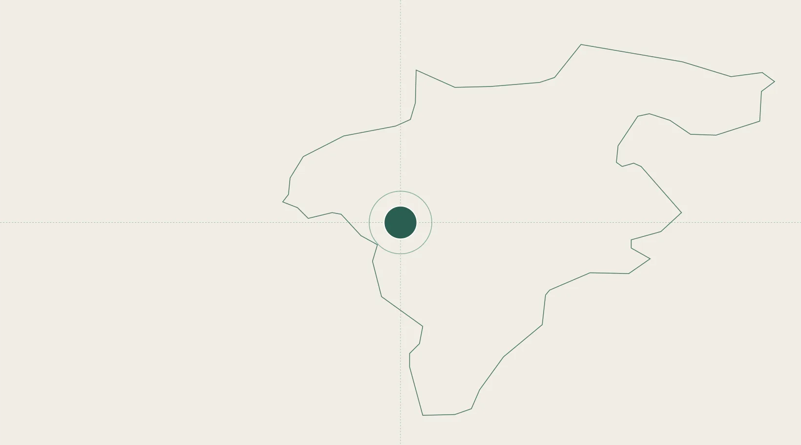
Nearby Logistics Neighbours

Cities
  1. 1Goresbridge10 km
  2. 2Dungarvan16 km
  3. 3Durrow35 km
  4. 4Callan35 km
  5. 5Marshmeadows/New Ross35 km
Nearest neighbours — logibook spatial index (haversine) over the source coordinates
Ports
  1. 1New Ross35 km
  2. 2Waterford50 km
  3. 3Rosslare65 km
  4. 4Dublin86 km
  5. 5Limerick113 km
Nearest neighbours — logibook spatial index (haversine) over the source coordinates
Airports
  1. 1Waterford Airport58 km
  2. 2Casement Air Base75 km
  3. 3Weston Airport79 km
  4. 4Dublin Airport93 km
  5. 5Shannon Airport133 km
Nearest neighbours — logibook spatial index (haversine) over the source coordinates
Trade Zones
  1. 1Dublin International Financial Services Centre86 km
  2. 2Shannon Free Zone131 km
  3. 3Isle of Man Free Zone and Business Park218 km
  4. 4Mersey Waters Enterprise Zone274 km
  5. 5Cheshire Science Corridor282 km
Nearest neighbours — logibook spatial index (haversine) over the source coordinates
DatabookThe Record of Consolidated Knowledge
Ireland beyond logistics?
Browse databook

All Sources

LocationsUN/LOCODE
UN/LOCODE — free
LocationsGeoNames
CC BY 4.0
Portsthe NGA World Port Index
Public domain (US gov)
AirportsOurAirports
Public domain
Trade Zonesthe World Bank SEZ database
CC BY 4.0
Trade ZonesOpen Zone Map
CC BY
← Ireland locations