Free Trade Zone · Ireland

Shannon Free Zone Inactive
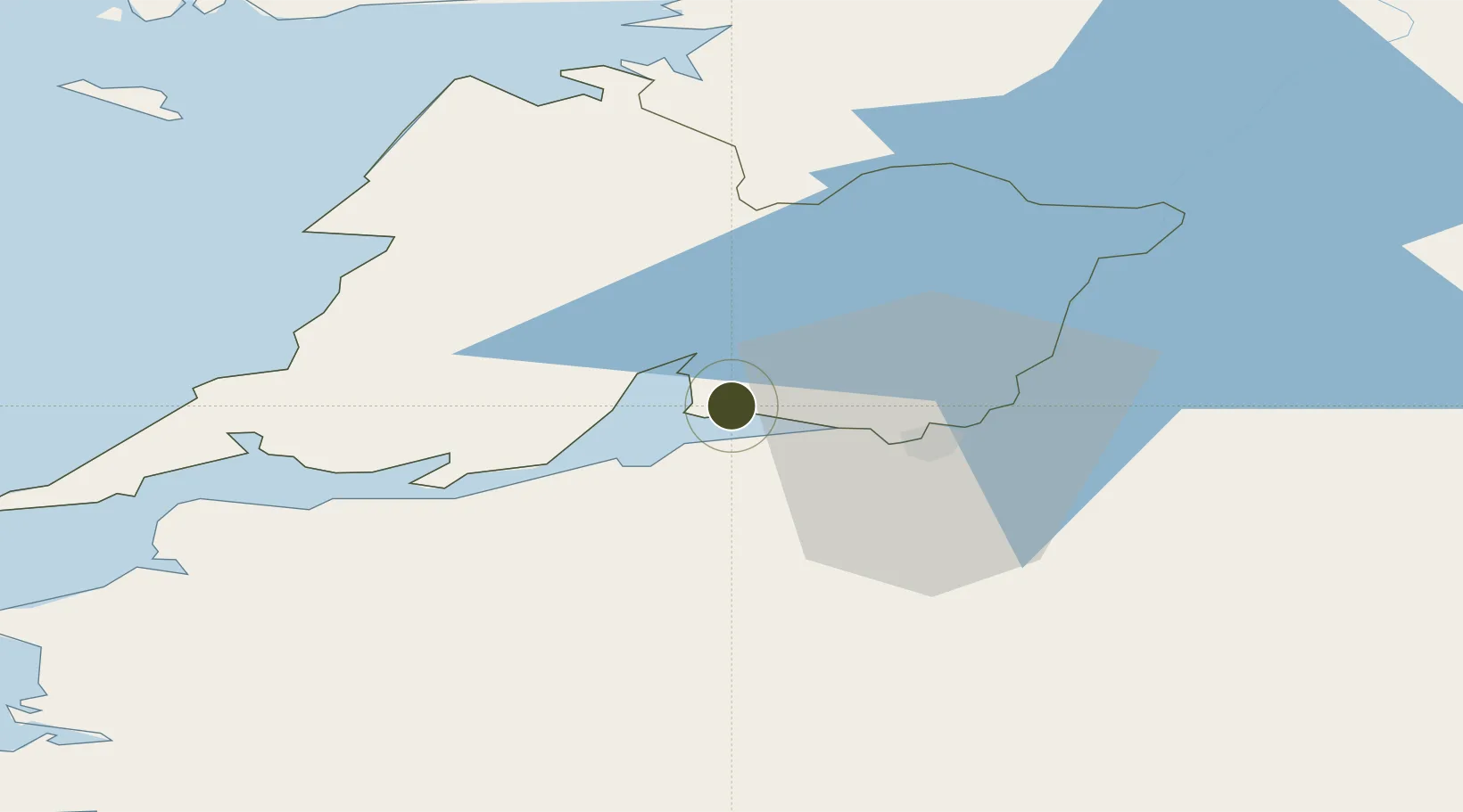
52.7031°, -8.8959°
243 ha
Zone area
17.7 km
Nearest port
2.0 km
Nearest airport

Gateway access

Nearest neighbours — logibook spatial index (haversine) over the source coordinates

Zone profile

Zone type
Free Trade Zone
Open Zone Map
Region
Clare
Open Zone Map
Status
Inactive
Open Zone Map
Management
Private
Open Zone Map
Operator
Shannon Group PLC.
Open Zone Map
Legal framework
Customs Free Airport (Amendment) Act 1958
Open Zone Map

Location

Location of ozm-2527
Natural Earth 10m (public domain) · Clare · ozm-2527 · 52.70, -8.90GoogleOSMYandex

Nearby Logistics Neighbours

Ports
  1. 1Foynes18 km
  2. 2Limerick20 km
  3. 3Tarbert34 km
  4. 4Kilrush42 km
  5. 5Galway64 km
Nearest neighbours — logibook spatial index (haversine) over the source coordinates
Airports
  1. 1Shannon Airport2 km
  2. 2Inisheer Aerodrome58 km
  3. 3Inishmaan Aerodrome63 km
  4. 4Inishmore Aerodrome68 km
  5. 5Connemara Regional Airport70 km
Nearest neighbours — logibook spatial index (haversine) over the source coordinates
Cities
  1. 1Shannon3 km
  2. 2Clarecastle13 km
  3. 3Rathkeale21 km
  4. 4Ballina33 km
  5. 5Murroe35 km
Nearest neighbours — logibook spatial index (haversine) over the source coordinates
Trade Zones
  1. 1Dublin International Financial Services Centre191 km
  2. 2Isle of Man Free Zone and Business Park322 km
  3. 3Cornwall Newquay Aerohub Enterprise Zone369 km
  4. 4Mersey Waters Enterprise Zone400 km
  5. 5Blackpool Enterprise Zone408 km
Nearest neighbours — logibook spatial index (haversine) over the source coordinates
DatabookThe Record of Consolidated Knowledge
Ireland beyond logistics?
Browse databook

All Sources

Trade ZonesOpen Zone Map
CC BY
Portsthe NGA World Port Index
Public domain (US gov)
AirportsOurAirports
Public domain
LocationsUN/LOCODE
UN/LOCODE — free
← Ireland trade zones