UN/LOCODE hub · Egypt
EGSOK

Sokhna Port

29.6638°, 32.3331°
1
Transport functions
1
Container terminals

Transport Functions

Port
Sokhna Port is also a profiled seaport →
UN/LOCODE

Hub Profile

Logistics facilities
8
UN/LOCODE
Container terminals
1
UN/LOCODE

Location

Location of EGSOK
Natural Earth 10m (public domain) · As Suways · EGSOK · 29.66, 32.33GoogleOSMYandex

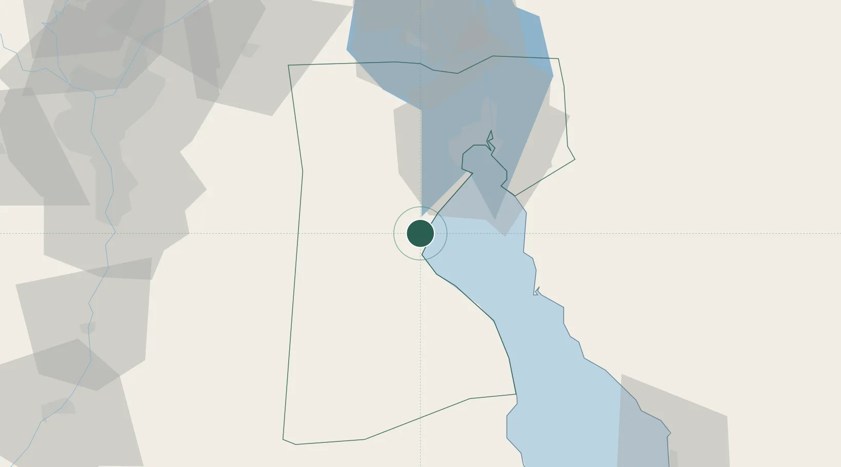
Nearby Logistics Neighbours

Cities
  1. 1Marsa Oriental Petrochemicals3 km
  2. 2Galala Marina24 km
  3. 3Al Adabiyah29 km
  4. 4Dome Marina30 km
  5. 5Ras Sudr33 km
Nearest neighbours — logibook spatial index (haversine) over the source coordinates
Ports
  1. 1Ain Sukhna Terminal4 km
  2. 2El-Adabiya26 km
  3. 3Ras Sudr37 km
  4. 4As Suways40 km
  5. 5El Ismailiya102 km
Nearest neighbours — logibook spatial index (haversine) over the source coordinates
Airports
  1. 1Capital International Airport65 km
  2. 2Cairo International Airport103 km
  3. 3Abu Suwayr Air Base104 km
  4. 4Ismailia Air Base104 km
  5. 5Bilbeis 2 Airfield105 km
Nearest neighbours — logibook spatial index (haversine) over the source coordinates
Trade Zones
  1. 1Suez Canal Economic Zone6 km
  2. 2Suez Public Free Zone39 km
  3. 310th of Ramadan Free Zone90 km
  4. 4El Saf Investment Zone103 km
  5. 5Nasr City Public Free Zone104 km
Nearest neighbours — logibook spatial index (haversine) over the source coordinates
DatabookThe Record of Consolidated Knowledge
Egypt beyond logistics?
Browse databook

All Sources

LocationsUN/LOCODE
UN/LOCODE — free
Portsthe NGA World Port Index
Public domain (US gov)
AirportsOurAirports
Public domain
Trade Zonesthe World Bank SEZ database
CC BY 4.0
Trade ZonesOpen Zone Map
CC BY
← Egypt locations