UN/LOCODE hub · Egypt
EGOPT

Marsa Oriental Petrochemicals

29.6833°, 32.3500°
2
Transport functions

Transport Functions

Port
Road
UN/LOCODE

Hub Profile

Region
SUZ
GeoNames

Location

Location of EGOPT
Natural Earth 10m (public domain) · SUZ · EGOPT · 29.68, 32.35GoogleOSMYandex

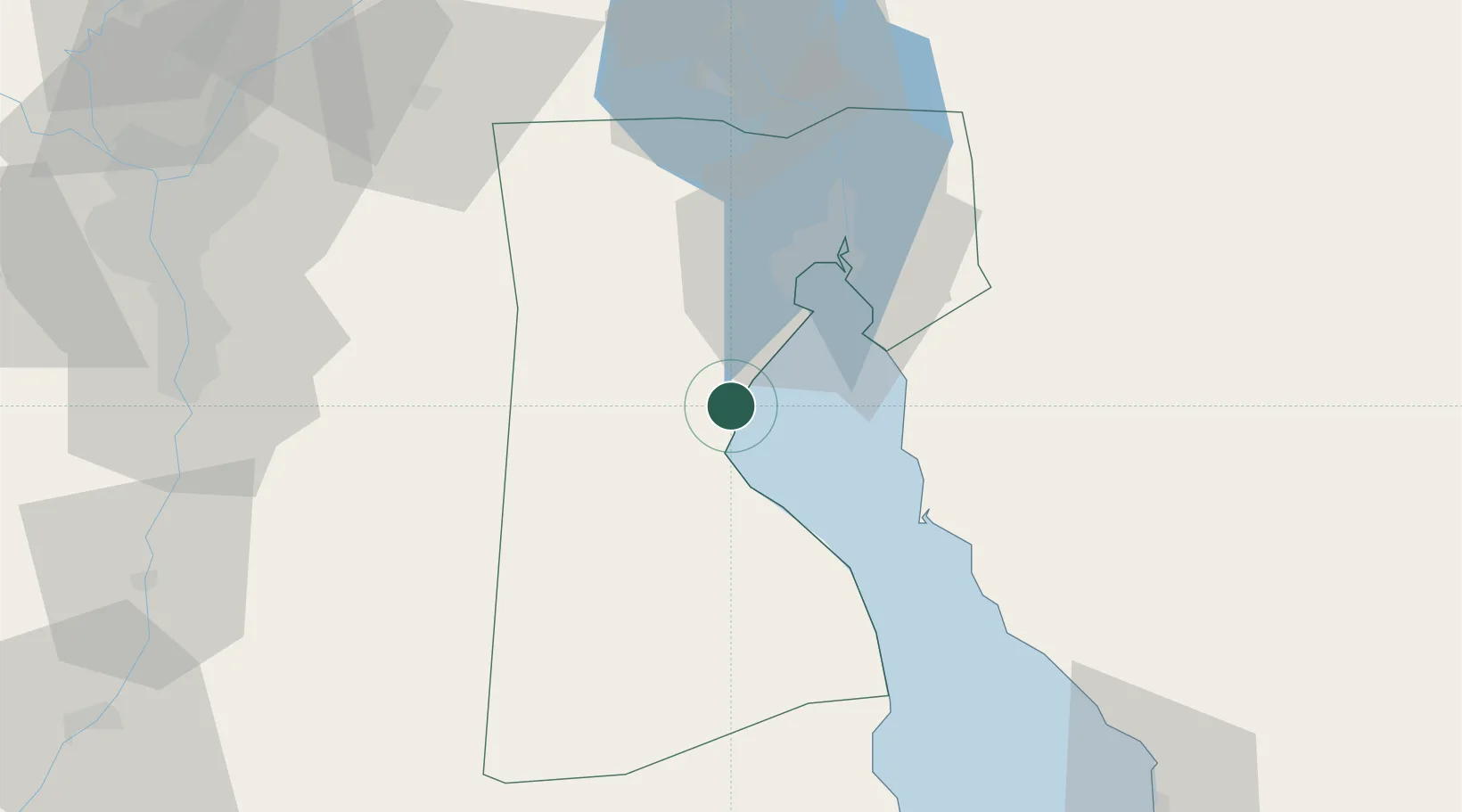
Nearby Logistics Neighbours

Cities
  1. 1Sokhna Port3 km
  2. 2Galala Marina25 km
  3. 3Al Adabiyah27 km
  4. 4Dome Marina31 km
  5. 5Ras Sudr32 km
Nearest neighbours — logibook spatial index (haversine) over the source coordinates
Ports
  1. 1Sokhna Port Gas Tanker Terminal2 km
  2. 2Ain Sukhna Terminal4 km
  3. 3El-Adabiya23 km
  4. 4Ras Sudr36 km
  5. 5As Suways37 km
Nearest neighbours — logibook spatial index (haversine) over the source coordinates
Airports
  1. 1Capital International Airport65 km
  2. 2Abu Suwayr Air Base102 km
  3. 3Ismailia Air Base102 km
  4. 4Cairo International Airport104 km
  5. 5Bilbeis 2 Airfield104 km
Nearest neighbours — logibook spatial index (haversine) over the source coordinates
Trade Zones
  1. 1Suez Canal Economic Zone6 km
  2. 2Suez Public Free Zone36 km
  3. 310th of Ramadan Free Zone89 km
  4. 4Ishmailia Public Free Zone103 km
  5. 5Ain Shams University Investment Zone104 km
Nearest neighbours — logibook spatial index (haversine) over the source coordinates
DatabookThe Record of Consolidated Knowledge
Egypt beyond logistics?
Browse databook

All Sources

LocationsUN/LOCODE
UN/LOCODE — free
Portsthe NGA World Port Index
Public domain (US gov)
AirportsOurAirports
Public domain
Trade Zonesthe World Bank SEZ database
CC BY 4.0
Trade ZonesOpen Zone Map
CC BY
← Egypt locations