UN/LOCODE hub · Canada
CASOH

Southport

49.9167°, -98.2667°
2
Transport functions

Transport Functions

Road
Multimodal
UN/LOCODE

Hub Profile

Place type
Locality
GeoNames
Region
Prince Edward Island
GeoNames
Time zone
America/Halifax
GeoNames
Elevation
11 m
GeoNames

Location

Location of CASOH
Natural Earth 10m (public domain) · Prince Edward Island · CASOH · 49.92, -98.27GoogleOSMYandex

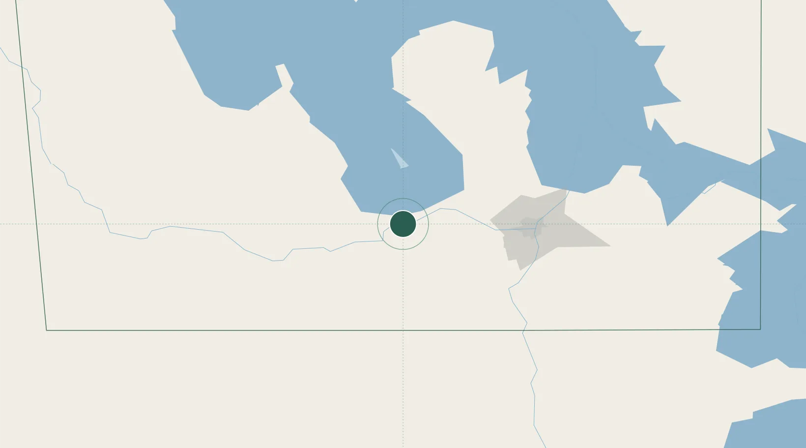
Nearby Logistics Neighbours

Cities
  1. 1Portage La Prairie6 km
  2. 2Newton14 km
  3. 3Oakville19 km
  4. 4Saint-Claude30 km
  5. 5Saint-Eustache36 km
Nearest neighbours — logibook spatial index (haversine) over the source coordinates
Ports
  1. 1Duluth575 km
  2. 2Superior579 km
  3. 3Two Harbors584 km
  4. 4Grand Marais628 km
  5. 5Bayfield650 km
Nearest neighbours — logibook spatial index (haversine) over the source coordinates
Airports
  1. 1Portage-la-Prairie / Southport Airport2 km
  2. 2Winnipeg / James Armstrong Richardson International Airport74 km
  3. 3Winnipeg / St. Andrews Airport90 km
  4. 4Gimli Industrial Park Airport118 km
  5. 5Brandon Municipal Airport121 km
Nearest neighbours — logibook spatial index (haversine) over the source coordinates
Trade Zones
  1. 1Winnipegs Centreport Canada81 km
  2. 2FTZ No. 103 Grand Forks237 km
  3. 3FTZ No. 259 Koochiching County341 km
  4. 4FTZ No. 267 Fargo354 km
  5. 5Global Transportation Hub Authority465 km
Nearest neighbours — logibook spatial index (haversine) over the source coordinates
DatabookThe Record of Consolidated Knowledge
Canada beyond logistics?
Browse databook

All Sources

LocationsUN/LOCODE
UN/LOCODE — free
Portsthe NGA World Port Index
Public domain (US gov)
AirportsOurAirports
Public domain
Trade Zonesthe World Bank SEZ database
CC BY 4.0
Trade ZonesOpen Zone Map
CC BY
← Canada locations