UN/LOCODE hub · Botswana
BWPAL

Palapye

-22.5667°, 27.1333°
52,636
Population
2
Transport functions

Transport Functions

Rail
Road
UN/LOCODE

Hub Profile

Place type
Populated place
GeoNames
Region
Central
GeoNames
Population
52,636
GeoNames
Time zone
Africa/Gaborone
GeoNames
Elevation
926 m
GeoNames

Location

Location of BWPAL
Natural Earth 10m (public domain) · Central · BWPAL · -22.57, 27.13GoogleOSMYandex

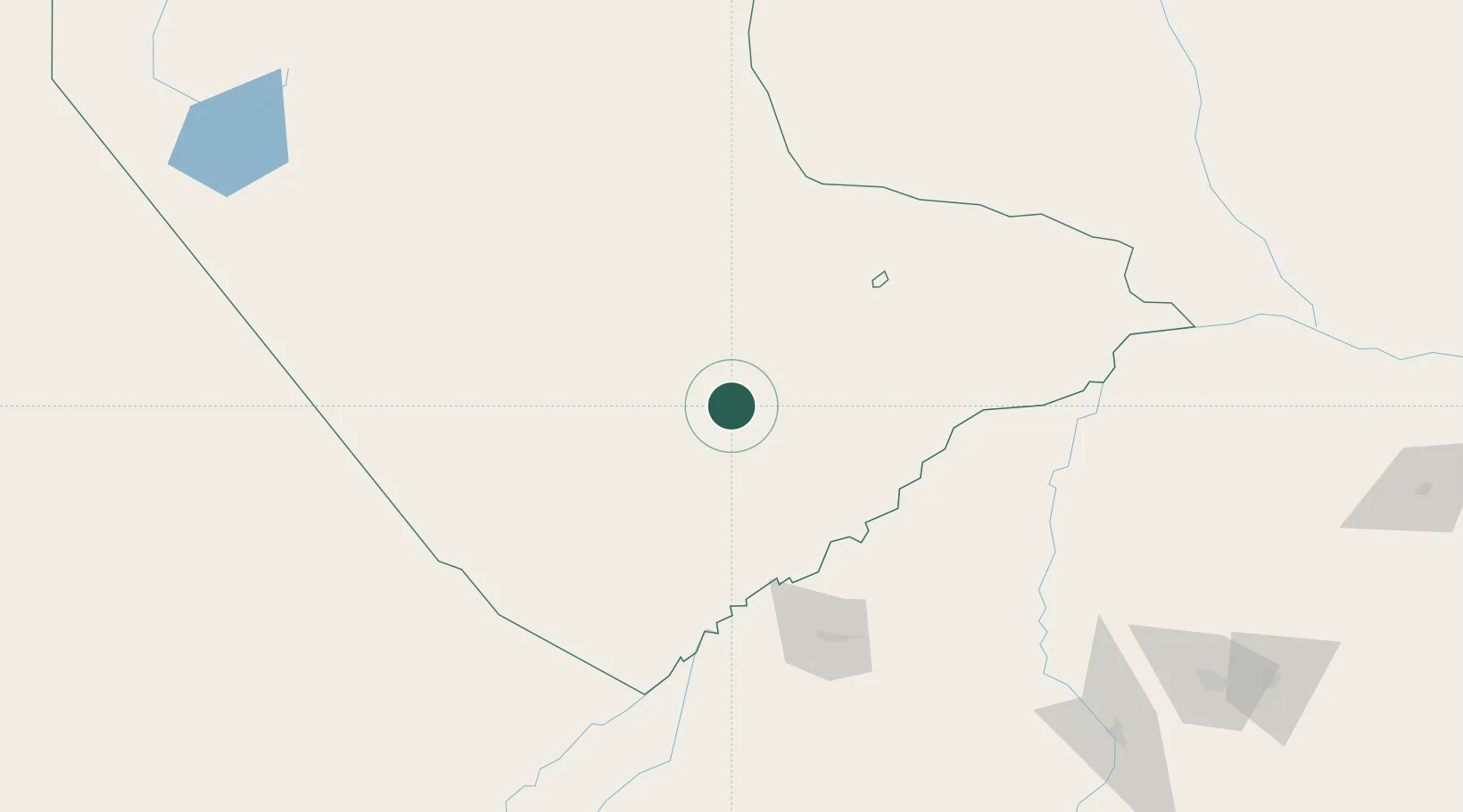
Nearby Logistics Neighbours

Cities
  1. 1Mahalapye67 km
  2. 2Francistown161 km
  3. 3Blouberg199 km
  4. 4Dukwi229 km
  5. 5Jupiter242 km
Nearest neighbours — logibook spatial index (haversine) over the source coordinates
Ports
  1. 1Maputo666 km
  2. 2Richards Bay854 km
  3. 3Beira854 km
  4. 4Inhambane858 km
  5. 5Durban901 km
Nearest neighbours — logibook spatial index (haversine) over the source coordinates
Airports
  1. 1Selebi Phikwe Airport91 km
  2. 2Phillip Gaonwe Matante International Airport160 km
  3. 3Sua Pan Airport247 km
  4. 4Sir Seretse Khama International Airport253 km
  5. 5Polokwane International Airport277 km
Nearest neighbours — logibook spatial index (haversine) over the source coordinates
Trade Zones
  1. 1Greater Palapye Special Economic Zone10 km
  2. 2Selebi Phikwe Special Economic Zone97 km
  3. 3Francistown Special Economic Zone166 km
  4. 4Tuli Block Tourism Zone212 km
  5. 5Sir Seretse Khama Intl Airport Zone257 km
Nearest neighbours — logibook spatial index (haversine) over the source coordinates
DatabookThe Record of Consolidated Knowledge
Botswana beyond logistics?
Browse databook

All Sources

LocationsUN/LOCODE
UN/LOCODE — free
LocationsGeoNames
CC BY 4.0
Portsthe NGA World Port Index
Public domain (US gov)
AirportsOurAirports
Public domain
Trade Zonesthe World Bank SEZ database
CC BY 4.0
Trade ZonesOpen Zone Map
CC BY
← Botswana locations