UN/LOCODE hub · Bhutan
BTJOM

Jomotshangkha

26.8833°, 93.1000°
2
Transport functions

Transport Functions

Road
Multimodal
UN/LOCODE

Hub Profile

Region
45
GeoNames

Location

Location of BTJOM
Natural Earth 10m (public domain) · 45 · BTJOM · 26.88, 93.10GoogleOSMYandex

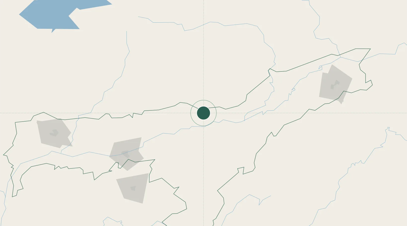
Nearby Logistics Neighbours

Cities
  1. 1Phuntsho Raptenling156 km
  2. 2Samdrup Jongkhar159 km
  3. 3Amingaon (Gauhati)161 km
  4. 4Pelzomthang (Nganglam)184 km
  5. 5Kamardwisa Lcs239 km
Nearest neighbours — logibook spatial index (haversine) over the source coordinates
Ports
  1. 1Chittagong524 km
  2. 2Mongla605 km
  3. 3Calcutta681 km
  4. 4Haldia Port742 km
  5. 5Sittwe751 km
Nearest neighbours — logibook spatial index (haversine) over the source coordinates
Airports
  1. 1Tezpur Airport37 km
  2. 2Itanagar Donyi Polo Hollongi Airport54 km
  3. 3Ziro Airport106 km
  4. 4Jorhat Airport108 km
  5. 5Lilabari North Lakhimpur Airport109 km
Nearest neighbours — logibook spatial index (haversine) over the source coordinates
Trade Zones
  1. 1Motanga Industrial Park160 km
  2. 2Bondeyma Industrial Park190 km
  3. 3Sylhet Special Economic Zone254 km
  4. 4Jigmeling Industrial Park281 km
  5. 5Shreehatta Srihatta Economic Zone289 km
Nearest neighbours — logibook spatial index (haversine) over the source coordinates
DatabookThe Record of Consolidated Knowledge
Bhutan beyond logistics?
Browse databook

All Sources

LocationsUN/LOCODE
UN/LOCODE — free
Portsthe NGA World Port Index
Public domain (US gov)
AirportsOurAirports
Public domain
Trade Zonesthe World Bank SEZ database
CC BY 4.0
Trade ZonesOpen Zone Map
CC BY
← Bhutan locations