UN/LOCODE hub · Bahamas
BSCEL

Cape Eleuthera

24.8167°, -76.3500°
2
Transport functions

Transport Functions

Port
Airport
UN/LOCODE

Hub Profile

Region
SE
GeoNames

Location

Location of BSCEL
Natural Earth 10m (public domain) · SE · BSCEL · 24.82, -76.35GoogleOSMYandex

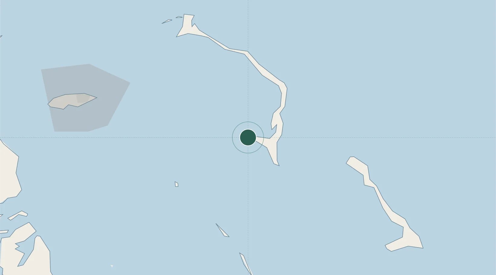
Nearby Logistics Neighbours

Cities
  1. 1Rock Sound18 km
  2. 2Little San Salvador51 km
  3. 3Harbour Island81 km
  4. 4Harbour Island81 km
  5. 5The Bight111 km
Nearest neighbours — logibook spatial index (haversine) over the source coordinates
Ports
  1. 1Nassau105 km
  2. 2Clifton Pier123 km
  3. 3Cockburn203 km
  4. 4South Riding Point274 km
  5. 5Freeport309 km
Nearest neighbours — logibook spatial index (haversine) over the source coordinates
Airports
  1. 1Rock Sound International Airport19 km
  2. 2Governor's Harbour Airport52 km
  3. 3Normans Cay Airport54 km
  4. 4Arthur's Town Airport71 km
  5. 5Staniel Cay Airport73 km
Nearest neighbours — logibook spatial index (haversine) over the source coordinates
Trade Zones
  1. 1Freeport Bahamas300 km
  2. 2Grand Bahama International Airport304 km
  3. 3FTZ No. 180 Miami (Wynwood)403 km
  4. 4FTZ No. 025 Broward County404 km
  5. 5FTZ No. 032 Miami413 km
Nearest neighbours — logibook spatial index (haversine) over the source coordinates
DatabookThe Record of Consolidated Knowledge
Bahamas beyond logistics?
Browse databook

All Sources

LocationsUN/LOCODE
UN/LOCODE — free
Portsthe NGA World Port Index
Public domain (US gov)
AirportsOurAirports
Public domain
Trade Zonesthe World Bank SEZ database
CC BY 4.0
Trade ZonesOpen Zone Map
CC BY
← Bahamas locations