Foreign Trade Zone · United States

FTZ No. 032 Miami Active
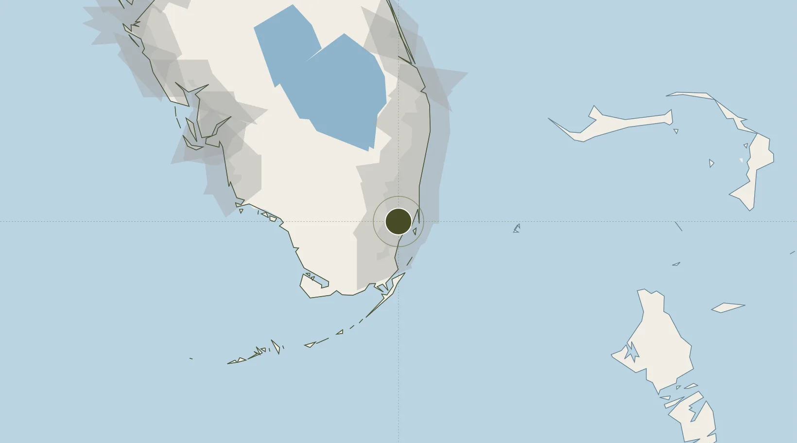
25.7925°, -80.3110°
12.8 km
Nearest port
2.2 km
Nearest airport

Gateway access

Nearest neighbours — logibook spatial index (haversine) over the source coordinates

Zone profile

Zone type
Foreign Trade Zone
Open Zone Map
Region
Florida
Open Zone Map
Status
Active
Open Zone Map
Management
Public
Open Zone Map
Operator
Greater Miami Foreign Trade Zone, Inc.
Open Zone Map
Legal framework
Foreign-Trade Zones Act
Open Zone Map

Location

Location of ozm-4793
Natural Earth 10m (public domain) · Florida · ozm-4793 · 25.79, -80.31GoogleOSMYandex

Nearby Logistics Neighbours

Ports
  1. 1Miami13 km
  2. 2Port Everglades39 km
  3. 3Palm Beach111 km
  4. 4Freeport172 km
  5. 5Fort Pierce186 km
Nearest neighbours — logibook spatial index (haversine) over the source coordinates
Airports
  1. 1Miami International Airport2 km
  2. 2Miami-Opa Locka Executive Airport13 km
  3. 3Miami Executive Airport20 km
  4. 4North Perry Airport24 km
  5. 5Homestead Air Reserve Base35 km
Nearest neighbours — logibook spatial index (haversine) over the source coordinates
Cities
  1. 1Miami7 km
  2. 2Hialeah Gardens8 km
  3. 3University Park9 km
  4. 4Hialeah9 km
  5. 5Coconut Grove10 km
Nearest neighbours — logibook spatial index (haversine) over the source coordinates
Trade Zones
  1. 1FTZ No. 180 Miami (Wynwood)11 km
  2. 2FTZ No. 025 Broward County37 km
  3. 3FTZ No. 241 Fort Lauderdale47 km
  4. 4FTZ No. 281 Miami-Dade County50 km
  5. 5FTZ No. 135 Palm Beach County112 km
Nearest neighbours — logibook spatial index (haversine) over the source coordinates
DatabookThe Record of Consolidated Knowledge
United States beyond logistics?
Browse databook

All Sources

Trade ZonesOpen Zone Map
CC BY
Portsthe NGA World Port Index
Public domain (US gov)
AirportsOurAirports
Public domain
LocationsUN/LOCODE
UN/LOCODE — free
← United States trade zones