UN/LOCODE hub · Angola
AONQI

Nóqui

-5.8500°, 13.4333°
3
Transport functions

Transport Functions

Port
Rail
Road
UN/LOCODE

Hub Profile

Place type
Populated place
GeoNames
Region
Zaire
GeoNames
Time zone
Africa/Luanda
GeoNames
Elevation
50 m
GeoNames

Location

Location of AONQI
Natural Earth 10m (public domain) · Zaire · AONQI · -5.85, 13.43GoogleOSMYandex

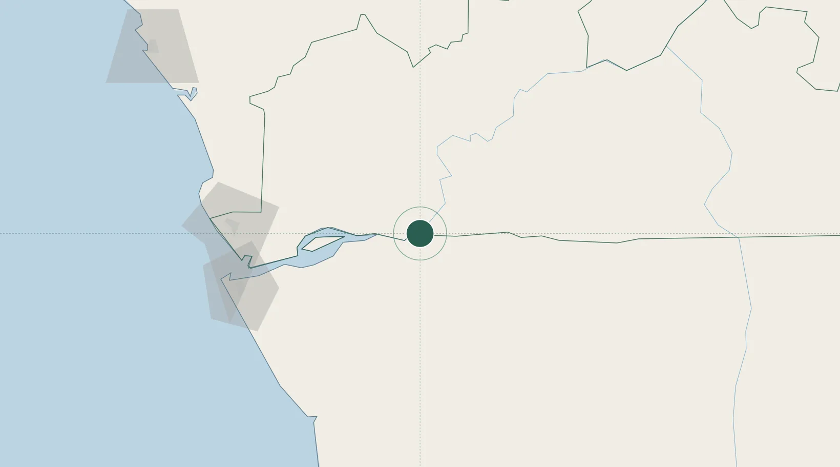
Nearby Logistics Neighbours

Cities
  1. 1Matadi3 km
  2. 2Boma42 km
  3. 3Sazaire Terminal119 km
  4. 4Soyo127 km
  5. 5Cabinda140 km
Nearest neighbours — logibook spatial index (haversine) over the source coordinates
Ports
  1. 1Matadi4 km
  2. 2Boma42 km
  3. 3Banana117 km
  4. 4Soyo Angola Lng Terminal125 km
  5. 5Cabinda141 km
Nearest neighbours — logibook spatial index (haversine) over the source coordinates
Airports
  1. 1Mbanza Congo Airport101 km
  2. 2Soyo Airport122 km
  3. 3Cabinda Airport141 km
  4. 4Ngot Nzoungou Airport202 km
  5. 5Antonio Agostinho-Neto International Airport206 km
Nearest neighbours — logibook spatial index (haversine) over the source coordinates
Trade Zones
  1. 1Fútila Industrial Development Pole143 km
  2. 2Pointe-Noire Special Economic Zone213 km
  3. 3Brazzaville Special Economic Zone240 km
  4. 4Maluku Special Economic Zone304 km
  5. 5Luanda-Bengo Special Economic Zone343 km
Nearest neighbours — logibook spatial index (haversine) over the source coordinates
DatabookThe Record of Consolidated Knowledge
Angola beyond logistics?
Browse databook

All Sources

LocationsUN/LOCODE
UN/LOCODE — free
Portsthe NGA World Port Index
Public domain (US gov)
AirportsOurAirports
Public domain
Trade Zonesthe World Bank SEZ database
CC BY 4.0
Trade ZonesOpen Zone Map
CC BY
← Angola locations