Special Economic Zone · Angola

Luanda-Bengo Special Economic Zone Active
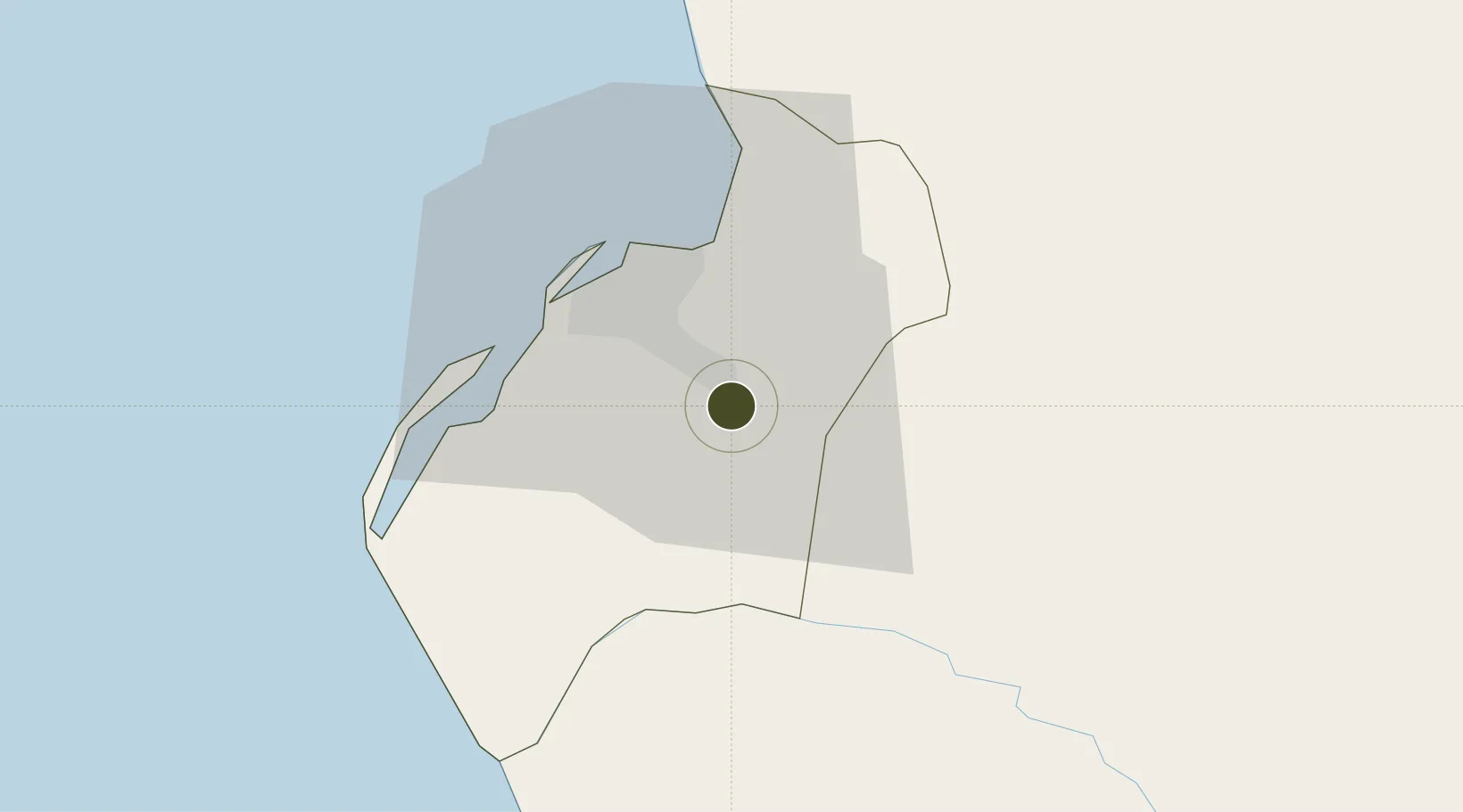
-8.9370°, 13.3995°
8,300 ha
Zone area
22.4 km
Nearest port
16.7 km
Nearest airport

Gateway access

Nearest neighbours — logibook spatial index (haversine) over the source coordinates

Zone profile

Zone type
Special Economic Zone
the World Bank SEZ database
Region
Luanda
the World Bank SEZ database
Status
Active
the World Bank SEZ database
Established
2011
the World Bank SEZ database
Management
Public agency
the World Bank SEZ database
Operator
Luanda-Bengo E.P. Special Economic Zone Development Association
the World Bank SEZ database
Regulatory authority
Government of Angola
the World Bank SEZ database
Legal framework
Presidential Legislative Decree no. 6/15
the World Bank SEZ database

Location

Location of AGO1
Natural Earth 10m (public domain) · Luanda · AGO1 · -8.94, 13.40GoogleOSMYandex

Fiscal & incentives

Corporate tax
30%
the World Bank SEZ database
Tax relief
10-100% exempt, depending on investment size, job creation, export turnover, national value-add, and local participation
the World Bank SEZ database
Relief duration
4 to 10 years
the World Bank SEZ database
VAT
No exemption
the World Bank SEZ database
Import duty (inputs)
100% exempt
the World Bank SEZ database
Import duty (capex)
100% exempt
the World Bank SEZ database
Profit repatriation
No exemption
the World Bank SEZ database
Capital gains
No exemption
the World Bank SEZ database
Withholding tax
No exemption
the World Bank SEZ database
Min. investment
$500,000 for local tenant, $1M for foreign tenant; required to be eligible for tax exemptions
the World Bank SEZ database
Min. export
0%
the World Bank SEZ database
Employment incentive
No exemption
the World Bank SEZ database
Developer incentive
No established framework
the World Bank SEZ database

Nearby Logistics Neighbours

Ports
  1. 1Luanda22 km
  2. 2Porto Do Ambriz127 km
  3. 3Greater Plutonio Terminal188 km
  4. 4Porto Amboim203 km
  5. 5Dalia Terminal227 km
Nearest neighbours — logibook spatial index (haversine) over the source coordinates
Airports
  1. 1Dr. Antonio Agostinho Neto International Airport17 km
  2. 2Quatro de Fevereiro International Airport20 km
  3. 3Porto Amboim Airport203 km
  4. 4Uige Airport233 km
  5. 5Negage Airport246 km
Nearest neighbours — logibook spatial index (haversine) over the source coordinates
Cities
  1. 1Luanda15 km
  2. 2Capulo109 km
  3. 3Greater Plutonio187 km
  4. 4N'Zeto (Ambrizete)195 km
  5. 5Gimboa207 km
Nearest neighbours — logibook spatial index (haversine) over the source coordinates
Trade Zones
  1. 1Viana Industrial Development Pole7 km
  2. 2Catumbela Industrial Development Pole386 km
  3. 3Fútila Industrial Development Pole412 km
  4. 4Pointe-Noire Special Economic Zone493 km
  5. 5Brazzaville Special Economic Zone537 km
Nearest neighbours — logibook spatial index (haversine) over the source coordinates
DatabookThe Record of Consolidated Knowledge
Angola beyond logistics?
Browse databook

All Sources

Trade Zonesthe World Bank SEZ database
CC BY 4.0
Portsthe NGA World Port Index
Public domain (US gov)
AirportsOurAirports
Public domain
LocationsUN/LOCODE
UN/LOCODE — free
← Angola trade zones