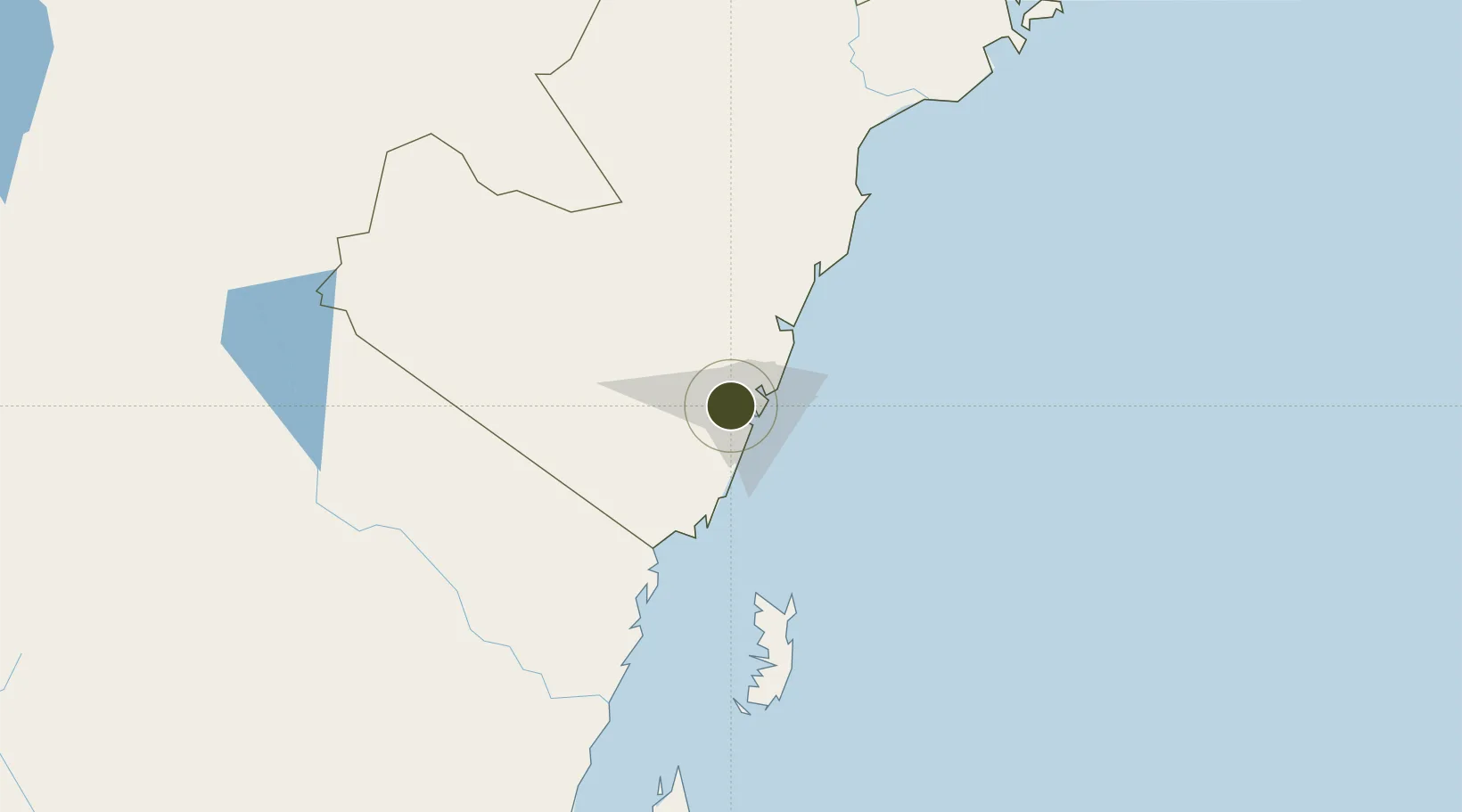
Diversified Zone · Kenya

Dongo Kundu Special Economic Zone Active

-3.9961°, 39.5649°
1,326 ha
Zone area
13.7 km
Nearest port
5.4 km
Nearest airport

Gateway access

Nearest neighbours — logibook spatial index (haversine) over the source coordinates

Zone profile

Zone type
Diversified Zone
Open Zone Map
Region
Coast
Open Zone Map
Status
Active
Open Zone Map
Management
Public
Open Zone Map
Operator
SEZ Authority, Government of Japan
Open Zone Map
Legal framework
Special Economic Zones Act No. 16 of 2015
Open Zone Map

Location

Location of ozm-2653
Natural Earth 10m (public domain) · Coast · ozm-2653 · -4.00, 39.56GoogleOSMYandex

Nearby Logistics Neighbours

Ports
  1. 1Mombasa14 km
  2. 2Kilifi52 km
  3. 3Malindi107 km
  4. 4Tanga131 km
  5. 5Lamu243 km
Nearest neighbours — logibook spatial index (haversine) over the source coordinates
Airports
  1. 1Moi International Airport5 km
  2. 2Malindi International Airport104 km
  3. 3Tanga Airport134 km
  4. 4Pemba Airport143 km
  5. 5Manda Airport245 km
Nearest neighbours — logibook spatial index (haversine) over the source coordinates
Cities
  1. 1Mombasa8 km
  2. 2Shimoni75 km
  3. 3Tanga129 km
  4. 4Zanzibar244 km
  5. 5Moshi258 km
Nearest neighbours — logibook spatial index (haversine) over the source coordinates
Trade Zones
  1. 1Kipevu Public Export Processing Zone10 km
  2. 2Mombasa Special Economic Zone23 km
  3. 3Dundani Industrial Park38 km
  4. 4Mkinga Special Economic Zone112 km
  5. 5Neema Tanga Special Economic Zone133 km
Nearest neighbours — logibook spatial index (haversine) over the source coordinates
DatabookThe Record of Consolidated Knowledge
Kenya beyond logistics?
Browse databook

All Sources

Trade ZonesOpen Zone Map
CC BY
Portsthe NGA World Port Index
Public domain (US gov)
AirportsOurAirports
Public domain
LocationsUN/LOCODE
UN/LOCODE — free
← Kenya trade zones