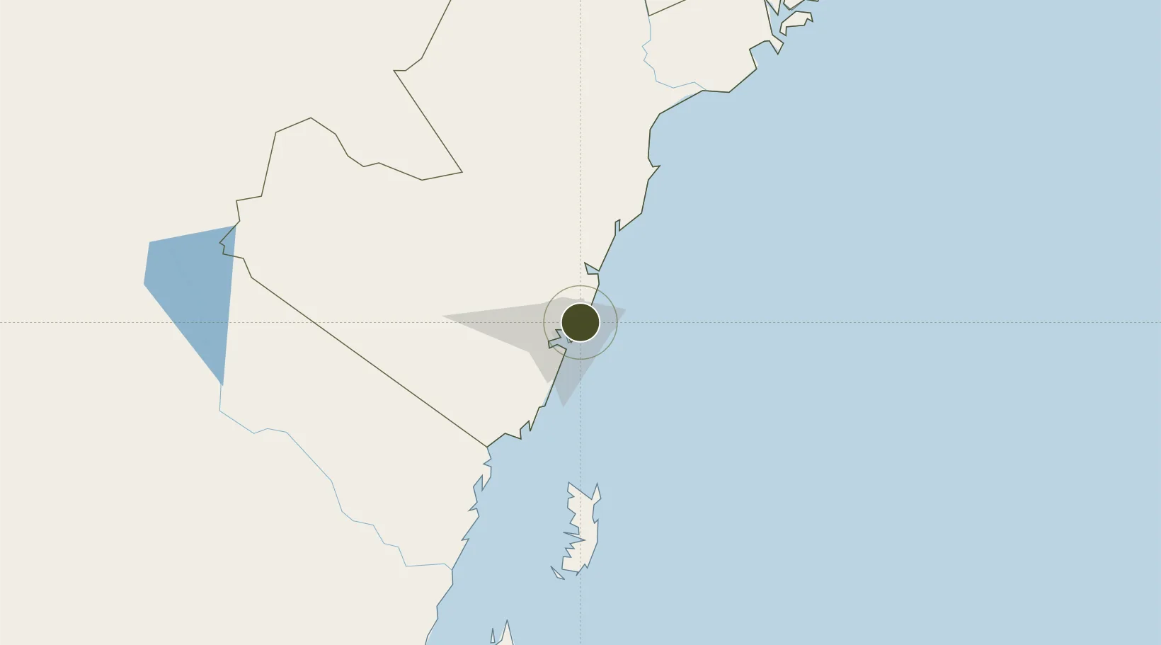
Diversified Zone · Kenya

Mombasa Special Economic Zone Active

-3.9262°, 39.7550°
170 ha
Zone area
18.4 km
Nearest port
21.5 km
Nearest airport

Gateway access

Nearest neighbours — logibook spatial index (haversine) over the source coordinates

Zone profile

Zone type
Diversified Zone
Open Zone Map
Region
Coast
Open Zone Map
Status
Active
Open Zone Map
Management
Public-Private Partnership
Open Zone Map
Operator
Ministry of Industrialization and Enterprise Development, SEZ Authority
Open Zone Map
Legal framework
Special Economic Zones Act No. 16 of 2015
Open Zone Map

Location

Location of ozm-2651
Natural Earth 10m (public domain) · Coast · ozm-2651 · -3.93, 39.76GoogleOSMYandex

Nearby Logistics Neighbours

Ports
  1. 1Mombasa18 km
  2. 2Kilifi35 km
  3. 3Malindi89 km
  4. 4Tanga147 km
  5. 5Lamu224 km
Nearest neighbours — logibook spatial index (haversine) over the source coordinates
Airports
  1. 1Moi International Airport22 km
  2. 2Malindi International Airport87 km
  3. 3Pemba Airport148 km
  4. 4Tanga Airport150 km
  5. 5Manda Airport226 km
Nearest neighbours — logibook spatial index (haversine) over the source coordinates
Cities
  1. 1Mombasa18 km
  2. 2Shimoni90 km
  3. 3Tanga146 km
  4. 4Zanzibar256 km
  5. 5Moshi276 km
Nearest neighbours — logibook spatial index (haversine) over the source coordinates
Trade Zones
  1. 1Kipevu Public Export Processing Zone17 km
  2. 2Dongo Kundu Special Economic Zone23 km
  3. 3Dundani Industrial Park60 km
  4. 4Mkinga Special Economic Zone129 km
  5. 5Neema Tanga Special Economic Zone149 km
Nearest neighbours — logibook spatial index (haversine) over the source coordinates
DatabookThe Record of Consolidated Knowledge
Kenya beyond logistics?
Browse databook

All Sources

Trade ZonesOpen Zone Map
CC BY
Portsthe NGA World Port Index
Public domain (US gov)
AirportsOurAirports
Public domain
LocationsUN/LOCODE
UN/LOCODE — free
← Kenya trade zones