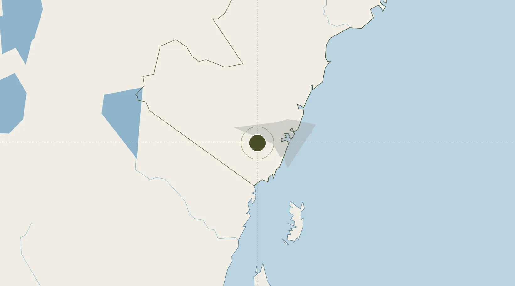
Export Processing Zone · Tanzania

Dundani Industrial Park Under Development

-4.0969°, 39.2397°
283 ha
Zone area
47.5 km
Nearest port
39.9 km
Nearest airport

Gateway access

Nearest neighbours — logibook spatial index (haversine) over the source coordinates

Zone profile

Zone type
Export Processing Zone
Open Zone Map
Region
Coast
Open Zone Map
Status
Under Development
Open Zone Map
Management
Public
Open Zone Map
Operator
Export Processing Zone Authority
Open Zone Map
Legal framework
Special Economic Zones Act of 2006
Open Zone Map

Location

Location of ozm-4412
Natural Earth 10m (public domain) · Coast · ozm-4412 · -4.10, 39.24GoogleOSMYandex

Nearby Logistics Neighbours

Ports
  1. 1Mombasa48 km
  2. 2Kilifi87 km
  3. 3Tanga111 km
  4. 4Malindi139 km
  5. 5Zanzibar230 km
Nearest neighbours — logibook spatial index (haversine) over the source coordinates
Airports
  1. 1Moi International Airport40 km
  2. 2Tanga Airport112 km
  3. 3Malindi International Airport136 km
  4. 4Pemba Airport144 km
  5. 5Abeid Amani Karume International Airport236 km
Nearest neighbours — logibook spatial index (haversine) over the source coordinates
Cities
  1. 1Mombasa44 km
  2. 2Shimoni64 km
  3. 3Tanga109 km
  4. 4Moshi227 km
  5. 5Zanzibar229 km
Nearest neighbours — logibook spatial index (haversine) over the source coordinates
Trade Zones
  1. 1Dongo Kundu Special Economic Zone38 km
  2. 2Kipevu Public Export Processing Zone45 km
  3. 3Mombasa Special Economic Zone60 km
  4. 4Mkinga Special Economic Zone90 km
  5. 5Neema Tanga Special Economic Zone112 km
Nearest neighbours — logibook spatial index (haversine) over the source coordinates
DatabookThe Record of Consolidated Knowledge
Tanzania beyond logistics?
Browse databook

All Sources

Trade ZonesOpen Zone Map
CC BY
Portsthe NGA World Port Index
Public domain (US gov)
AirportsOurAirports
Public domain
LocationsUN/LOCODE
UN/LOCODE — free
← Tanzania trade zones