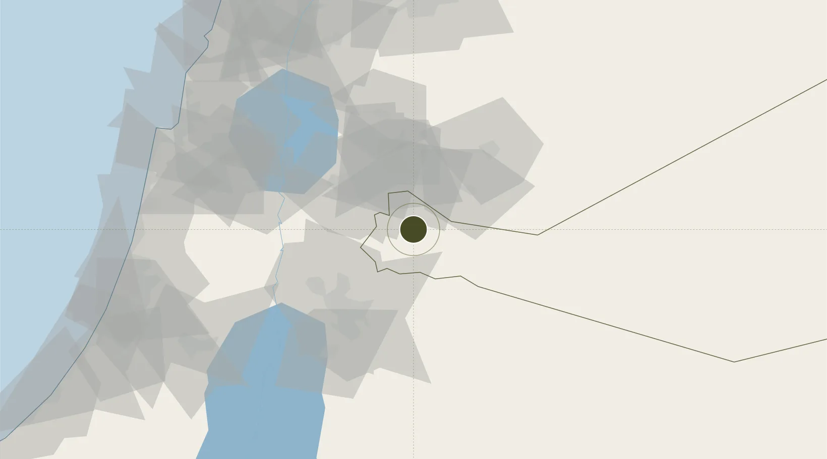
Diversified Zone · Jordan

Al Mafraq Industrial Estate Active

32.3403°, 36.2046°
182 ha
Zone area
123.3 km
Nearest port
45.5 km
Nearest airport

Gateway access

Nearest neighbours — logibook spatial index (haversine) over the source coordinates

Zone profile

Zone type
Diversified Zone
Open Zone Map
Region
Mafraq
Open Zone Map
Status
Active
Open Zone Map
Management
Public
Open Zone Map
Operator
Jordan Industrial Estates Corporation
Open Zone Map
Legal framework
The Investment Law No. (30) of 2014.
Open Zone Map

Location

Location of ozm-2620
Natural Earth 10m (public domain) · Mafraq · ozm-2620 · 32.34, 36.20GoogleOSMYandex

Nearby Logistics Neighbours

Ports
  1. 1Hadera123 km
  2. 2Haifa125 km
  3. 3Sayda152 km
  4. 4Sidon/zahrani Terminal156 km
  5. 5Ashdod158 km
Nearest neighbours — logibook spatial index (haversine) over the source coordinates
Airports
  1. 1Marka International (Amman Civil) Airport46 km
  2. 2Queen Alia International Airport72 km
  3. 3Muwaffaq Salti Air Base79 km
  4. 4Khalkhalah Air Base88 km
  5. 5Rosh Pina Airport93 km
Nearest neighbours — logibook spatial index (haversine) over the source coordinates
Cities
  1. 1Zarka Free Zone30 km
  2. 2Abu Alandah54 km
  3. 3Beit Shean Jordan Cargo Terminal59 km
  4. 4Beit Shean Jordan Meshakef59 km
  5. 5Arava Terminal Zin62 km
Nearest neighbours — logibook spatial index (haversine) over the source coordinates
Trade Zones
  1. 1King Hussein bin Talal Development Zone0 km
  2. 2Daraa Free Zone19 km
  3. 3Al-Hassan Industrial estate24 km
  4. 4Irbid Development Area27 km
  5. 5Zarqa Free Zone28 km
Nearest neighbours — logibook spatial index (haversine) over the source coordinates
DatabookThe Record of Consolidated Knowledge
Jordan beyond logistics?
Browse databook

All Sources

Trade ZonesOpen Zone Map
CC BY
Portsthe NGA World Port Index
Public domain (US gov)
AirportsOurAirports
Public domain
LocationsUN/LOCODE
UN/LOCODE — free
← Jordan trade zones