Diversified Zone · India

Sterling SEZ Pvt.Ltd. Active
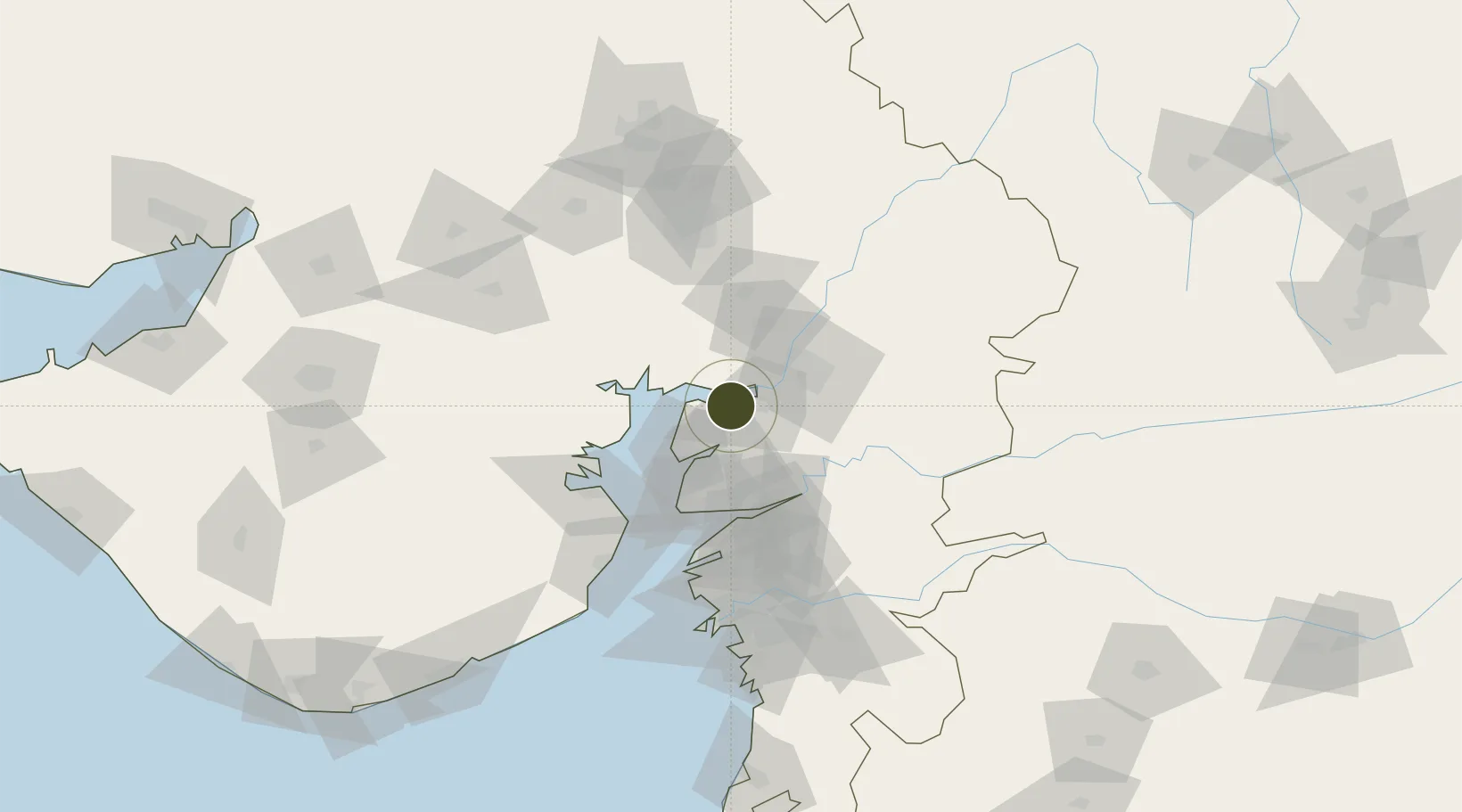
22.1788°, 72.7910°
1,262 ha
Zone area
59.5 km
Nearest port
48.1 km
Nearest airport

Gateway access

Nearest neighbours — logibook spatial index (haversine) over the source coordinates

Zone profile

Zone type
Diversified Zone
Open Zone Map
Region
Gujarat
Open Zone Map
Status
Active
Open Zone Map
Management
Private
Open Zone Map
Operator
Sandesara Group
Open Zone Map
Legal framework
Gujarat Special Economic Zone ACT, 2004., The Special Economic Zones Act, 2005
Open Zone Map

Location

Location of ozm-2127
Natural Earth 10m (public domain) · Gujarat · ozm-2127 · 22.18, 72.79GoogleOSMYandex

Nearby Logistics Neighbours

Ports
  1. 1Dahej60 km
  2. 2Bhavnagar74 km
  3. 3Magdalla115 km
  4. 4Hazira123 km
  5. 5Pipavav Bandar193 km
Nearest neighbours — logibook spatial index (haversine) over the source coordinates
Airports
  1. 1Vadodara International Airport48 km
  2. 2Bhavnagar Airport78 km
  3. 3Sardar Vallabh Patel International Airport101 km
  4. 4Surat International Airport118 km
  5. 5Rajkot International Airport182 km
Nearest neighbours — logibook spatial index (haversine) over the source coordinates
Cities
  1. 1Dishman-Pharmaceutical-SEZ/Kalyangadh37 km
  2. 2Vadodara40 km
  3. 3Chhani/Vadodora43 km
  4. 4Baroda43 km
  5. 5Sterling-SEZ/Bharuch56 km
Nearest neighbours — logibook spatial index (haversine) over the source coordinates
Trade Zones
  1. 1Jubilant Infrastructure Ltd.45 km
  2. 2L & T Ltd. Vill Ankhol, Vadodara50 km
  3. 3Dahej SEZ Ltd.56 km
  4. 4HBS Pharma SEZ Private Limited, Bharuch75 km
  5. 5Zydus Infrastructure Pvt.Ltd.88 km
Nearest neighbours — logibook spatial index (haversine) over the source coordinates
DatabookThe Record of Consolidated Knowledge
India beyond logistics?
Browse databook

All Sources

Trade ZonesOpen Zone Map
CC BY
Portsthe NGA World Port Index
Public domain (US gov)
AirportsOurAirports
Public domain
LocationsUN/LOCODE
UN/LOCODE — free
← India trade zones