Diversified Zone · Bangladesh

Patia Economic Zone Under Development
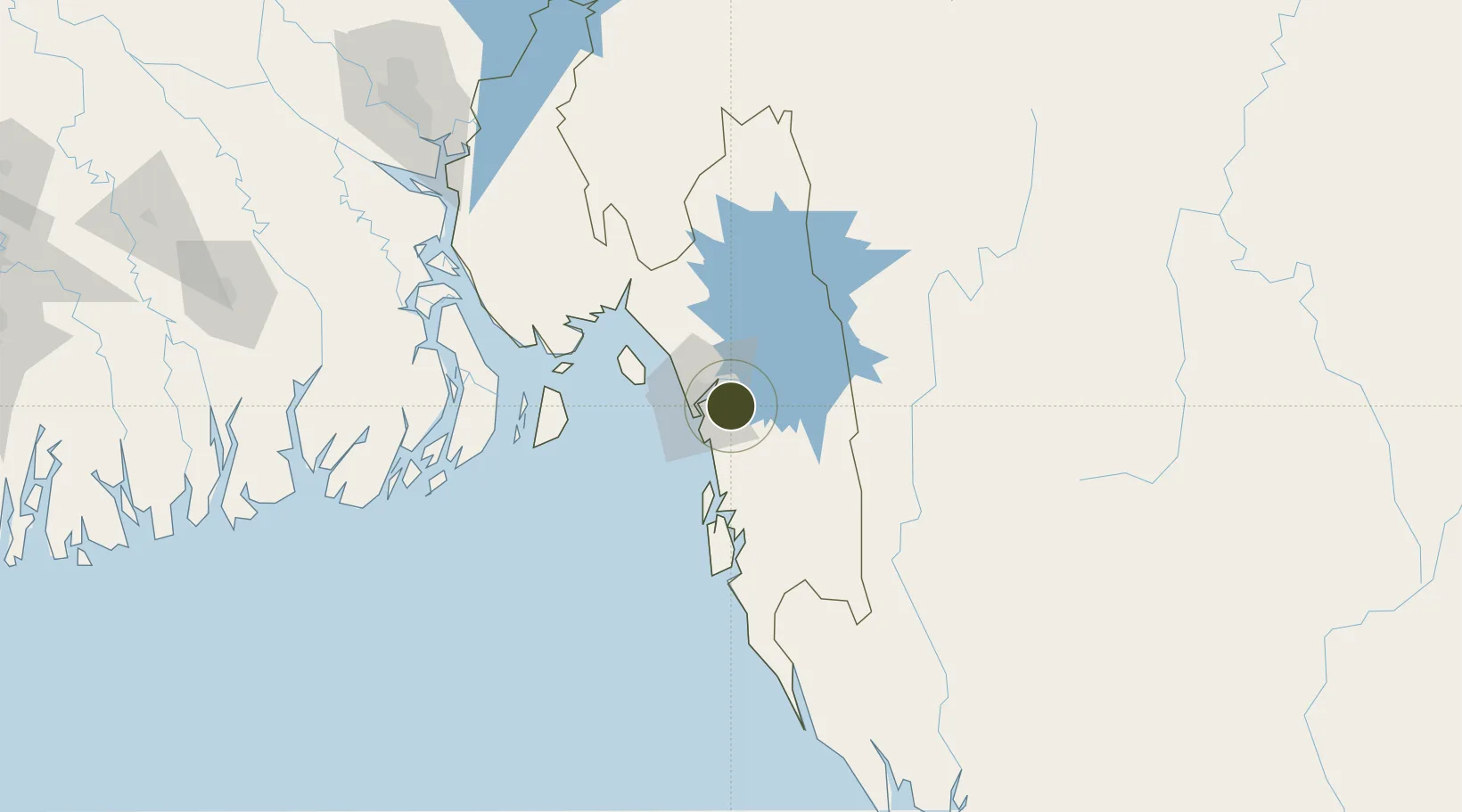
22.2941°, 91.9678°
313 ha
Zone area
15.8 km
Nearest port
16.7 km
Nearest airport

Gateway access

Nearest neighbours — logibook spatial index (haversine) over the source coordinates

Zone profile

Zone type
Diversified Zone
Open Zone Map
Region
Chittagong
Open Zone Map
Status
Under Development
Open Zone Map
Management
Public
Open Zone Map
Operator
Bangladesh Economic Zones Authority
Open Zone Map
Legal framework
Bangladesh Economic Zones Act: 2010, Amendment of Bangladesh Economic Zones Act-2015:
Open Zone Map

Location

Location of ozm-106
Natural Earth 10m (public domain) · Chittagong · ozm-106 · 22.29, 91.97GoogleOSMYandex

Nearby Logistics Neighbours

Ports
  1. 1Chittagong16 km
  2. 2Mongla244 km
  3. 3Sittwe259 km
  4. 4Calcutta375 km
  5. 5Haldia Port401 km
Nearest neighbours — logibook spatial index (haversine) over the source coordinates
Airports
  1. 1Shah Amanat International Airport17 km
  2. 2Cox's Bazar Airport93 km
  3. 3Saiha Helipad107 km
  4. 4Barisal Airport180 km
  5. 5Lengpui Airport184 km
Nearest neighbours — logibook spatial index (haversine) over the source coordinates
Cities
  1. 1Chattogram19 km
  2. 2Payra Port180 km
  3. 3Narayanganj206 km
  4. 4Munshiganj206 km
  5. 5Panchashar206 km
Nearest neighbours — logibook spatial index (haversine) over the source coordinates
Trade Zones
  1. 1Chinese Economic And Industrial Zone (CEIZ)14 km
  2. 2Anwara Economic Zone (Gahira)14 km
  3. 3Anowara Economic Zone -217 km
  4. 4Karnapuli Export Processing Zone18 km
  5. 5Abul Khair Economic Zone19 km
Nearest neighbours — logibook spatial index (haversine) over the source coordinates
DatabookThe Record of Consolidated Knowledge
Bangladesh beyond logistics?
Browse databook

All Sources

Trade ZonesOpen Zone Map
CC BY
Portsthe NGA World Port Index
Public domain (US gov)
AirportsOurAirports
Public domain
LocationsUN/LOCODE
UN/LOCODE — free
← Bangladesh trade zones