UN/LOCODE hub · South Africa
ZAWBK

Wandsbeck

-28.5667°, 31.4167°
1
Transport functions

Transport Functions

Multimodal
UN/LOCODE

Hub Profile

Region
KZN
GeoNames

Location

Location of ZAWBK
Natural Earth 10m (public domain) · KZN · ZAWBK · -28.57, 31.42GoogleOSMYandex

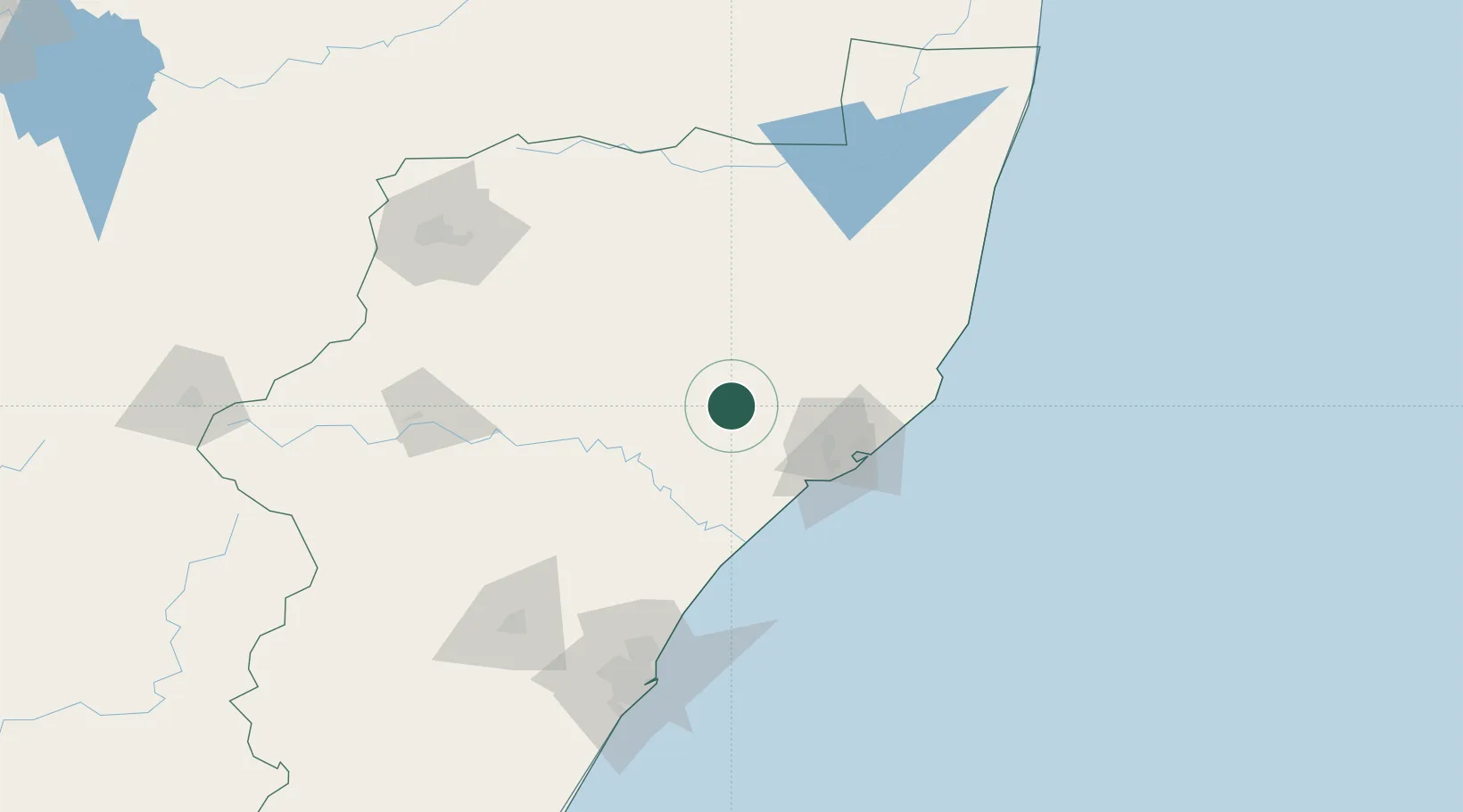
Nearby Logistics Neighbours

Cities
  1. 1Felixton53 km
  2. 2Isithebe59 km
  3. 3Alton63 km
  4. 4Compensation106 km
  5. 5Ballito Bay109 km
Nearest neighbours — logibook spatial index (haversine) over the source coordinates
Ports
  1. 1Richards Bay72 km
  2. 2Durban149 km
  3. 3Maputo310 km
  4. 4East London599 km
  5. 5Inhambane652 km
Nearest neighbours — logibook spatial index (haversine) over the source coordinates
Airports
  1. 1Prince Mangosuthu Buthelezi Airport27 km
  2. 2Richards Bay Airport69 km
  3. 3King Shaka International Airport120 km
  4. 4Mkuze Airport121 km
  5. 5Virginia Airport138 km
Nearest neighbours — logibook spatial index (haversine) over the source coordinates
Trade Zones
  1. 1Isithebe Industrial Park59 km
  2. 2Richards Bay Special Economic Zone63 km
  3. 3Durban Aerotropolis116 km
  4. 4Dube TradeZone119 km
  5. 5Dube AgriZone120 km
Nearest neighbours — logibook spatial index (haversine) over the source coordinates
DatabookThe Record of Consolidated Knowledge
South Africa beyond logistics?
Browse databook

All Sources

LocationsUN/LOCODE
UN/LOCODE — free
Portsthe NGA World Port Index
Public domain (US gov)
AirportsOurAirports
Public domain
Trade Zonesthe World Bank SEZ database
CC BY 4.0
Trade ZonesOpen Zone Map
CC BY
← South Africa locations