UN/LOCODE hub · South Africa
ZACGH

Creighton

-30.0333°, 29.8333°
1
Transport functions

Transport Functions

Multimodal
UN/LOCODE

Hub Profile

Place type
District seat
GeoNames
Region
KwaZulu-Natal
GeoNames
Time zone
Africa/Johannesburg
GeoNames
Elevation
1,006 m
GeoNames

Location

Location of ZACGH
Natural Earth 10m (public domain) · KwaZulu-Natal · ZACGH · -30.03, 29.83GoogleOSMYandex

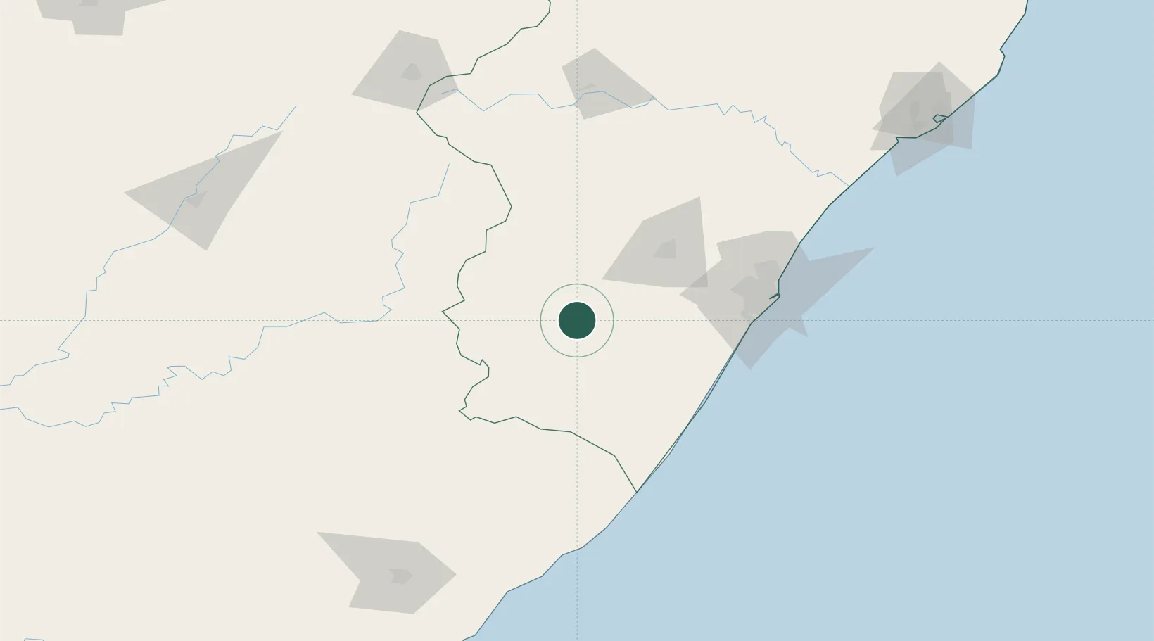
Nearby Logistics Neighbours

Cities
  1. 1Kokstad70 km
  2. 2Lions River70 km
  3. 3City Centre72 km
  4. 4Nottingham Road78 km
  5. 5Umgeni Dam91 km
Nearest neighbours — logibook spatial index (haversine) over the source coordinates
Ports
  1. 1Durban120 km
  2. 2Richards Bay258 km
  3. 3East London380 km
  4. 4Maputo525 km
  5. 5Port Elizabeth588 km
Nearest neighbours — logibook spatial index (haversine) over the source coordinates
Airports
  1. 1Pietermaritzburg Airport69 km
  2. 2Margate Airport104 km
  3. 3Virginia Airport122 km
  4. 4King Shaka International Airport133 km
  5. 5Ladysmith Airport162 km
Nearest neighbours — logibook spatial index (haversine) over the source coordinates
Trade Zones
  1. 1Dube TradePort130 km
  2. 2Dube AgriZone130 km
  3. 3Dube TradeZone133 km
  4. 4Durban Aerotropolis133 km
  5. 5Isithebe Industrial Park185 km
Nearest neighbours — logibook spatial index (haversine) over the source coordinates
DatabookThe Record of Consolidated Knowledge
South Africa beyond logistics?
Browse databook

All Sources

LocationsUN/LOCODE
UN/LOCODE — free
Portsthe NGA World Port Index
Public domain (US gov)
AirportsOurAirports
Public domain
Trade Zonesthe World Bank SEZ database
CC BY 4.0
Trade ZonesOpen Zone Map
CC BY
← South Africa locations