UN/LOCODE hub · United States
USZWV

Wadesville

38.1000°, -87.7833°
3
Transport functions

Transport Functions

Rail
Road
Multimodal
UN/LOCODE

Hub Profile

Place type
Populated place
GeoNames
Region
Indiana
GeoNames
Time zone
America/Chicago
GeoNames
Elevation
146 m
GeoNames

Location

Location of USZWV
Natural Earth 10m (public domain) · Indiana · USZWV · 38.10, -87.78GoogleOSMYandex

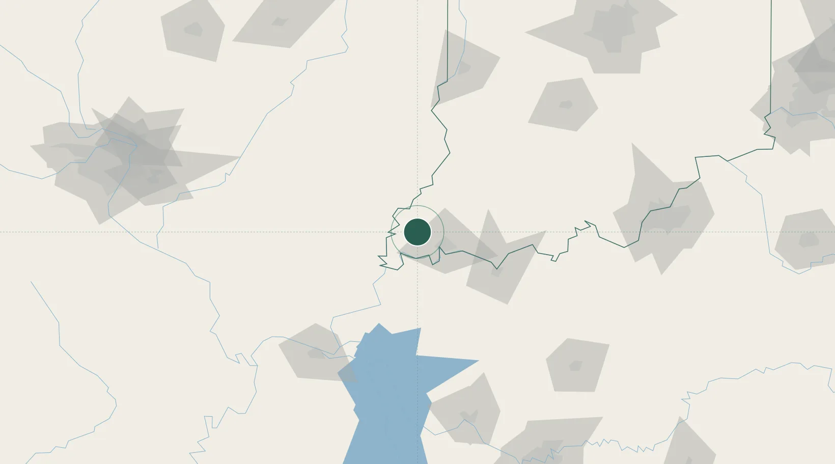
Nearby Logistics Neighbours

Cities
  1. 1Griffin16 km
  2. 2Owensville21 km
  3. 3Evansville23 km
  4. 4Fort Branch25 km
  5. 5Grayville25 km
Nearest neighbours — logibook spatial index (haversine) over the source coordinates
Ports
  1. 1Gary393 km
  2. 2Indiana Harbor398 km
  3. 3Port Of Memphis399 km
  4. 4Calumet Harbor405 km
  5. 5Michigan City411 km
Nearest neighbours — logibook spatial index (haversine) over the source coordinates
Airports
  1. 1Evansville Regional Airport23 km
  2. 2Owensboro Daviess County Airport67 km
  3. 3Veterans Airport of Southern Illinois115 km
  4. 4Southern Illinois Airport134 km
  5. 5Barkley Regional Airport145 km
Nearest neighbours — logibook spatial index (haversine) over the source coordinates
Trade Zones
  1. 1FTZ No. 177 Evansville19 km
  2. 2FTZ No. 294 Western Kentucky135 km
  3. 3FTZ No. 029 Louisville174 km
  4. 4FTZ No. 072 Indianapolis221 km
  5. 5FTZ No. 078 Nashville222 km
Nearest neighbours — logibook spatial index (haversine) over the source coordinates
DatabookThe Record of Consolidated Knowledge
United States beyond logistics?
Browse databook

All Sources

LocationsUN/LOCODE
UN/LOCODE — free
Portsthe NGA World Port Index
Public domain (US gov)
AirportsOurAirports
Public domain
Trade Zonesthe World Bank SEZ database
CC BY 4.0
Trade ZonesOpen Zone Map
CC BY
← United States locations