UN/LOCODE hub · United States
USZDP

Greenup

38.5667°, -82.8167°
1,157
Population
1
Transport functions

Transport Functions

Multimodal
UN/LOCODE

Hub Profile

Place type
Provincial seat
GeoNames
Region
Kentucky
GeoNames
Population
1,157
GeoNames
Time zone
America/New_York
GeoNames
Elevation
160 m
GeoNames

Location

Location of USZDP
Natural Earth 10m (public domain) · Kentucky · USZDP · 38.57, -82.82GoogleOSMYandex

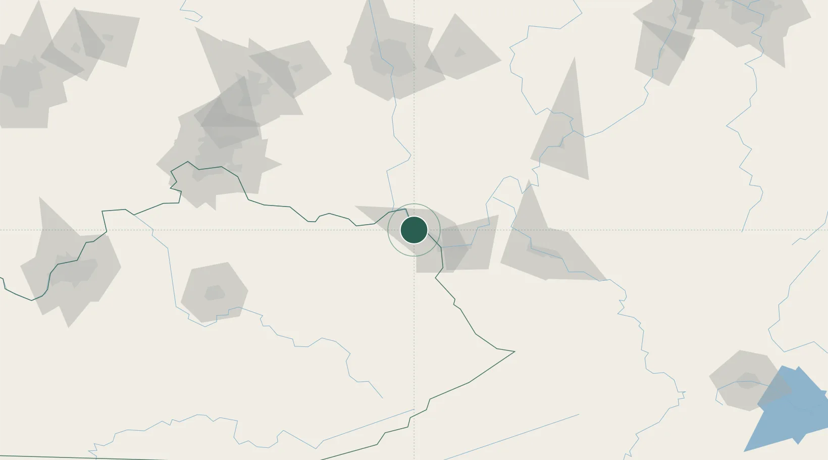
Nearby Logistics Neighbours

Cities
  1. 1Wurtland5 km
  2. 2Franklin Furnace8 km
  3. 3Lagrange13 km
  4. 4West Portsmouth27 km
  5. 5Ceredo31 km
Nearest neighbours — logibook spatial index (haversine) over the source coordinates
Ports
  1. 1Huron316 km
  2. 2Sandusky321 km
  3. 3Vermilion321 km
  4. 4Lorain327 km
  5. 5Port Clinton328 km
Nearest neighbours — logibook spatial index (haversine) over the source coordinates
Airports
  1. 1Tri-State Airport / Milton J. Ferguson Field32 km
  2. 2Yeager Airport109 km
  3. 3Julian Carroll Airport117 km
  4. 4Wilmington Airpark128 km
  5. 5Rickenbacker International Airport139 km
Nearest neighbours — logibook spatial index (haversine) over the source coordinates
Trade Zones
  1. 1FTZ No. 229 Charleston99 km
  2. 2FTZ No. 054 Clinton County128 km
  3. 3FTZ No. 138 Franklin County139 km
  4. 4FTZ No. 046 CIncinnati159 km
  5. 5FTZ No. 047 Boone County185 km
Nearest neighbours — logibook spatial index (haversine) over the source coordinates
DatabookThe Record of Consolidated Knowledge
United States beyond logistics?
Browse databook

All Sources

LocationsUN/LOCODE
UN/LOCODE — free
LocationsGeoNames
CC BY 4.0
Portsthe NGA World Port Index
Public domain (US gov)
AirportsOurAirports
Public domain
Trade Zonesthe World Bank SEZ database
CC BY 4.0
Trade ZonesOpen Zone Map
CC BY
← United States locations