UN/LOCODE hub · United States
USTMN

Trumann

35.6667°, -90.5000°
7,145
Population
4
Transport functions

Transport Functions

Port
Rail
Road
Multimodal
UN/LOCODE

Hub Profile

Place type
Populated place
GeoNames
Region
Arkansas
GeoNames
Population
7,145
GeoNames
Time zone
America/Chicago
GeoNames
Elevation
69 m
GeoNames

Location

Location of USTMN
Natural Earth 10m (public domain) · Arkansas · USTMN · 35.67, -90.50GoogleOSMYandex

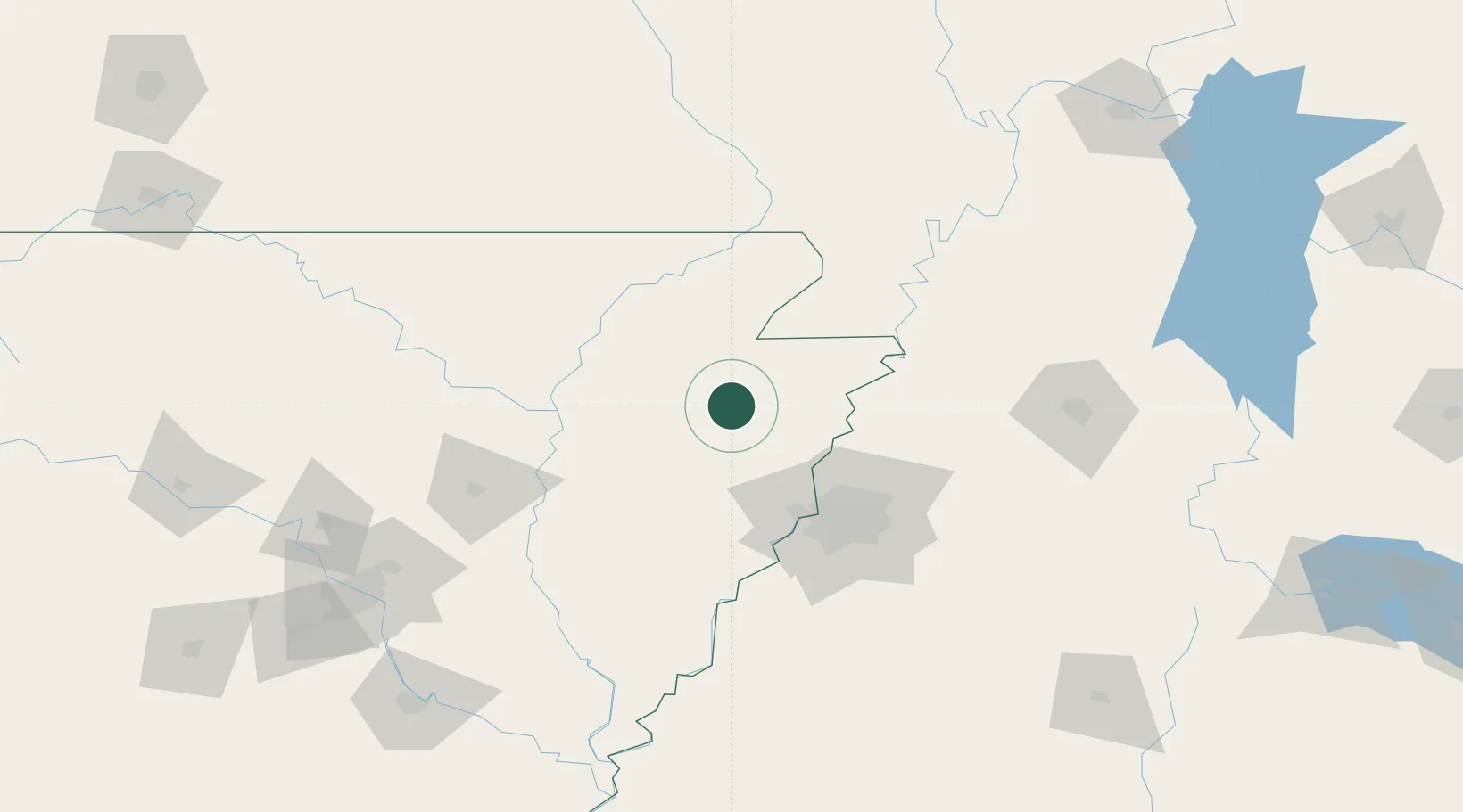
Nearby Logistics Neighbours

Cities
  1. 1Marked Tree18 km
  2. 2Leachville37 km
  3. 3Evadale38 km
  4. 4Bono40 km
  5. 5Waldenburg41 km
Nearest neighbours — logibook spatial index (haversine) over the source coordinates
Ports
  1. 1Port Of Memphis73 km
  2. 2Baton Rouge584 km
  3. 3Madisonville587 km
  4. 4Mobile597 km
  5. 5Slidell604 km
Nearest neighbours — logibook spatial index (haversine) over the source coordinates
Airports
  1. 1Jonesboro Municipal Airport23 km
  2. 2Arkansas International Airport60 km
  3. 3Millington-Memphis Airport67 km
  4. 4Memphis International Airport84 km
  5. 5McKellar-Sipes Regional Airport143 km
Nearest neighbours — logibook spatial index (haversine) over the source coordinates
Trade Zones
  1. 1FTZ No. 077 Memphis64 km
  2. 2FTZ No. 273 West Memphis64 km
  3. 3FTZ No. 223 Memphis69 km
  4. 4FTZ No. 283 West Tennessee75 km
  5. 5FTZ No. 262 Southaven90 km
Nearest neighbours — logibook spatial index (haversine) over the source coordinates
DatabookThe Record of Consolidated Knowledge
United States beyond logistics?
Browse databook

All Sources

LocationsUN/LOCODE
UN/LOCODE — free
LocationsGeoNames
CC BY 4.0
Portsthe NGA World Port Index
Public domain (US gov)
AirportsOurAirports
Public domain
Trade Zonesthe World Bank SEZ database
CC BY 4.0
Trade ZonesOpen Zone Map
CC BY
← United States locations