UN/LOCODE hub · United States
USQUI

Quincy

39.9167°, -120.9167°
1,728
Population
2
Transport functions

Transport Functions

Port
Rail
UN/LOCODE

Hub Profile

Place type
Provincial seat
GeoNames
Region
California
GeoNames
Population
1,728
GeoNames
Time zone
America/Los_Angeles
GeoNames
Elevation
1,046 m
GeoNames

Location

Location of USQUI
Natural Earth 10m (public domain) · California · USQUI · 39.92, -120.92GoogleOSMYandex

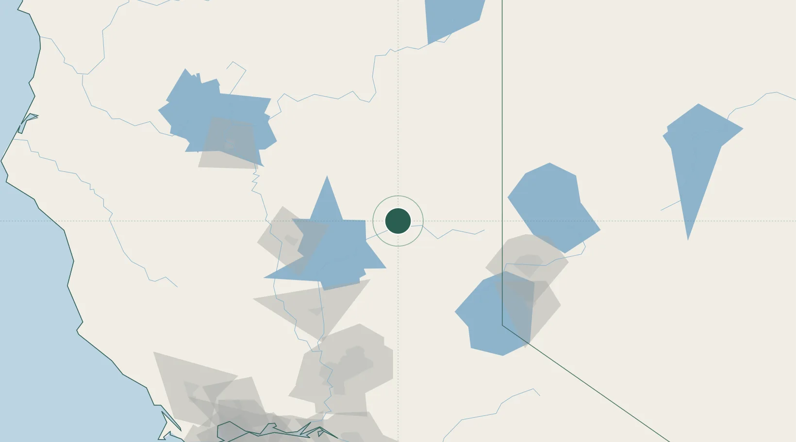
Nearby Logistics Neighbours

Cities
  1. 1Saint Louis24 km
  2. 2La Porte27 km
  3. 3Lake Almanor42 km
  4. 4Berry Creek52 km
  5. 5Butte Meadows57 km
Nearest neighbours — logibook spatial index (haversine) over the source coordinates
Ports
  1. 1Sacramento157 km
  2. 2Courtland185 km
  3. 3Walnut Grove194 km
  4. 4Isleton203 km
  5. 5Rio Vista208 km
Nearest neighbours — logibook spatial index (haversine) over the source coordinates
Airports
  1. 1Truckee Tahoe Airport94 km
  2. 2Beale Air Force Base98 km
  3. 3Yuba County Airport107 km
  4. 4Reno Tahoe International Airport109 km
  5. 5Red Bluff Municipal Airport117 km
Nearest neighbours — logibook spatial index (haversine) over the source coordinates
Trade Zones
  1. 1FTZ No. 126 Sparks104 km
  2. 2FTZ No. 143 West Sacramento157 km
  3. 3FTZ No. 231 Stockton221 km
  4. 4FTZ No. 056 Oakland262 km
  5. 5FTZ No. 003 San Francisco268 km
Nearest neighbours — logibook spatial index (haversine) over the source coordinates
DatabookThe Record of Consolidated Knowledge
United States beyond logistics?
Browse databook

All Sources

LocationsUN/LOCODE
UN/LOCODE — free
LocationsGeoNames
CC BY 4.0
Portsthe NGA World Port Index
Public domain (US gov)
AirportsOurAirports
Public domain
Trade Zonesthe World Bank SEZ database
CC BY 4.0
Trade ZonesOpen Zone Map
CC BY
← United States locations