Foreign Trade Zone · United States

FTZ No. 231 Stockton Active

37.9509°, -121.3264°
2.3 km
Nearest port
10.1 km
Nearest airport

Gateway access

Nearest neighbours — logibook spatial index (haversine) over the source coordinates

Zone profile

Zone type
Foreign Trade Zone
Open Zone Map
Region
California
Open Zone Map
Status
Active
Open Zone Map
Management
Public
Open Zone Map
Operator
Port of Stockton
Open Zone Map
Legal framework
Foreign-Trade Zones Act
Open Zone Map

Location

Location of ozm-4736
Natural Earth 10m (public domain) · California · ozm-4736 · 37.95, -121.33GoogleOSMYandex

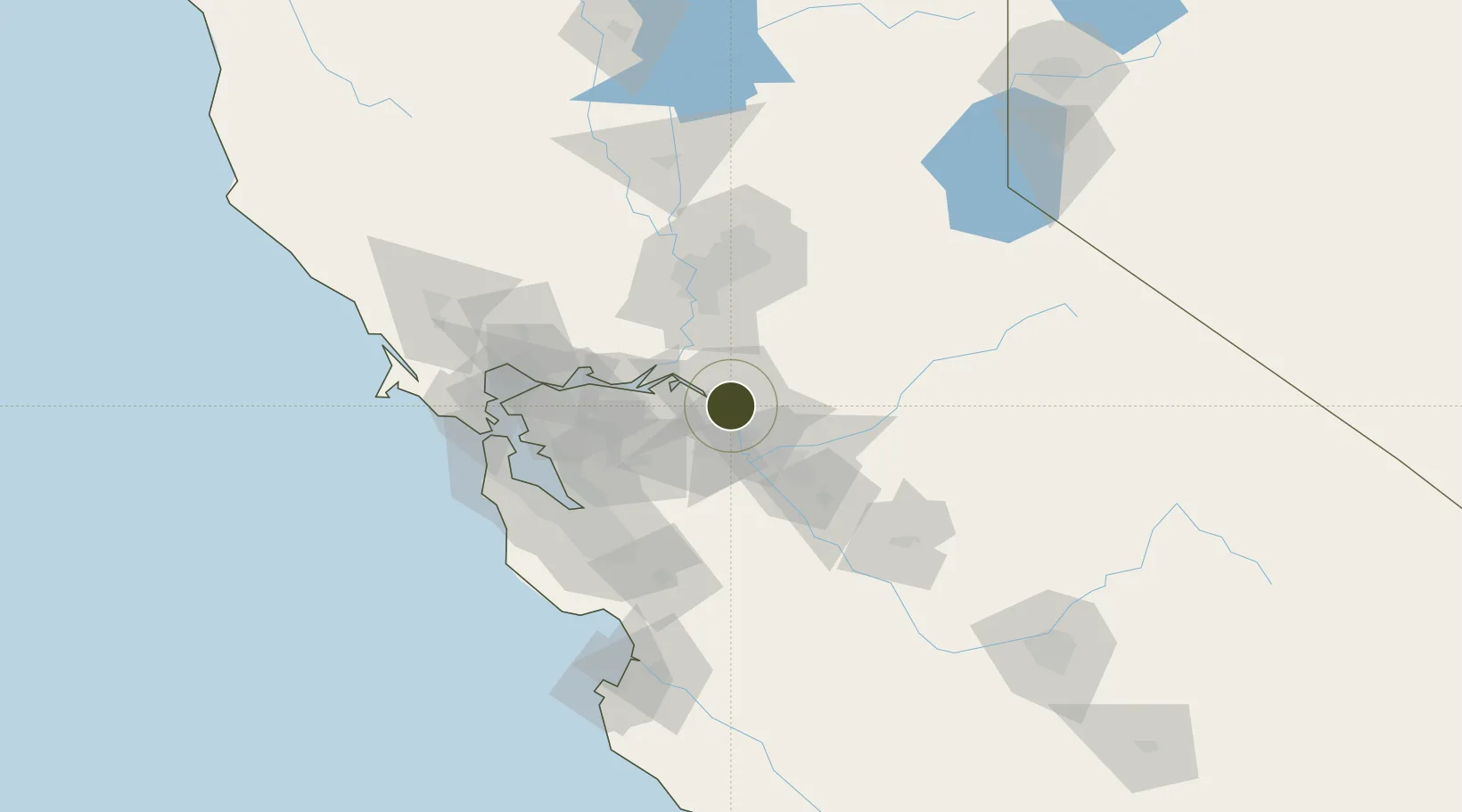
Nearby Logistics Neighbours

Ports
  1. 1Stockton2 km
  2. 2Isleton34 km
  3. 3Walnut Grove36 km
  4. 4Rio Vista40 km
  5. 5Antioch42 km
Nearest neighbours — logibook spatial index (haversine) over the source coordinates
Airports
  1. 1Stockton Metropolitan Airport10 km
  2. 2Modesto City Co-Harry Sham Field49 km
  3. 3Travis Air Force Base63 km
  4. 4Sacramento Executive Airport64 km
  5. 5Buchanan Field64 km
Nearest neighbours — logibook spatial index (haversine) over the source coordinates
Cities
  1. 1Stockton7 km
  2. 2East Stockton7 km
  3. 3French Camp12 km
  4. 4Collegeville18 km
  5. 5Victor23 km
Nearest neighbours — logibook spatial index (haversine) over the source coordinates
Trade Zones
  1. 1FTZ No. 143 West Sacramento72 km
  2. 2FTZ No. 018 San Jose84 km
  3. 3FTZ No. 056 Oakland85 km
  4. 4FTZ No. 003 San Francisco95 km
  5. 5FTZ No. 226 Merced, Madera and Fresno Counties103 km
Nearest neighbours — logibook spatial index (haversine) over the source coordinates
DatabookThe Record of Consolidated Knowledge
United States beyond logistics?
Browse databook

All Sources

Trade ZonesOpen Zone Map
CC BY
Portsthe NGA World Port Index
Public domain (US gov)
AirportsOurAirports
Public domain
LocationsUN/LOCODE
UN/LOCODE — free
← United States trade zones