UN/LOCODE hub · United States
USNWU

Newton

42.8667°, -71.0333°
4,513
Population
2
Transport functions

Transport Functions

Road
Multimodal
UN/LOCODE

Hub Profile

Place type
Populated place
GeoNames
Region
New Hampshire
GeoNames
Population
4,513
GeoNames
Time zone
America/New_York
GeoNames
Elevation
61 m
GeoNames

Location

Location of USNWU
Natural Earth 10m (public domain) · New Hampshire · USNWU · 42.87, -71.03GoogleOSMYandex

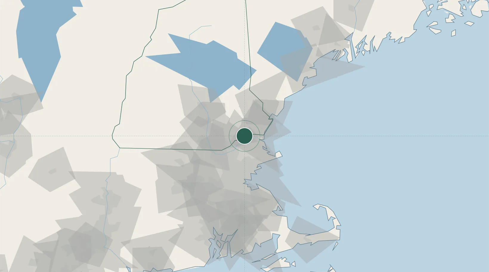
Nearby Logistics Neighbours

Cities
  1. 1South Hampton7 km
  2. 2Bradford12 km
  3. 3Newbury16 km
  4. 4Newburyport16 km
  5. 5North Hampton20 km
Nearest neighbours — logibook spatial index (haversine) over the source coordinates
Ports
  1. 1Newburyport15 km
  2. 2Portsmouth33 km
  3. 3Beverly39 km
  4. 4Rockport41 km
  5. 5Salem41 km
Nearest neighbours — logibook spatial index (haversine) over the source coordinates
Airports
  1. 1Lawrence Municipal Airport18 km
  2. 2Portsmouth International Airport at Pease29 km
  3. 3Beverly Regional Airport33 km
  4. 4Manchester-Boston Regional Airport34 km
  5. 5Laurence G Hanscom Field49 km
Nearest neighbours — logibook spatial index (haversine) over the source coordinates
Trade Zones
  1. 1FTZ No. 081 Portsmouth26 km
  2. 2FTZ No. 027 Boston62 km
  3. 3FTZ No. 105 Providence and North Kingstown122 km
  4. 4FTZ No. 268 Brattleboro128 km
  5. 5FTZ No. 028 New Bedford134 km
Nearest neighbours — logibook spatial index (haversine) over the source coordinates
DatabookThe Record of Consolidated Knowledge
United States beyond logistics?
Browse databook

All Sources

LocationsUN/LOCODE
UN/LOCODE — free
LocationsGeoNames
CC BY 4.0
Portsthe NGA World Port Index
Public domain (US gov)
AirportsOurAirports
Public domain
Trade Zonesthe World Bank SEZ database
CC BY 4.0
Trade ZonesOpen Zone Map
CC BY
← United States locations