UN/LOCODE hub · United States
USKIH

Kihei

20.7833°, -156.4500°
20,881
Population
2
Transport functions

Transport Functions

Port
Road
UN/LOCODE

Hub Profile

Place type
Populated place
GeoNames
Region
Hawaii
GeoNames
Population
20,881
GeoNames
Time zone
Pacific/Honolulu
GeoNames
Elevation
3 m
GeoNames

Location

Location of USKIH
Natural Earth 10m (public domain) · Hawaii · USKIH · 20.78, -156.45GoogleOSMYandex

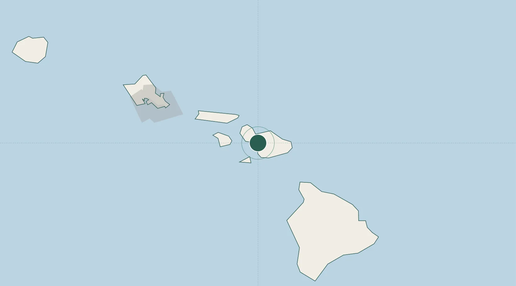
Nearby Logistics Neighbours

Cities
  1. 1Kahului13 km
  2. 2Ulupalakua16 km
  3. 3Haiku20 km
  4. 4Kailua150 km
  5. 5Honolulu161 km
Nearest neighbours — logibook spatial index (haversine) over the source coordinates
Ports
  1. 1Kahului13 km
  2. 2Lahaina24 km
  3. 3Hana49 km
  4. 4Kaunakakai69 km
  5. 5Kawaihae105 km
Nearest neighbours — logibook spatial index (haversine) over the source coordinates
Airports
  1. 1Kahului International Airport13 km
  2. 2Kapalua Airport31 km
  3. 3Hana Airport45 km
  4. 4Manele Heliport48 km
  5. 5Lanai Airport52 km
Nearest neighbours — logibook spatial index (haversine) over the source coordinates
Trade Zones
  1. 1FTZ No. 009 Honolulu158 km
  2. 2FTZ No. 248 Eureka3768 km
  3. 3FTZ No. 003 San Francisco3775 km
  4. 4FTZ No. 056 Oakland3785 km
  5. 5FTZ No. 132 Coos County3898 km
Nearest neighbours — logibook spatial index (haversine) over the source coordinates
DatabookThe Record of Consolidated Knowledge
United States beyond logistics?
Browse databook

All Sources

LocationsUN/LOCODE
UN/LOCODE — free
LocationsGeoNames
CC BY 4.0
Portsthe NGA World Port Index
Public domain (US gov)
AirportsOurAirports
Public domain
Trade Zonesthe World Bank SEZ database
CC BY 4.0
Trade ZonesOpen Zone Map
CC BY
← United States locations