UN/LOCODE hub · United States
USFLL

Fort Lauderdale

26.0947°, -80.1360°
183,146
Population
3
Transport functions

Transport Functions

Port
Road
Airport
UN/LOCODE

Hub Profile

Place type
Provincial seat
GeoNames
Region
Florida
GeoNames
Population
183,146
GeoNames
Time zone
America/New_York
GeoNames
Elevation
1 m
GeoNames
Logistics facilities
5
UN/LOCODE

Location

Location of USFLL
Natural Earth 10m (public domain) · Florida · USFLL · 26.09, -80.14GoogleOSMYandex

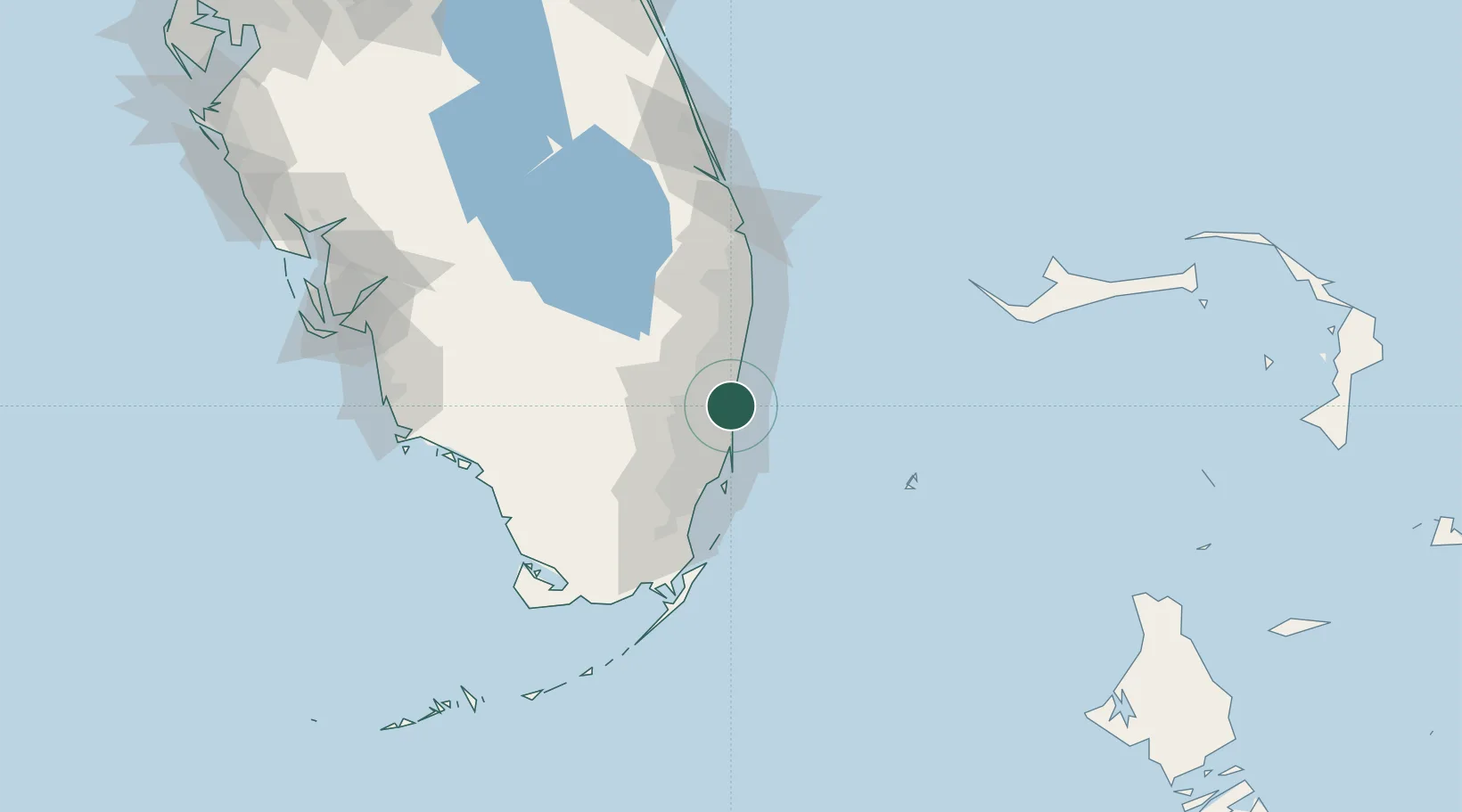
Nearby Logistics Neighbours

Cities
  1. 1Port Everglades3 km
  2. 2Port Laudania5 km
  3. 3Lauderdale Lakes9 km
  4. 4Oakland Park, Broward10 km
  5. 5Plantation12 km
Nearest neighbours — logibook spatial index (haversine) over the source coordinates
Ports
  1. 1Port Everglades2 km
  2. 2Miami35 km
  3. 3Palm Beach75 km
  4. 4Freeport143 km
  5. 5Fort Pierce154 km
Nearest neighbours — logibook spatial index (haversine) over the source coordinates
Airports
  1. 1Fort Lauderdale Hollywood International Airport3 km
  2. 2Fort Lauderdale Executive Airport12 km
  3. 3North Perry Airport15 km
  4. 4Miami-Opa Locka Executive Airport25 km
  5. 5Boca Raton Airport32 km
Nearest neighbours — logibook spatial index (haversine) over the source coordinates
Trade Zones
  1. 1FTZ No. 025 Broward County2 km
  2. 2FTZ No. 241 Fort Lauderdale12 km
  3. 3FTZ No. 180 Miami (Wynwood)33 km
  4. 4FTZ No. 032 Miami38 km
  5. 5FTZ No. 135 Palm Beach County76 km
Nearest neighbours — logibook spatial index (haversine) over the source coordinates
DatabookThe Record of Consolidated Knowledge
United States beyond logistics?
Browse databook

All Sources

LocationsUN/LOCODE
UN/LOCODE — free
LocationsGeoNames
CC BY 4.0
Portsthe NGA World Port Index
Public domain (US gov)
AirportsOurAirports
Public domain
Trade Zonesthe World Bank SEZ database
CC BY 4.0
Trade ZonesOpen Zone Map
CC BY
← United States locations