UN/LOCODE hub · United States
USBF3

Boeing Field Apt

47.5333°, -122.2333°
3
Transport functions

Transport Functions

Rail
Road
Airport
UN/LOCODE

Hub Profile

Region
WA
GeoNames

Location

Location of USBF3
Natural Earth 10m (public domain) · WA · USBF3 · 47.53, -122.23GoogleOSMYandex

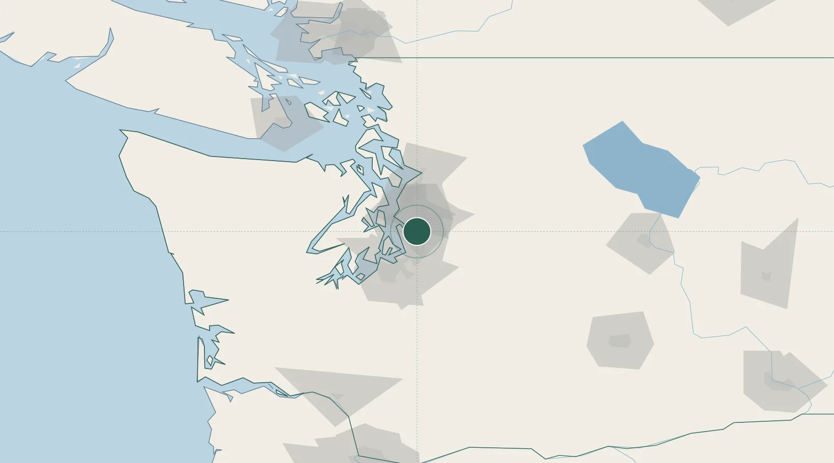
Nearby Logistics Neighbours

Cities
  1. 1Seattle7 km
  2. 2Burien11 km
  3. 3Madison Park11 km
  4. 4Des Moines16 km
  5. 5Port Blakely21 km
Nearest neighbours — logibook spatial index (haversine) over the source coordinates
Ports
  1. 1Seattle11 km
  2. 2Port Orchard30 km
  3. 3Point Wells31 km
  4. 4Tacoma31 km
  5. 5Bremerton32 km
Nearest neighbours — logibook spatial index (haversine) over the source coordinates
Airports
  1. 1King County International Airport - Boeing Field5 km
  2. 2Seattle–Tacoma International Airport11 km
  3. 3Kenmore Air Harbor Seaplane Base13 km
  4. 4Kenmore Air Harbor LLC Seaplane Base25 km
  5. 5Tacoma Narrows Airport39 km
Nearest neighbours — logibook spatial index (haversine) over the source coordinates
Trade Zones
  1. 1FTZ No. 005 Seattle21 km
  2. 2FTZ No. 086 Tacoma33 km
  3. 3FTZ No. 212 Tacoma39 km
  4. 4FTZ No. 085 Everett52 km
  5. 5FTZ No. 216 Olympia76 km
Nearest neighbours — logibook spatial index (haversine) over the source coordinates
DatabookThe Record of Consolidated Knowledge
United States beyond logistics?
Browse databook

All Sources

LocationsUN/LOCODE
UN/LOCODE — free
Portsthe NGA World Port Index
Public domain (US gov)
AirportsOurAirports
Public domain
Trade Zonesthe World Bank SEZ database
CC BY 4.0
Trade ZonesOpen Zone Map
CC BY
← United States locations