UN/LOCODE hub · United States
USABC

Port Hadlock

48.0741°, -122.7461°
1
Transport functions

Transport Functions

Port
UN/LOCODE

Hub Profile

Place type
Populated place
GeoNames
Region
Washington
GeoNames
Time zone
America/Los_Angeles
GeoNames
Elevation
40 m
GeoNames
Logistics facilities
1
UN/LOCODE

Location

Location of USABC
Natural Earth 10m (public domain) · Washington · USABC · 48.07, -122.75GoogleOSMYandex

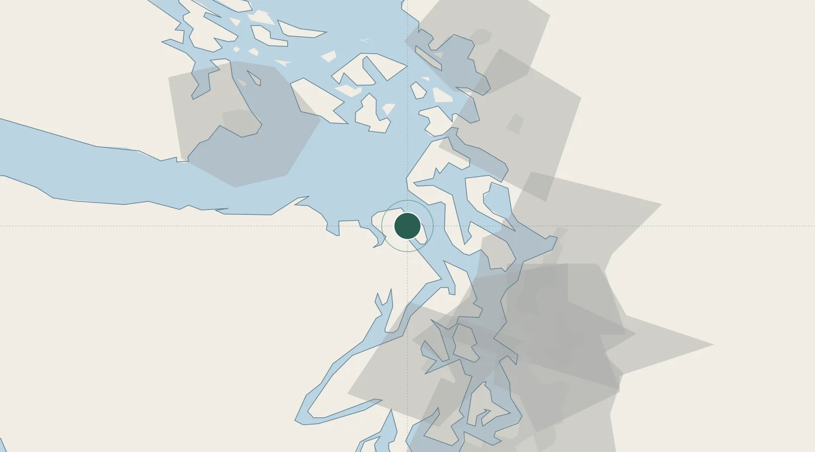
Nearby Logistics Neighbours

Cities
  1. 1Freeland18 km
  2. 2Port Ludlow18 km
  3. 3Port Gamble28 km
  4. 4Tulalip34 km
  5. 5Mukilteo36 km
Nearest neighbours — logibook spatial index (haversine) over the source coordinates
Ports
  1. 1Port Townsend5 km
  2. 2Coupeville18 km
  3. 3Port Gamble28 km
  4. 4Mukilteo36 km
  5. 5Poulsbo39 km
Nearest neighbours — logibook spatial index (haversine) over the source coordinates
Airports
  1. 1Whidbey Island Naval Air Station (Ault Field)32 km
  2. 2Seattle Paine Field International Airport39 km
  3. 3Arlington Municipal Airport45 km
  4. 4Center Island Airport47 km
  5. 5Anacortes Airport48 km
Nearest neighbours — logibook spatial index (haversine) over the source coordinates
Trade Zones
  1. 1FTZ No. 085 Everett40 km
  2. 2FTZ No. 005 Seattle55 km
  3. 3FTZ No. 129 Bellingham77 km
  4. 4FTZ No. 128 Whatcom County84 km
  5. 5FTZ No. 212 Tacoma93 km
Nearest neighbours — logibook spatial index (haversine) over the source coordinates
DatabookThe Record of Consolidated Knowledge
United States beyond logistics?
Browse databook

All Sources

LocationsUN/LOCODE
UN/LOCODE — free
Portsthe NGA World Port Index
Public domain (US gov)
AirportsOurAirports
Public domain
Trade Zonesthe World Bank SEZ database
CC BY 4.0
Trade ZonesOpen Zone Map
CC BY
← United States locations