UN/LOCODE hub · Norway
NOGRF

Grovfjord

68.6833°, 17.1167°
1
Transport functions

Transport Functions

Port
UN/LOCODE

Hub Profile

Region
19
GeoNames

Location

Location of NOGRF
Natural Earth 10m (public domain) · 19 · NOGRF · 68.68, 17.12GoogleOSMYandex

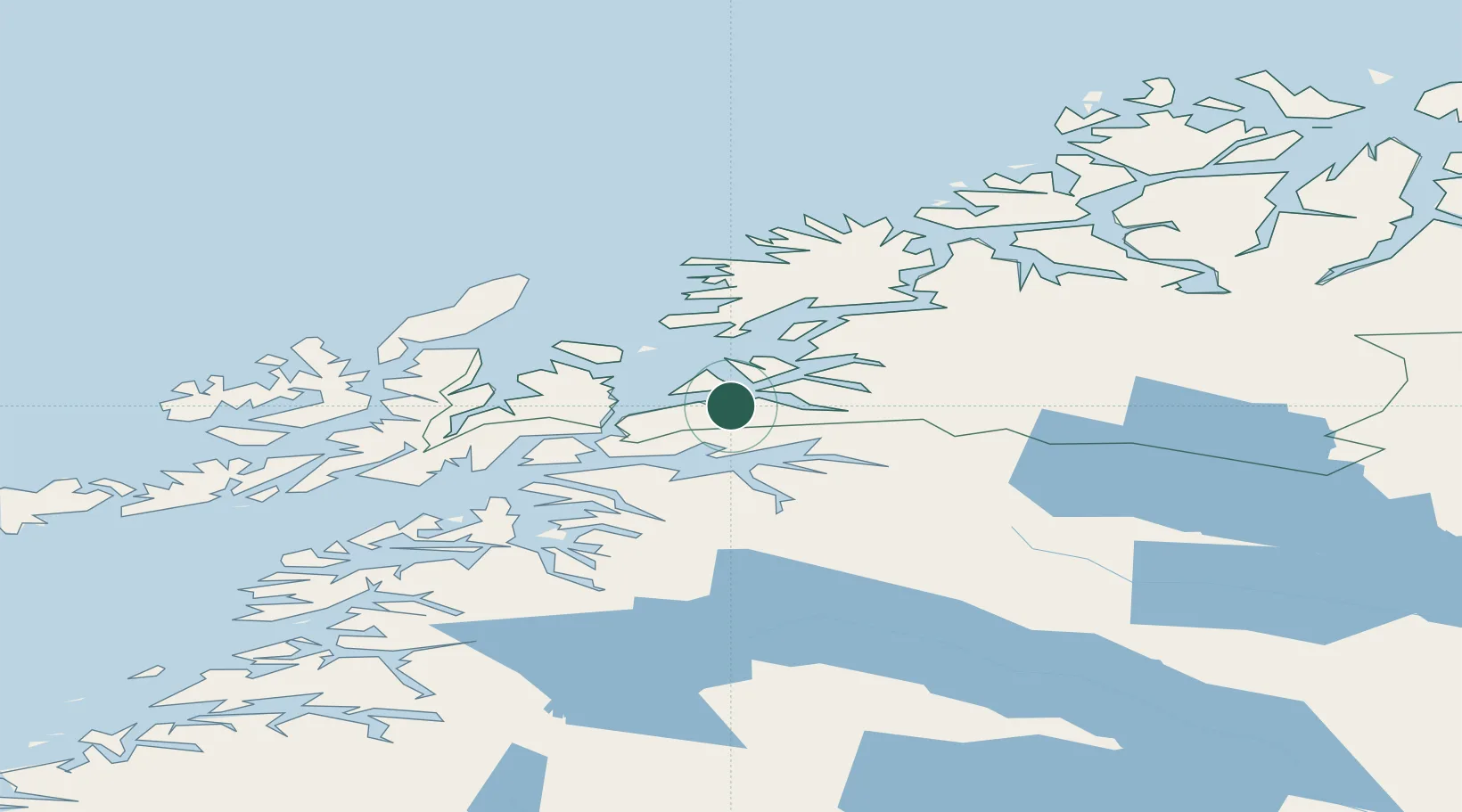
Nearby Logistics Neighbours

Cities
  1. 1Tovik9 km
  2. 2Bogen19 km
  3. 3Bjerkvik23 km
  4. 4Fornes25 km
  5. 5Harstad26 km
Nearest neighbours — logibook spatial index (haversine) over the source coordinates
Ports
  1. 1Lilandsgrunnen25 km
  2. 2Harstad26 km
  3. 3Narvik31 km
  4. 4Sjovegan36 km
  5. 5Ulvik38 km
Nearest neighbours — logibook spatial index (haversine) over the source coordinates
Airports
  1. 1Harstad/Narvik Airport28 km
  2. 2Bardufoss Airport71 km
  3. 3Andøya Airport, Andenes78 km
  4. 4Stokmarknes Airport, Skagen85 km
  5. 5Svolvær Airport, Helle111 km
Nearest neighbours — logibook spatial index (haversine) over the source coordinates
Trade Zones
  1. 1Oulu Port Free Warehouse Area547 km
  2. 2Turku Free Zone947 km
  3. 3Free Zone of Lappeenranta993 km
  4. 4Freeport of Hanko1022 km
  5. 5Port of Hamina-Kotka1024 km
Nearest neighbours — logibook spatial index (haversine) over the source coordinates
DatabookThe Record of Consolidated Knowledge
Norway beyond logistics?
Browse databook

All Sources

LocationsUN/LOCODE
UN/LOCODE — free
Portsthe NGA World Port Index
Public domain (US gov)
AirportsOurAirports
Public domain
Trade Zonesthe World Bank SEZ database
CC BY 4.0
Trade ZonesOpen Zone Map
CC BY
← Norway locations