UN/LOCODE hub · Mexico
MXLIN

Linares

24.8500°, -99.5667°
70,378
Population
2
Transport functions

Transport Functions

Rail
Road
UN/LOCODE

Hub Profile

Place type
Populated place
GeoNames
Region
Nuevo León
GeoNames
Population
70,378
GeoNames
Time zone
America/Monterrey
GeoNames
Elevation
357 m
GeoNames

Location

Location of MXLIN
Natural Earth 10m (public domain) · Nuevo León · MXLIN · 24.85, -99.57GoogleOSMYandex

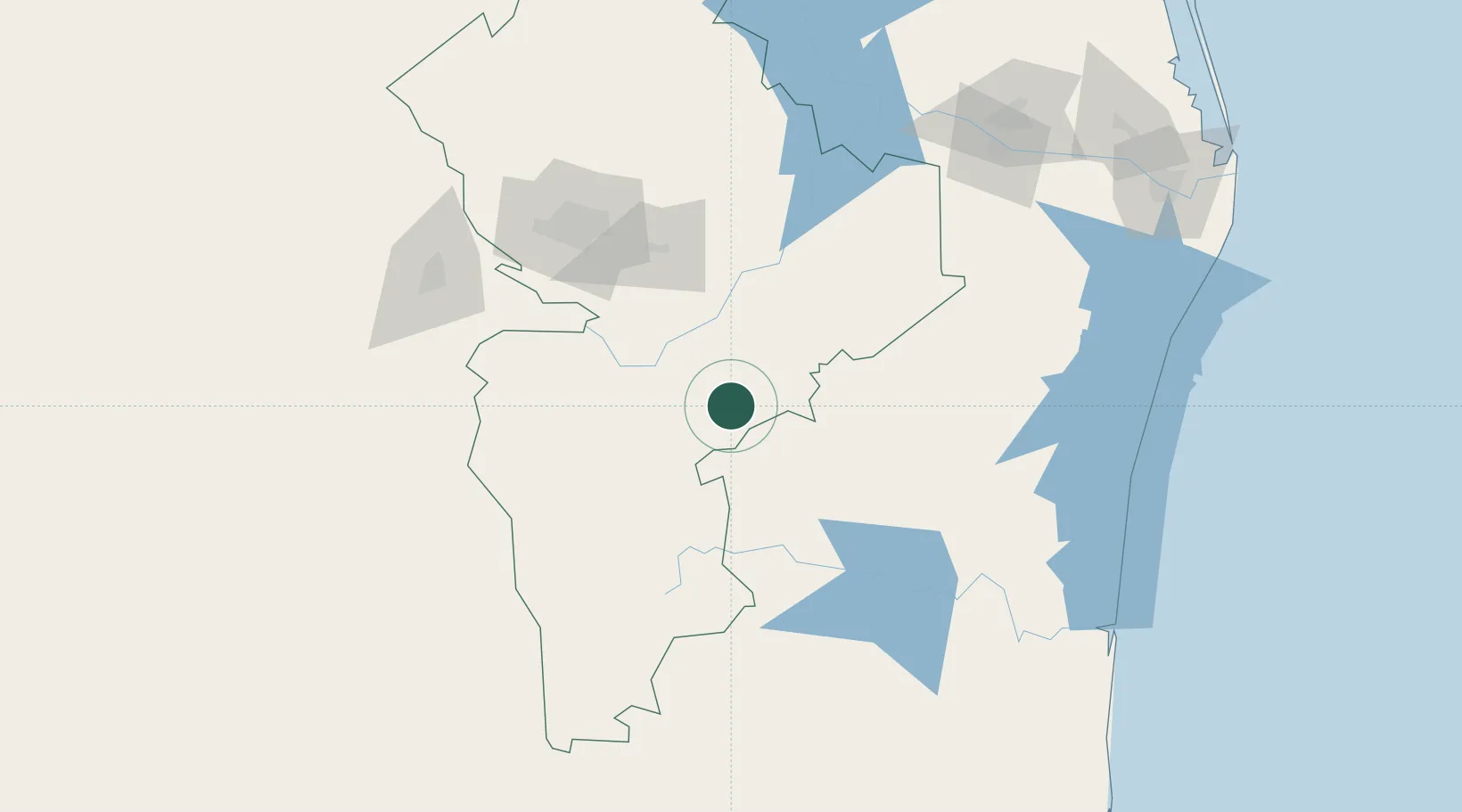
Nearby Logistics Neighbours

Cities
  1. 1Lampazos5 km
  2. 2General Terán48 km
  3. 3Cadereyta Jiménez94 km
  4. 4Barretal97 km
  5. 5Garza García124 km
Nearest neighbours — logibook spatial index (haversine) over the source coordinates
Ports
  1. 1Brownsville250 km
  2. 2Port Isabel274 km
  3. 3Altamira316 km
  4. 4Tampico340 km
  5. 5Corpus Christi394 km
Nearest neighbours — logibook spatial index (haversine) over the source coordinates
Airports
  1. 1Monterrey International Airport117 km
  2. 2Del Norte International Airport132 km
  3. 3General Pedro Jose Mendez International Airport142 km
  4. 4Plan De Guadalupe International Airport157 km
  5. 5General Lucio Blanco International Airport186 km
Nearest neighbours — logibook spatial index (haversine) over the source coordinates
Trade Zones
  1. 1FTZ No. 095 Starr County186 km
  2. 2FTZ No. 012 McAllen195 km
  3. 3FTZ No. 156 Weslaco213 km
  4. 4FTZ No. 157 Casper213 km
  5. 5FTZ No. 062 Brownsville249 km
Nearest neighbours — logibook spatial index (haversine) over the source coordinates
DatabookThe Record of Consolidated Knowledge
Mexico beyond logistics?
Browse databook

All Sources

LocationsUN/LOCODE
UN/LOCODE — free
LocationsGeoNames
CC BY 4.0
Portsthe NGA World Port Index
Public domain (US gov)
AirportsOurAirports
Public domain
Trade Zonesthe World Bank SEZ database
CC BY 4.0
Trade ZonesOpen Zone Map
CC BY
← Mexico locations