UN/LOCODE hub · South Korea
KRGRI

Guri

37.5833°, 127.1333°
2
Transport functions

Transport Functions

Rail
Road
UN/LOCODE

Hub Profile

Region
41
GeoNames

Location

Location of KRGRI
Natural Earth 10m (public domain) · 41 · KRGRI · 37.58, 127.13GoogleOSMYandex

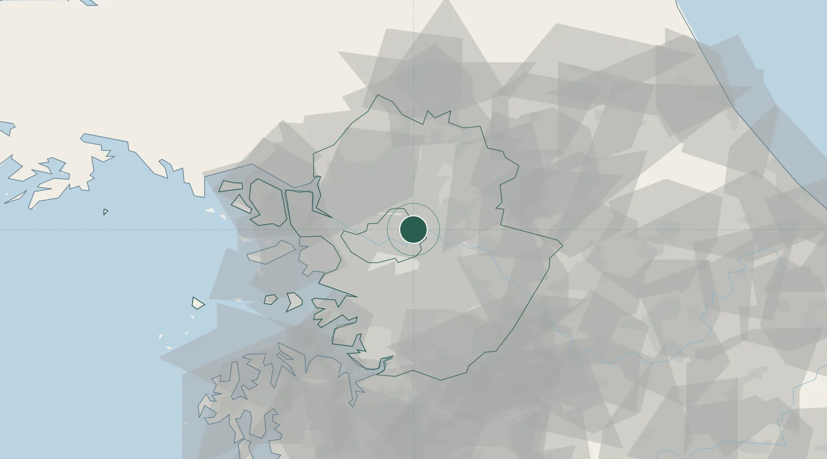
Nearby Logistics Neighbours

Cities
  1. 1Namyangju8 km
  2. 2Hanam8 km
  3. 3Seongnam17 km
  4. 4Uijeongbu18 km
  5. 5Sungnam (Seoul Ab)20 km
Nearest neighbours — logibook spatial index (haversine) over the source coordinates
Ports
  1. 1Inchon47 km
  2. 2Pyeongtaek Hang71 km
  3. 3Daesan Hang90 km
  4. 4Haeju Hang134 km
  5. 5Sokch'o Hang146 km
Nearest neighbours — logibook spatial index (haversine) over the source coordinates
Airports
  1. 1Seoul Air Base (K-16)16 km
  2. 2Gimpo International Airport30 km
  3. 3Suwon Airport40 km
  4. 4Osan Air Base56 km
  5. 5Incheon International Airport62 km
Nearest neighbours — logibook spatial index (haversine) over the source coordinates
Trade Zones
  1. 1Godeok New International Industrial Complex2 km
  2. 2Seongnam General Industrial Complex17 km
  3. 3Pangyo Techno Valley20 km
  4. 4Seoul Digital National Industrial Complex24 km
  5. 5Nam-myeon Industrial Complex In Yangju26 km
Nearest neighbours — logibook spatial index (haversine) over the source coordinates
DatabookThe Record of Consolidated Knowledge
South Korea beyond logistics?
Browse databook

All Sources

LocationsUN/LOCODE
UN/LOCODE — free
Portsthe NGA World Port Index
Public domain (US gov)
AirportsOurAirports
Public domain
Trade Zonesthe World Bank SEZ database
CC BY 4.0
Trade ZonesOpen Zone Map
CC BY
← South Korea locations