UN/LOCODE hub · South Korea
KRGHA

Ganghwa-gun/Incheon

37.7333°, 126.4833°
2
Transport functions

Transport Functions

Rail
Road
UN/LOCODE

Hub Profile

Region
28
GeoNames

Location

Location of KRGHA
Natural Earth 10m (public domain) · 28 · KRGHA · 37.73, 126.48GoogleOSMYandex

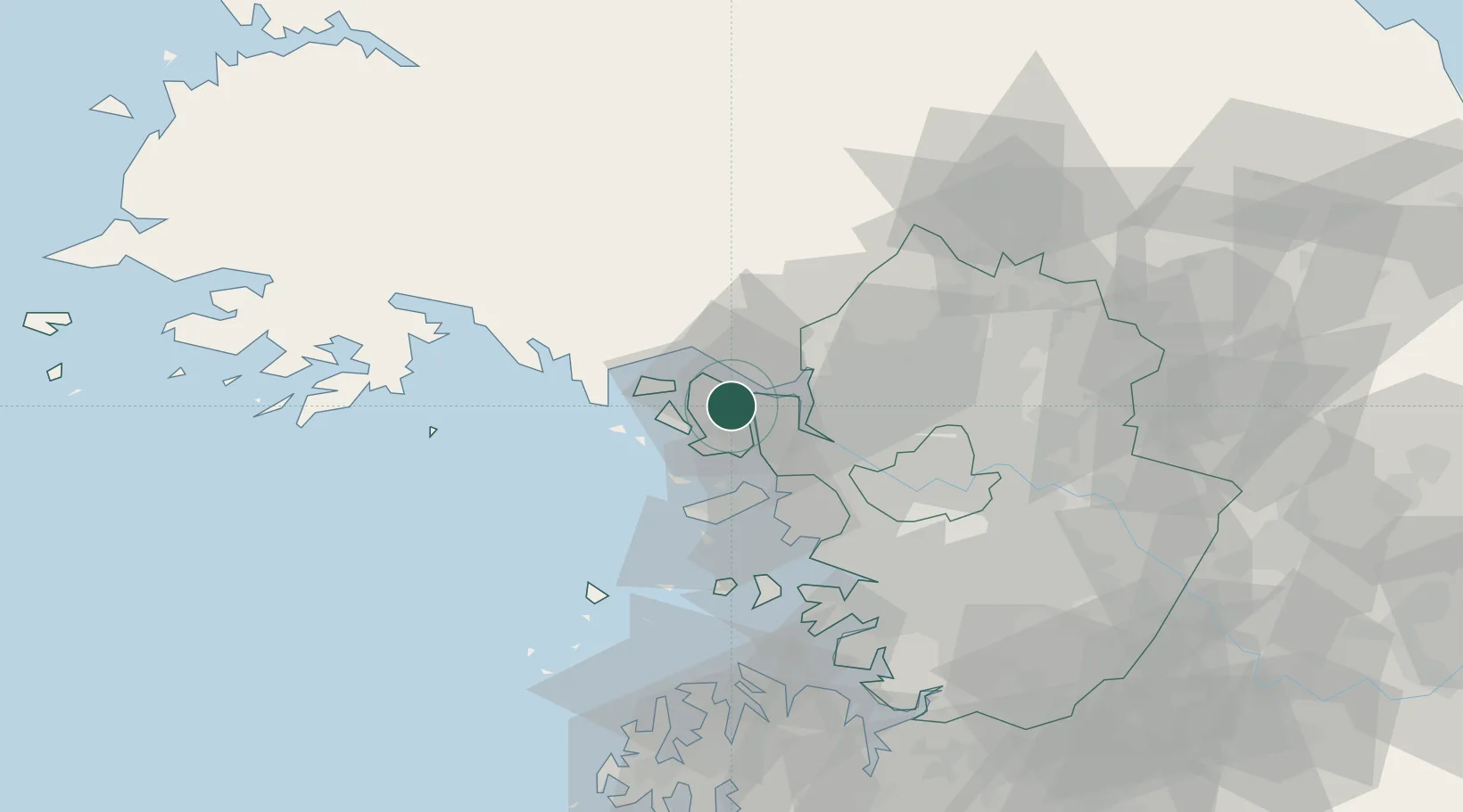
Nearby Logistics Neighbours

Cities
  1. 1Gimpo22 km
  2. 2Gyeongin25 km
  3. 3Dorasan/Paju25 km
  4. 4Paju25 km
  5. 5Ilsan-dong26 km
Nearest neighbours — logibook spatial index (haversine) over the source coordinates
Ports
  1. 1Inchon32 km
  2. 2Haeju Hang75 km
  3. 3Daesan Hang80 km
  4. 4Pyeongtaek Hang86 km
  5. 5Kyomip'o135 km
Nearest neighbours — logibook spatial index (haversine) over the source coordinates
Airports
  1. 1Incheon International Airport30 km
  2. 2Gimpo International Airport33 km
  3. 3Seoul Air Base (K-16)64 km
  4. 4Haeju Airfield69 km
  5. 5Suwon Airport72 km
Nearest neighbours — logibook spatial index (haversine) over the source coordinates
Trade Zones
  1. 1Paju Book City National Industrial Complex20 km
  2. 2Cheongna International City23 km
  3. 3Geomdan General Industrial Complex23 km
  4. 4Wollong High-tech Industrial Complex in Paju25 km
  5. 5Kaesong Industrial Region25 km
Nearest neighbours — logibook spatial index (haversine) over the source coordinates
DatabookThe Record of Consolidated Knowledge
South Korea beyond logistics?
Browse databook

All Sources

LocationsUN/LOCODE
UN/LOCODE — free
Portsthe NGA World Port Index
Public domain (US gov)
AirportsOurAirports
Public domain
Trade Zonesthe World Bank SEZ database
CC BY 4.0
Trade ZonesOpen Zone Map
CC BY
← South Korea locations