UN/LOCODE hub · Iceland
ISHEL

Helguvik

64.0333°, -22.5500°
1
Transport functions

Transport Functions

Port
Helguvik is also a profiled seaport →
UN/LOCODE

Location

Location of ISHEL
Natural Earth 10m (public domain) · Suðurnes · ISHEL · 64.03, -22.55GoogleOSMYandex

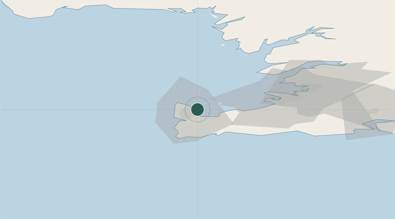
Nearby Logistics Neighbours

Cities
  1. 1Vogar10 km
  2. 2Hafnir15 km
  3. 3Grindavík23 km
  4. 4Kópavogur32 km
  5. 5Reykjavík36 km
Nearest neighbours — logibook spatial index (haversine) over the source coordinates
Ports
  1. 1Keflavik4 km
  2. 2Sandgerdi8 km
  3. 3Grindavik23 km
  4. 4Straumsvik24 km
  5. 5Skerjafjordur29 km
Nearest neighbours — logibook spatial index (haversine) over the source coordinates
Airports
  1. 1Keflavik International Airport6 km
  2. 2Reykjavík Domestic Airport32 km
  3. 3Vestmannaeyjar Airport131 km
  4. 4Bildudalur Airport185 km
  5. 5Ísafjörður Airport227 km
Nearest neighbours — logibook spatial index (haversine) over the source coordinates
Trade Zones
  1. 1Prestwick Airport Free Zone1372 km
  2. 2Shannon Free Zone1484 km
  3. 3Carlisle Kingmoor Park Enterprise Zone1488 km
  4. 4Isle of Man Free Zone and Business Park1497 km
  5. 5Dublin International Financial Services Centre1507 km
Nearest neighbours — logibook spatial index (haversine) over the source coordinates
DatabookThe Record of Consolidated Knowledge
Iceland beyond logistics?
Browse databook

All Sources

LocationsUN/LOCODE
UN/LOCODE — free
Portsthe NGA World Port Index
Public domain (US gov)
AirportsOurAirports
Public domain
Trade Zonesthe World Bank SEZ database
CC BY 4.0
Trade ZonesOpen Zone Map
CC BY
← Iceland locations