UN/LOCODE hub · Iran
IRJBD

Abadeh

30.0333°, 52.5333°
1
Transport functions

Transport Functions

Multimodal
UN/LOCODE

Hub Profile

Place type
Populated place
GeoNames
Region
Fars
GeoNames
Time zone
Asia/Tehran
GeoNames
Elevation
1,608 m
GeoNames

Location

Location of IRJBD
Natural Earth 10m (public domain) · Fars · IRJBD · 30.03, 52.53GoogleOSMYandex

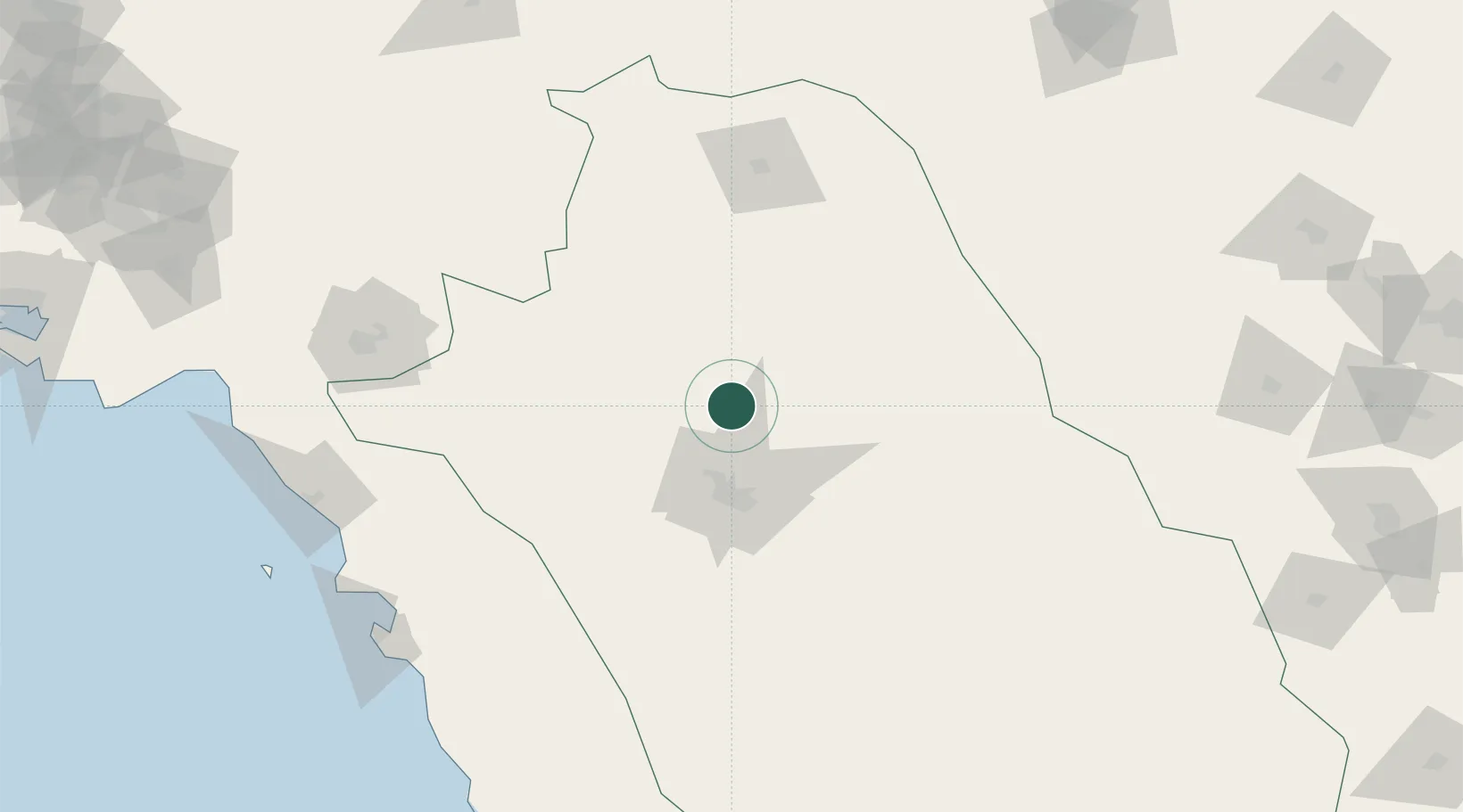
Nearby Logistics Neighbours

Cities
  1. 1Dehbid91 km
  2. 2Borazjan156 km
  3. 3Ganaveh170 km
  4. 4Bushehr203 km
  5. 5Dayyer252 km
Nearest neighbours — logibook spatial index (haversine) over the source coordinates
Ports
  1. 1Bushehr202 km
  2. 2Kharg Island Oil Terminal231 km
  3. 3Sirus Oil Terminal316 km
  4. 4Bandar-E Mahshahr325 km
  5. 5Bandar Khomeyni334 km
Nearest neighbours — logibook spatial index (haversine) over the source coordinates
Airports
  1. 1Shiraz Shahid Dastghaib International Airport55 km
  2. 2Yasuj Airport121 km
  3. 3Gachsaran Airport167 km
  4. 4Fasa Airport171 km
  5. 5Bushehr Airport204 km
Nearest neighbours — logibook spatial index (haversine) over the source coordinates
Trade Zones
  1. 1Shiraz Special Economic Zone64 km
  2. 2Kazarun Kazeroon Special Economic Zone100 km
  3. 3Jahrom Special Economic Zone168 km
  4. 4Neyriz Special Economic Zone194 km
  5. 5Bushehr Port197 km
Nearest neighbours — logibook spatial index (haversine) over the source coordinates
DatabookThe Record of Consolidated Knowledge
Iran beyond logistics?
Browse databook

All Sources

LocationsUN/LOCODE
UN/LOCODE — free
Portsthe NGA World Port Index
Public domain (US gov)
AirportsOurAirports
Public domain
Trade Zonesthe World Bank SEZ database
CC BY 4.0
Trade ZonesOpen Zone Map
CC BY
← Iran locations